Mara Canyon, also known as the Cinnamon Ridge Trail, is a short but rugged hike in the Lac du Bois Grasslands Protected Area near Kamloops. The route climbs steeply above the Thompson Valley through dry grassland, hoodoos, loose gravel, and exposed slopes before descending into the canyon and returning through the creek bed.
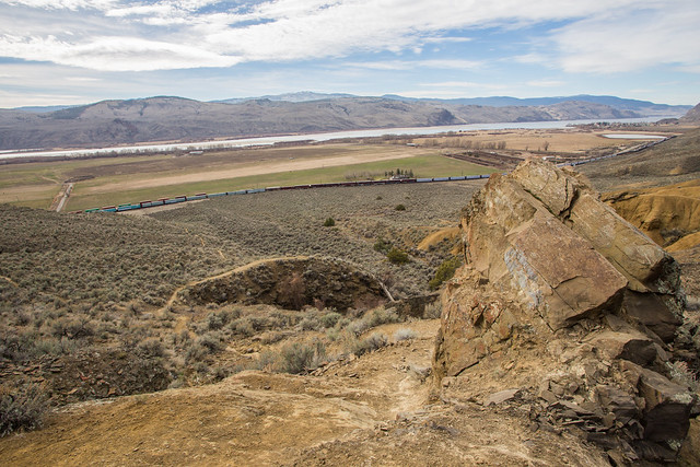
The scenery is completely different from the forested hikes of the Coast Mountains. Expect open sagebrush terrain, cacti, ponderosa pine, dry gullies, eroded hoodoos, and expansive views over the Kamloops area.
This hike is only about 4.6 km, but sections are steep, loose, exposed, and slippery. Expect loose gravel over bedrock, sidehill traverses, and route-finding that is more difficult than the distance suggests. Good footwear and confident footing are important.
Trail Stats
These statistics are based on my recorded GPS route.
- Distance: approximately 4.6 km
- My hiking time: approximately 3 hours 40 minutes
- Low point: approximately 329 m
- High point: approximately 761 m
- Net elevation gain: approximately 430 m
- Cumulative elevation gain: approximately 480 m
- Difficulty: Moderate to difficult because of steep, loose terrain
- Route: Semi-loop
BC Parks currently describes the Cinnamon Ridge Trail as approximately 4.25 km and rates it moderate to hard because of the hills and rugged terrain. My GPS recording was slightly longer at about 4.6 km.
Getting There
The trail is located northwest of Kamloops in the Lac du Bois Grasslands Protected Area. Access is from the Tranquille Road area, with the Cinnamon Ridge trailhead reached near Ord Road.
Road conditions in the protected area can vary with weather, erosion, and seasonal conditions, so check current BC Parks information before travelling.
Interesting Facts
- Lac du Bois Grasslands: The protected area covers more than 15,000 hectares northwest of Kamloops and protects an unusually complete sequence of low-elevation grasslands, ponderosa pine forest, and higher Interior Douglas-fir ecosystems.
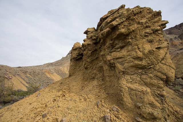
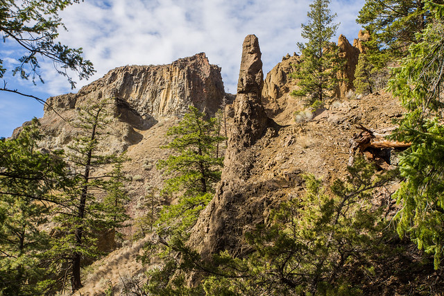
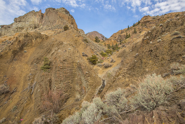
- Hoodoos: Mara Canyon contains dramatic eroded formations created by water, wind, and the gradual removal of softer sediment. These hoodoos and steep gullies give the hike its distinctive desert-like appearance.
- Biogeoclimatic zones: The lower and middle elevations of this area are strongly associated with the Bunchgrass and Ponderosa Pine biogeoclimatic zones. Higher portions of the protected area transition into the Interior Douglas-fir zone.
- Dry interior vegetation: Big sagebrush, bluebunch wheatgrass, prickly pear cactus, and ponderosa pine are characteristic plants of the dry Thompson Valley landscape.
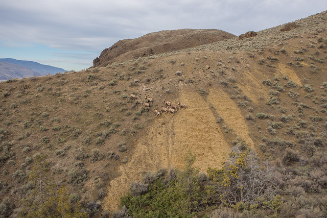
- California bighorn sheep: Bighorn sheep occur in the Kamloops grasslands and rocky slopes. I encountered a group during this hike. Give wildlife plenty of space and never approach or feed them.
- Seasonal heat: The open slopes can become extremely hot in summer. Spring and autumn are often more comfortable times for this hike.
The Route
The interactive map below shows my GPS route through Mara Canyon and along Cinnamon Ridge. Use the layer control in the upper-right corner to switch between the regular map and satellite imagery.
Climbing the West Ridge
The hike begins near Tranquille Road and quickly climbs the western side of Mara Canyon. The grade becomes steep almost immediately, and the dry surface can make good footing difficult.
Loose gravel over hard bedrock is common, so take your time. On the day of my hike, a group of California bighorn sheep moved across the slopes with considerably more confidence than I did.
First Viewpoint
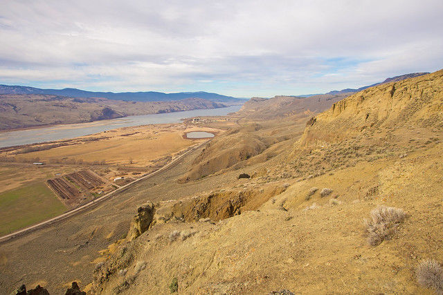
The first major viewpoint is reached after a steep climb of roughly 250 m. From here, the terrain opens dramatically and the dry Thompson Valley landscape becomes much more apparent.
Hoodoos and Ridge Terrain
Beyond the first viewpoint, the route continues north across exposed ridge terrain and around large hoodoo formations. The surface can be loose and slippery, particularly where small gravel sits on smooth bedrock.
Some traverses are steep enough that careful hand placement can help with balance. This is not a technically difficult climbing route, but it rewards slow, deliberate movement.
Descending into Mara Canyon
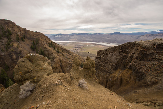
Near the high point of the route, the trail begins descending into Mara Canyon. The descent contains more loose rock and steep sidehill sections, so footing remains important.
Mara Canyon Creek Bed
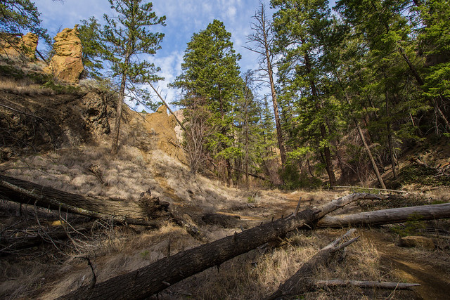
The lower canyon has a completely different character from the exposed ridge. The dry creek bed is enclosed by steep eroded walls and hoodoos, with more trees appearing in protected areas.
Seasonal water may be present in parts of the creek, but it should not be relied upon as a water source.
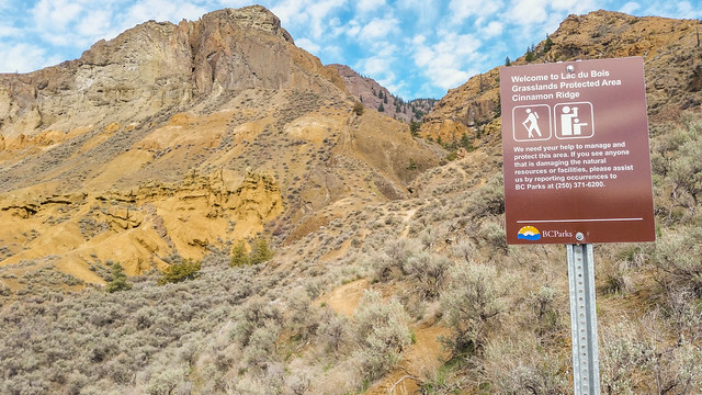
Trailhead and Protected Area
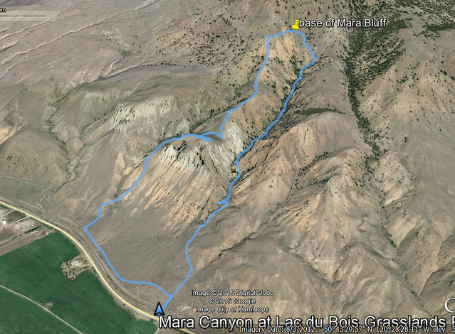
Historical Route Image
I also created this Google Earth image of the route after completing the hike.
What to Bring
Mara Canyon is relatively short, but the steep, loose terrain makes it more demanding than an ordinary 4 to 5 km walk. Carry sufficient water, sun protection, sturdy footwear, navigation, and basic emergency supplies.
For hot-weather hiking, bring considerably more water than you would on a shaded coastal trail. There is very little shade on the exposed ridges.
An offline map or GPS route is useful because junctions and informal paths can make the route less obvious in places.
Leave No Trace
Please follow Leave No Trace principles throughout the protected area. Stay on established routes where practical, avoid damaging fragile grassland and desert vegetation, pack out everything you bring in, and keep wildlife at a distance.
Do not disturb hoodoos, fossils, bones, plants, or other natural features. The dry grassland environment can be surprisingly fragile despite its rugged appearance.
Before You Go
Check current BC Parks information for Lac du Bois Grasslands Protected Area before heading out. Weather, road conditions, fire restrictions, and access can change seasonally.