DeBoville Slough is one of my favourite places for an easy walk in the Tri-Cities. Located along the border of Coquitlam and Port Coquitlam, this peaceful wetland offers flat dyke trails, beautiful mountain views, excellent birdwatching, and plenty of opportunities to see wildlife. Black bears are also regular visitors. In fact, I encountered two bears during one of my walks here!
DeBoville Slough Trail Stats
🥾 Distance: Approximately 5 km return to the Pitt River
⏱️ Hiking time: Approximately 1 to 1.5 hours, depending on pace and stops
⛰️ Elevation: Near sea level
📈 Elevation gain: Minimal
💪 Difficulty: Easy
🔄 Route type: Out and back, with north and south dyke options
🚶 Activities: Walking, cycling, and birdwatching
📍 Trailhead: Start of South dyke Trail
📍 Trailhead: Start of North dyke Trail
DeBoville Slough Trail Map
DeBoville Slough is approximately 2.2 km long, connecting the Hyde Creek drainage system with the Pitt River. Walking paths follow the dykes on both sides, offering slightly different perspectives of the wetlands, farmland, and surrounding mountains.
For a route map, see the City of Port Coquitlam’s official Traboulay PoCo Trail Map (PDF). DeBoville Slough forms part of the northern section of this extensive trail network.
The route is nearly level, making it a great option for a leisurely walk, a bike ride, or simply spending some time outdoors.
Walking Along DeBoville Slough
North dyke or South dyke?
You have two main choices when walking along DeBoville Slough: the north dyke or the south dyke. I’ve enjoyed both, and each provides excellent views of the water and surrounding landscape.
The north side borders agricultural lands, including extensive blueberry fields, while the south side forms part of the Traboulay PoCo Trail system.
Both routes are relatively flat, with open views of the slough. Unlike hiking through dense forest, you can see quite a distance here, which is especially enjoyable on a clear day.
After reaching the Pitt River, you can turn around and return the same way, or continue exploring the riverside dykes to the north or south.
One thing I particularly like about this walk is that there’s no real climbing involved. You can concentrate on the scenery, photography, and wildlife rather than watching your footing on steep trails.
Reaching the Pitt River
The Pitt River is the destination for my approximately 5 km return walk. The scenery opens up as you approach the river, with views of the surrounding mountains, river traffic, and broad wetlands.
Here’s one of my photographs taken near the mouth of DeBoville Slough.
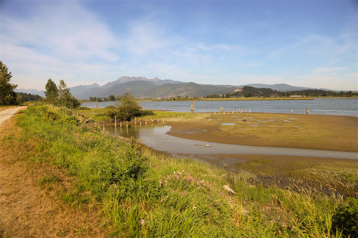
The Pitt River is a particularly interesting waterway because its lower reaches are influenced by tides from the Fraser River system. This tidal influence also affects water levels in DeBoville Slough.
Black Bears at DeBoville Slough
One of the highlights of my walk was seeing two black bears. Both were some distance away and didn’t seem particularly interested in me.
The area provides excellent feeding opportunities for bears. There are blueberry fields along the northern side of the slough, blackberry bushes around the wetlands, and fish in the waterways. It’s easy to see why bears are attracted to this landscape.
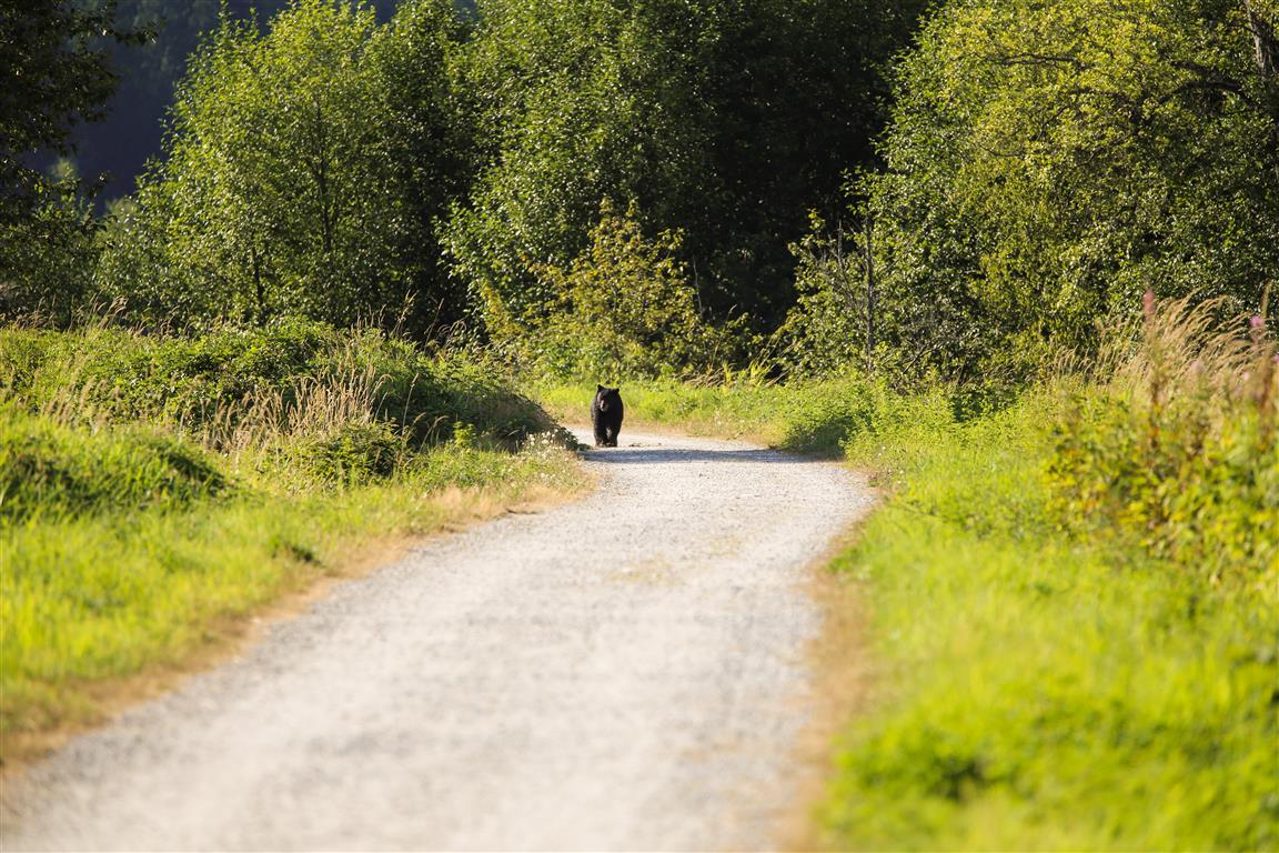
Here’s one of the bears I encountered on the path.
And here’s another photograph of a bear I spotted during my walk.
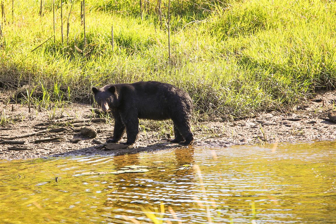
Black bear sightings are not unusual around DeBoville Slough and the nearby agricultural lands. The City of Coquitlam specifically identifies bears as seasonal visitors to this area.
Bear Safety
Although the bears I encountered were calm and largely ignored me, it’s important to remember that they are wild animals.
- Stay alert, particularly around berry bushes and areas with limited visibility.
- Keep a safe distance and never approach a bear for photographs.
- Do not feed bears or leave food or garbage behind.
- Keep dogs leashed and under control when bears may be nearby.
- If you encounter a bear, remain calm, don’t run, and slowly back away while giving it an escape route.
- Carry bear spray where appropriate and know how to use it.
If a bear is on the trail ahead, give it plenty of room. There is no reason to approach or try to pass a bear when you can simply wait or turn around.
Blueberry Fields and Agricultural Land
Another interesting feature of DeBoville Slough is the extensive agricultural land on the northern side.
The blueberry fields create an attractive rural landscape, particularly during the growing season.
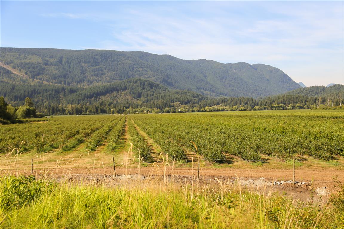
The combination of cultivated berry fields, wild blackberries, marsh vegetation, and nearby forest makes this an attractive feeding area for wildlife.
It’s also a reminder that the dyke trails pass through a working agricultural landscape. Visitors should respect neighbouring farms, stay on public trails, and avoid entering private fields.
The Slough and Wetland Scenery
The slough itself is beautiful, particularly when the water is calm and reflects the surrounding vegetation.
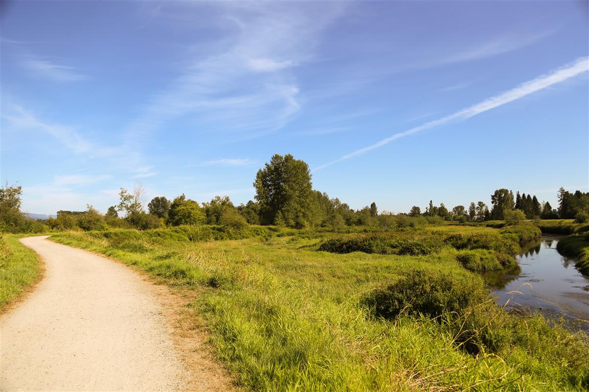
Wetlands like these provide important habitat for birds, fish, amphibians, and mammals. The shallow water, marsh vegetation, and surrounding trees create a variety of feeding and nesting opportunities.
Birdwatchers may spot belted kingfishers, ospreys, great blue herons, green herons, bald eagles, and numerous waterfowl species.
Because the dykes are open and relatively flat, it’s easy to stop and observe wildlife without leaving the established paths. A pair of binoculars can make the walk even more enjoyable.
Views of Mount Baker
On a clear day, you can even see Mount Baker in Washington State. The snow-covered volcano makes an impressive backdrop to the relatively flat landscape around DeBoville Slough.
Here’s a photograph I took of Mount Baker from the slough.
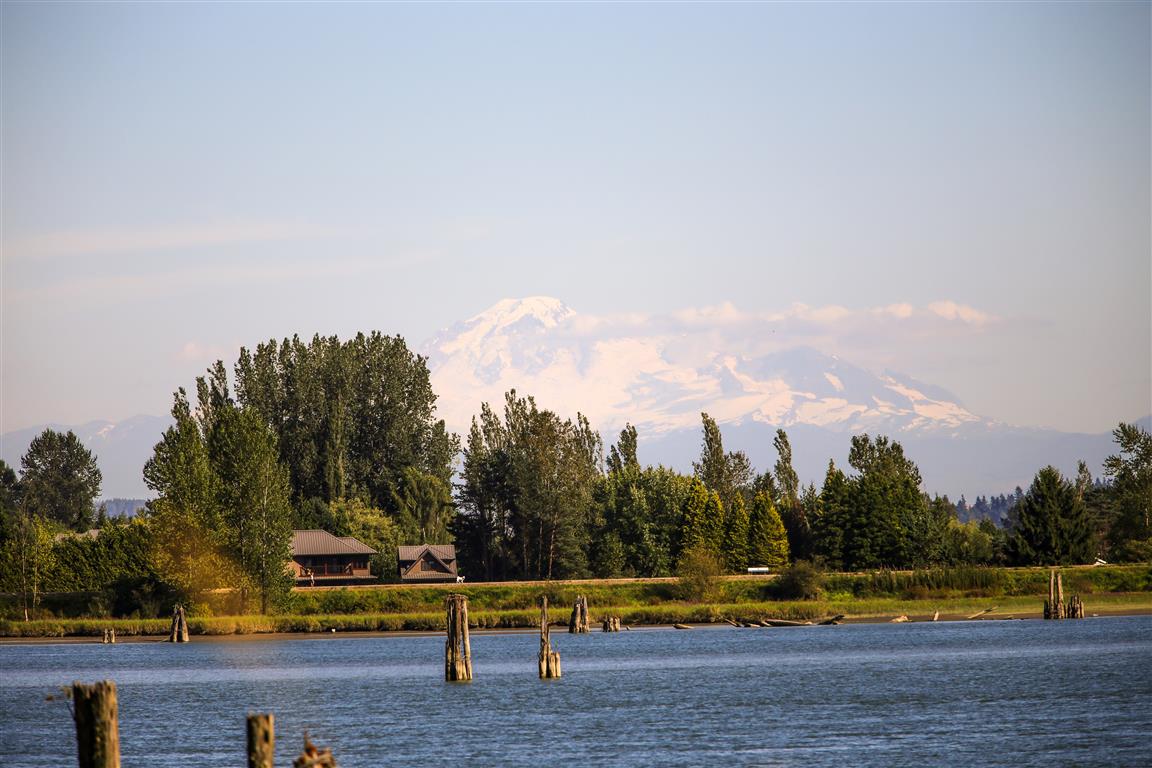
The contrast between the low-lying wetlands and the distant mountain scenery is one of the things that makes this walk so enjoyable.
More Wildlife Encounters
While exploring the dykes, I also captured a couple of photographs that I particularly liked.
First, a moment that made me want to put on the brakes!
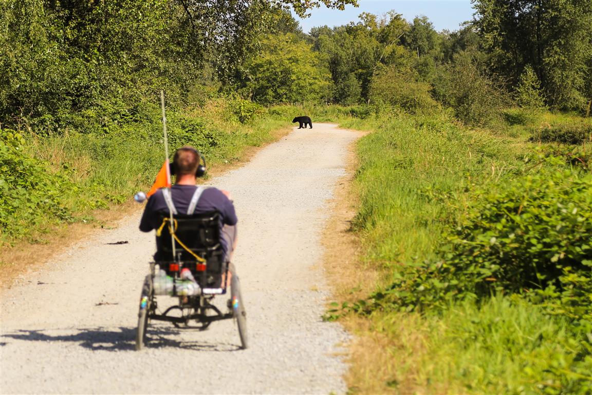
And here’s another interesting sight: a bear swimming in the water.
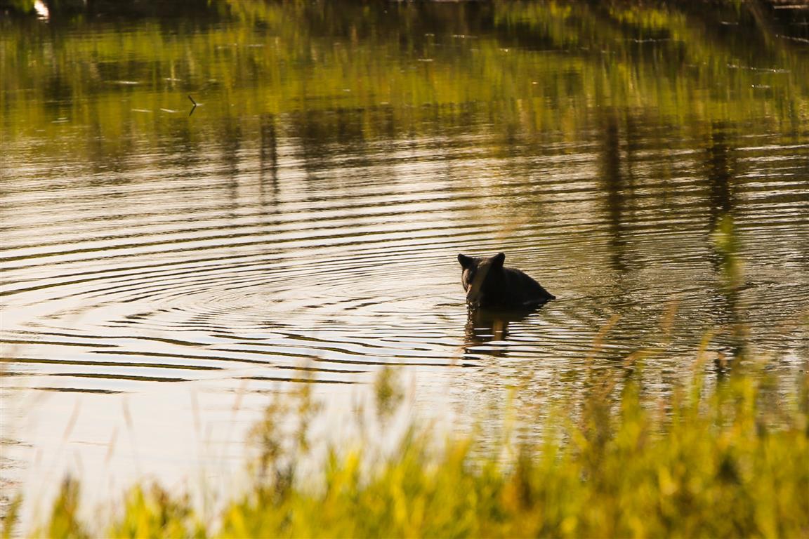
Black bears are capable swimmers, and water doesn’t necessarily prevent them from moving between feeding areas. Seeing one in the water was another reminder of how well these animals are adapted to the landscape.
Interesting Facts About DeBoville Slough
- Approximately 2.2 km long: DeBoville Slough connects the Hyde Creek drainage system with the Pitt River. The dykes on either side provide convenient walking and cycling routes.
- Part of the Traboulay PoCo Trail: The southern dyke connects with Port Coquitlam’s approximately 25 km recreational trail system, which follows rivers, creeks, wetlands, and urban greenways around the city.
- The dykes help manage flooding: DeBoville Slough lies within the low-lying Pitt River floodplain. dykes and drainage infrastructure help protect nearby agricultural lands and developed areas.
- The Pitt River is influenced by tides: Although the water is freshwater, tidal fluctuations affect water levels in the lower Pitt River and connected waterways.
- A haven for birds: DeBoville Slough is known for birdwatching. Species recorded in the area include belted kingfishers, ospreys, green herons, bald eagles, and occasionally greater sandhill cranes.
- Part of a larger wetland system: Nearby Pitt-Addington Marsh Wildlife Management Area protects approximately 2,972 hectares of important wetland habitat used by more than 200 bird species.
- Black bears are seasonal visitors: Berry fields, wild vegetation, and surrounding natural areas provide attractive feeding opportunities, particularly when berries are ripening.
- Biogeoclimatic Zone: The area lies within the Coastal Western Hemlock biogeoclimatic zone, characteristic of southwestern BC’s mild, wet coastal climate. The local floodplain supports wetlands, shrubs, and deciduous trees such as black cottonwood, red alder, and willow.
Best Time to Visit
DeBoville Slough can be enjoyed throughout the year, although each season has something different to offer.
- Spring: Migrating birds, fresh vegetation, and activity around the wetlands.
- Summer: Warm weather, green fields, and opportunities to see wildlife, including bears. Some stretches can become quite hot because there is little shade.
- Autumn: Changing vegetation, cooler temperatures, and excellent opportunities for birdwatching and photography.
- Winter: A quieter walking experience, with waterfowl and other birds using the wetlands.
Because the trails are exposed, windy or rainy conditions can make the walk less comfortable. The paths may also become muddy or wet after heavy rainfall.
Walking Preparation
This is an easy, nearly level walk, so you don’t need the same level of equipment as you would for a mountain hike. However, it still makes sense to bring a few basic essentials.
Comfortable walking shoes, weather-appropriate clothing, a charged phone, and a small first-aid kit are usually sensible choices. A trail map or downloaded offline map is useful if you’re planning to explore beyond the main dykes.
For longer outings, consider the Ten Essentials recommended by North Shore Rescue.
Binoculars and a camera are also great things to bring, particularly if you’re interested in birds and wildlife photography.
Leave No Trace
DeBoville Slough is an important wetland and wildlife habitat, so please help protect the area while enjoying the trails.
- Stay on public trails: Avoid entering agricultural fields or disturbing wetland vegetation.
- Pack out your garbage: Food scraps and other waste can attract bears and other wildlife.
- Give wildlife space: Never approach or feed bears, birds, or other animals.
- Respect nesting birds: Observe birds from a distance, particularly during the breeding season.
- Keep dogs under control: Follow posted leash requirements and prevent pets from disturbing wildlife.
- Share the trail: Walkers, cyclists, and other permitted trail users share portions of the dyke system. Cyclists should slow down when passing pedestrians or wildlife.
Final Thoughts
DeBoville Slough is an excellent choice when you want an easy walk with beautiful scenery and plenty of opportunities for wildlife photography.
My two bear encounters certainly made the outing memorable, but even without the bears, the wetlands, blueberry fields, Pitt River, and distant mountain views make this a worthwhile destination.
It’s also a great reminder that some of the most interesting natural areas in the Tri-Cities don’t require a strenuous hike to enjoy.
Trail Conditions and Disclaimer
This article describes conditions and wildlife encounters during my original walk. Trail conditions, access arrangements, parking, and wildlife activity may have changed since then. dyke paths can be affected by flooding, maintenance, and seasonal conditions. Confirm current access information and follow posted signs before heading out.