Buntzen Lake Hiking Guide
The Buntzen Lake area offers everything from short forest walks to long, demanding mountain routes. This page provides a quick overview of the main hiking trails around Buntzen Lake, with distances, hiking times, elevation information, photographs, and links to my more detailed hike pages.
The statistics below are based primarily on my GPS tracks and hiking experience. Hiking times vary considerably depending on fitness, trail conditions, weather, and how often you stop.
Elevation gain is the difference between the lowest and highest points on the route.
Cumulative elevation gain is the total of all uphill climbing throughout the hike.
Trail Guide at a Glance
| Trail | Time | Distance | Elevation Gain |
Cumulative Gain |
|---|---|---|---|---|
| Buntzen Lake Loop | 1.5–4 hours | 10.1 km | 100 m | 325 m |
| Lakeview Trail | 2–5 hours | 11.4 km | 146 m | 412 m |
| Diez Vistas Trail | 3–7 hours | 12.4 km | 450 m | 720 m |
| Lindsay Lake Loop | 6–8 hours | 13 km | 1,000 m | 1,150 m |
| Swan Falls Loop | 8–10 hours | 16 km | 1,100 m | 1,500 m |
| Dilly Dally Loop | 10–12 hours | 22 km | 1,125 m | 1,585 m |
| Energy Trail | 30–60 min | 1.9 km | 30 m | 80 m |
| Academy Trail | 2–2.5 hours one way | 4 km | 100 m | — |
| Old Buntzen Lake Trail | 45 min one way | 1.5 km | 20 m | — |
Buntzen Lake Loop
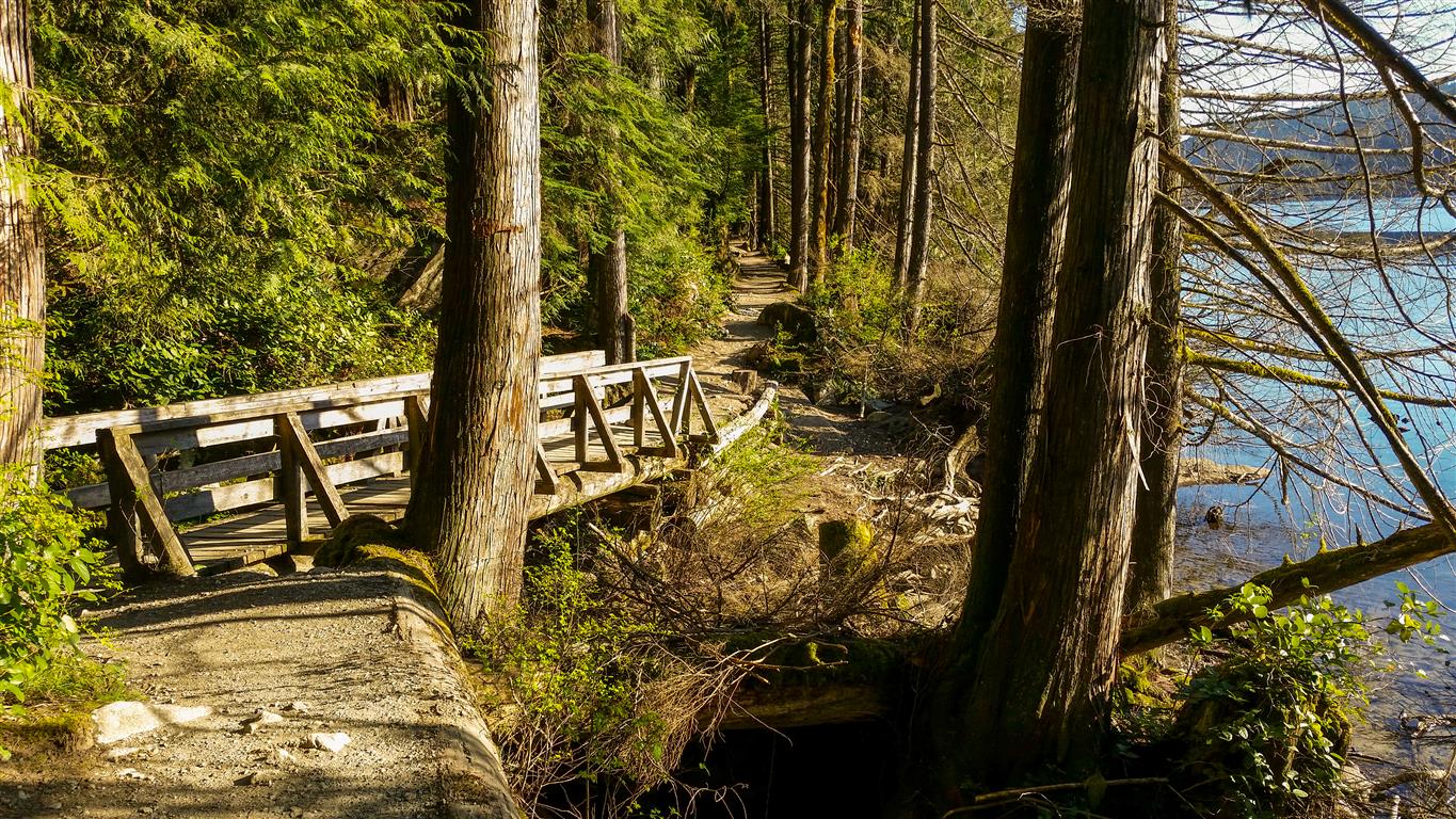
Circle Buntzen Lake and enjoy beautiful views of the lake and surrounding mountains. Starting at Buntzen Creek Bridge on the east side of South Beach, the trail heads north past several lake-access points and viewpoints.
After a short section on Powerhouse Road, the Buntzen Lake Trail continues to the North Beach picnic area. From here, cross the suspension bridge to continue around the lake. You can also return along the same eastern trail for a shorter outing.
After crossing the suspension bridge, the trail passes through open areas beneath the powerline, mature forest, and several bridge crossings before reaching Pumphouse Road. Follow the road south to the floating bridge at the southwest arm of Buntzen Lake, cross the bridge, and continue back to South Beach.
Diez Vistas Trail
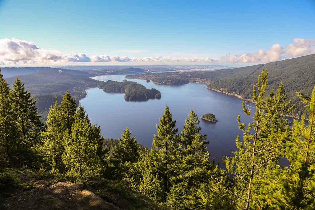
This route is recommended for experienced and fit hikers.
Diez Vistas means “ten views,” and the route offers viewpoints towards Burrard Inlet, Indian Arm, the North Shore Mountains, Eagle Ridge, and Buntzen Lake.
The trail begins near the southwest side of Buntzen Lake and climbs steadily through the forest. After crossing the powerline and pipeline, a series of switchbacks leads towards the first viewpoint. An eastern loop provides additional views towards Belcarra, Sasamat Lake, Eagle Ridge, and Buntzen Lake.
Farther north, the route eventually reaches a BC Hydro service road. From there, the Old Buntzen Lake Trail reconnects with the Buntzen Lake Trail near the suspension bridge and North Beach. The return to South Beach can be made along either Powerhouse Road or the Buntzen Lake Trail.
Lakeview Trail

Lakeview Trail is an alternate route along the west side of Buntzen Lake. It is a little longer and hillier than the main lakeside trail and generally sees fewer hikers.
The trail begins near the north end of Pumphouse Road and travels through forested terrain above the lake. The route is multi-use, including hikers, equestrians, and mountain bikes. Near the north end is a good viewpoint overlooking the surrounding area.
Halvor Lunden (Eagle Ridge) Trail
The Halvor Lunden Trail provides access to the higher terrain east of Buntzen Lake and includes the Lindsay Lake, Swan Falls, and Dilly Dally loops. The trailhead is on Powerhouse Road near the southeast corner of the South Beach parking area.
Lindsay Lake Loop
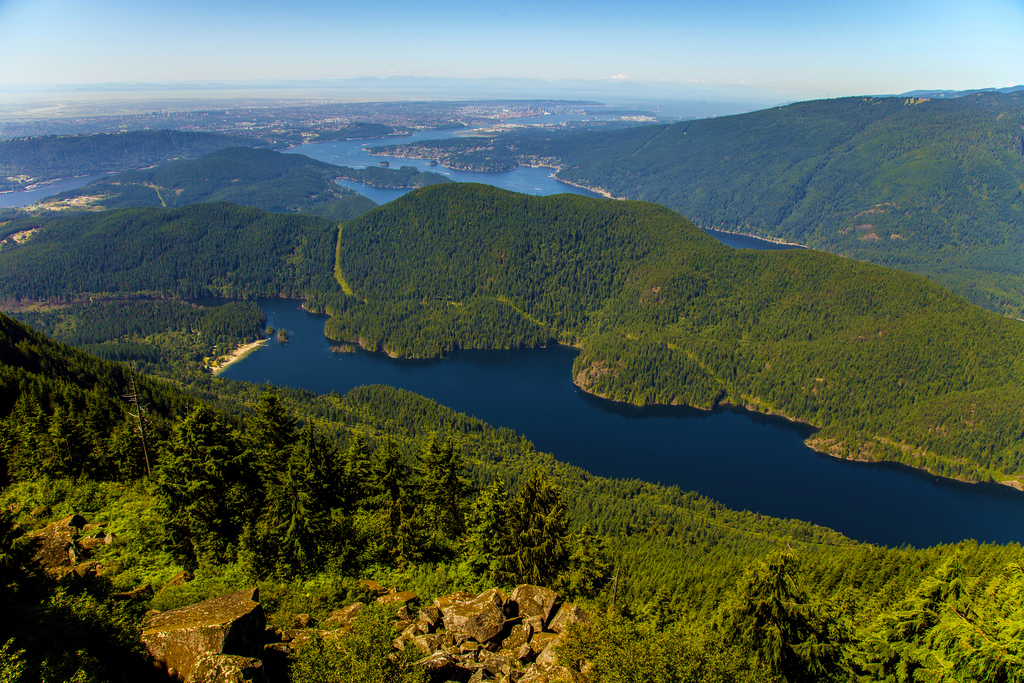
This route is recommended for experienced and fit hikers.
The Lindsay Lake Loop climbs to El Paso Junction before crossing Buntzen Creek and continuing through mountain forest and several viewpoints. At Lindsay Lake Junction, the route turns south through the “lakes district” before returning to El Paso Junction and descending to the main parking area.
Swan Falls Loop
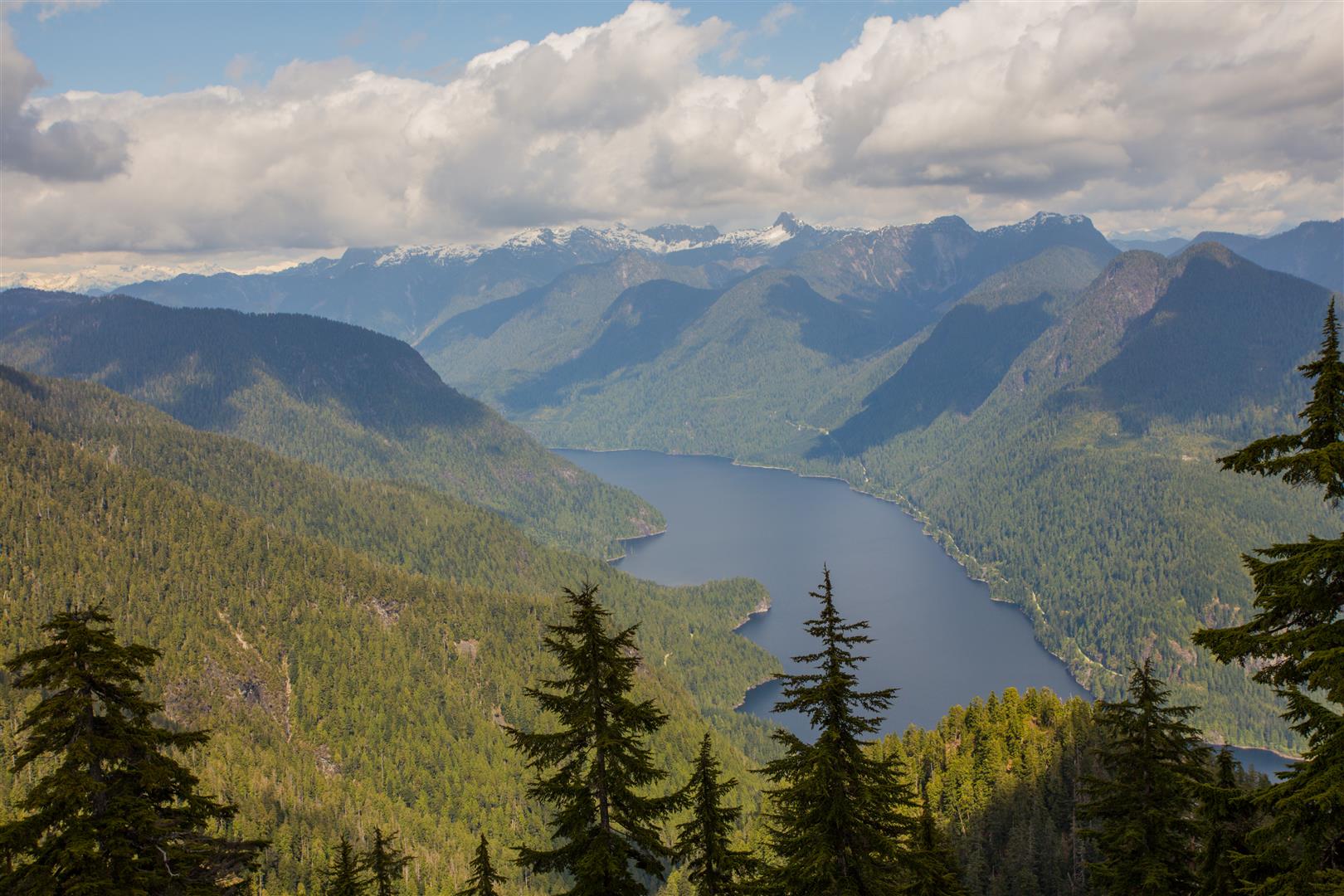
This route is recommended for experienced and fit hikers. It is very steep in places.
From El Paso Junction, hikers can reach Lindsay Lake Junction through either the old-growth forest and viewpoint route or the lakes district. Continuing north leads to Mount Beautiful (Eagle Peak), where there are expansive views of the surrounding mountains and valleys.
At Swan Falls Junction, the route turns onto the steep descent towards Powerhouse Road before returning to South Beach.
Dilly Dally Loop
This route is recommended for experienced and fit hikers.
The Dilly Dally Loop? Don’t believe it! Dilly dally along this trail and you may be spending the night. This is a long mountain route, so make sure you have the whole day and pay close attention to the Buntzen Lake gate-closing time.
Follow the Swan Falls route to Swan Falls Junction, then continue north along the ridge towards Dilly Dally Peak. The route eventually descends by trail and access road to Powerhouse Road and back towards South Beach.
Energy Trail

The Energy Trail loops around the forested knoll southwest of South Beach. It passes through several forest landscapes, provides occasional views of Buntzen Lake, and includes interpretive displays along the way.
This is a good option for newer hikers, families, and anyone looking for a shorter walk near South Beach.
Academy Trail
The Academy Trail begins near the main entrance gate and extends north through forest while roughly paralleling the main access road. It continues towards the equestrian parking area, follows Rogue Creek, and eventually reaches a transmission-line access road connecting with Powerhouse Road.
Old Buntzen Lake Trail
Before the suspension bridge was built, this trail formed part of the route around Buntzen Lake.
The trail follows the transmission-line corridor north from the Buntzen Lake Trail towards a concrete water-intake structure, then passes through the forest before joining Powerhouse Road northwest of the dam.
Equestrian and Mountain Biking Trails
Several trails around Buntzen Lake were originally constructed and maintained for equestrian use. Many are also open to hikers and mountain bikers. Some sections follow purpose-built trails, while others use old logging roads and transmission-line rights-of-way.
Bear Claw / Saddle Ridge / Horseshoe Trails
These trails climb into the cedar and hemlock forests on the slopes around Buntzen Lake. They form various loops with Powerhouse Road and Lakeview Trail and can also provide access towards Diez Vistas and the Sasamat Lake area.
Trail users should follow all posted signs and current access restrictions.
Before You Hike
For the longer and more demanding routes, make sure you are properly prepared. Carry the Ten Essentials, leave a trip plan with someone you trust, and make sure you know the Buntzen Lake gate-closing time before starting.
Bring a fully charged phone and consider carrying a backup battery. GPS works without cellular service when the required maps have been downloaded in advance.
Please respect the trails and surrounding environment. Pack out what you bring in and leave the area as you found it.