The Stawamus Chief, commonly known simply as the Chief, is one of the most popular hikes near Squamish, BC. Rising dramatically above Howe Sound, this enormous granite mountain has three summits, each offering spectacular views of Squamish, the surrounding mountains, and the water far below. I hiked to the Third Peak, following a steep forest trail that reminded me of the Grouse Grind in places. It’s a strenuous climb, but the views from the top are well worth the effort.
Stawamus Chief Trail Stats
🥾 Distance: 4.6 km return (my original recorded route)
⏱️ Estimated time: Allow approximately 3 to 5 hours for a hike to Third Peak, depending on pace and stops
⛰️ Original low point: 64 m
🏔️ Original high point: 686 m
📈 Original elevation difference: 622 m
💪 Difficulty: Challenging, with steep stairs, rocky terrain, and exposed viewpoints
🔄 Route type: Out and back to Third Peak
🌲 Park: Stawamus Chief Provincial Park, Squamish, BC
📍 Trailhead: Stawamus Chief Trailhead
These statistics reflect my original hike. My uploaded GPX file measures approximately 4.25 km but does not contain elevation readings. BC Parks lists the Third Peak trail as 1.8 km with approximately 630 m of elevation gain. Distances can vary depending on the starting point, summit exploration, and GPS recording methods.
Stawamus Chief GPS Route Map
The interactive map below shows my original recorded route towards the Third Peak of the Stawamus Chief. You can zoom in, move around the map, and switch between Map and Satellite views.
This map preserves my historical GPS recording, including the return route. The recorded start and finish points differ slightly, and the track does not contain elevation data. Follow current trail signs rather than relying exclusively on a historical GPS route.
Getting to the Stawamus Chief
The Stawamus Chief is located immediately south of Squamish, beside the Sea to Sky Highway. Its enormous granite cliffs are impossible to miss when approaching the town from Vancouver.
The main hiking trail starts near the Stawamus Chief Provincial Park campground and day-use parking area. You can also reach the trail system from nearby Shannon Falls Provincial Park using connecting paths.
The Sea to Sky Gondola is located nearby, but it is a separate attraction with its own trails and parking area. You don’t need to purchase a gondola ticket to hike the Chief.
Parking Information
BC Parks provides day-use parking at the Stawamus Chief. Parking can fill quickly during sunny weekends, particularly during the summer. Obey posted signs and park only in designated spaces, as BC Parks enforces parking restrictions and may tow illegally parked vehicles.
The nearby Sea to Sky Gondola introduced paid parking in March 2025. As of October 2026, its posted rates are $8 for a half-day and $10 plus applicable taxes for a full day. These charges apply to the gondola parking area, not necessarily to the provincial park’s own parking facilities.
For the latest information, check BC Parks’ Stawamus Chief Park information.
Hiking to the Third Peak
The Steep Beginning
The Stawamus Chief Trail starts out steep, and I found that parts of the climb reminded me of the Grouse Grind. There are plenty of stairs, rocks, and roots, so you gain elevation quickly.
Despite the relatively short distance, this is a demanding hike. The trail climbs through coastal forest, following a rough and sometimes uneven route towards the three summits.
One of the nice things about the Chief is that there are several destinations to choose from. You can hike to First Peak, Second Peak, or Third Peak, and some hikers combine two or all three in a longer outing.
Here’s a photograph I took of the Chief from Shannon Falls Provincial Park.
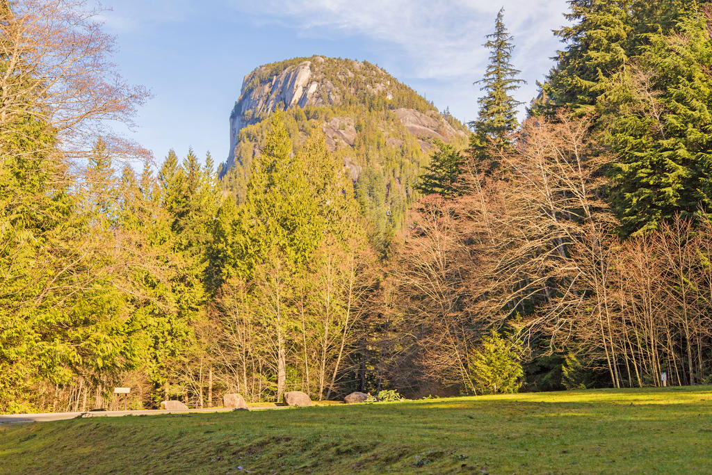
The Stawamus Chief rising above the surrounding forest, photographed from Shannon Falls Provincial Park.
Choosing Between the Three Peaks
As you climb higher, the trail eventually branches towards the different summits. The three peaks have their own viewpoints and provide somewhat different perspectives of Howe Sound and the Squamish Valley.
BC Parks lists the following approximate one-way trail distances and elevation gains:
| Summit | Trail distance | Elevation gain |
|---|---|---|
| First Peak | 1.5 km | 540 m |
| Second Peak | 1.7 km | 590 m |
| Third Peak | 1.8 km | 630 m |
These are BC Parks’ published trail distances to each summit. Visiting multiple peaks adds further distance and climbing, especially when descending and climbing between viewpoints.
Some of the upper trail sections include steep rock, scrambling, and assisted sections with fixed chains or ladders. The exposed granite can be particularly slippery when wet, so this isn’t a hike I’d recommend in poor weather.
The Third Peak
I continued towards Third Peak, which is the summit shown in my original photographs.
After the steep forest climb, the terrain opens onto the exposed granite near the top. This is where the scenery becomes truly spectacular.
From the summit, there are outstanding views over Howe Sound, the town of Squamish, and the surrounding Coast Mountains.
Here is one of my photographs from Third Peak.
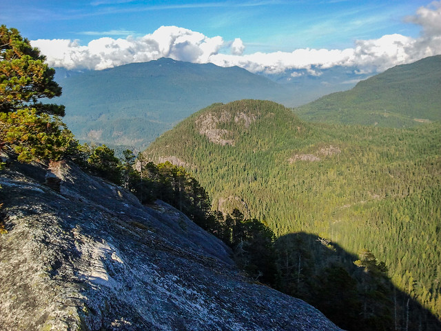
The view from the Third Peak of the Stawamus Chief.
And here’s another view from my hike.
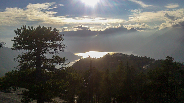
More spectacular scenery from the Chief.
And finally, here I am at the top!
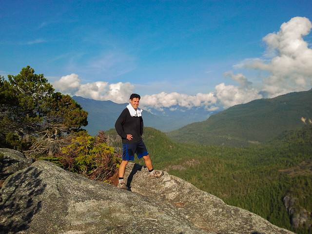
Me at the Third Peak of the Stawamus Chief.
One important thing to remember is that the summit areas have serious drop-offs. There are exposed rock faces and cliffs, so take care when exploring viewpoints or taking photographs. Stay well back from edges, particularly when conditions are wet or windy.
The Return Hike
After enjoying the summit, I returned by the same general route.
The descent can be harder on your knees than you might expect. There are plenty of steep stairs and rocky sections, and fatigue can make it easier to slip or lose your footing.
Take your time, especially where the trail is steep or exposed.
Interesting Facts About the Stawamus Chief
- One of the world’s great granite landmarks: The Stawamus Chief is among the largest granite monoliths in the world. Its imposing cliffs rise approximately 700 m above the surrounding landscape.
- Three summits: First, Second, and Third Peaks offer separate viewpoints. Many hikers visit only one, while others combine several in a longer hike.
- A world-famous rock-climbing destination: The Chief attracts climbers from around the world. Its steep granite faces contain many established climbing routes, including some exceptionally challenging multi-pitch climbs.
- Granite shaped by glaciers: The Chief consists largely of granitic rock formed deep underground and later exposed through erosion. Glaciers helped shape the surrounding valleys and smooth some of the rock surfaces visible today.
- Peregrine falcons nest on the cliffs: The sheer rock faces provide nesting habitat for peregrine falcons. BC Parks may temporarily close particular climbing routes during the nesting season to protect the birds.
- Howe Sound is a fjord: The deep coastal inlet below the Chief was shaped by glaciers. The combination of mountains, ocean, and steep forested slopes creates the spectacular views from the summits.
- Biogeoclimatic Zone: The Chief is primarily within the Coastal Western Hemlock biogeoclimatic zone. The lower forest includes western hemlock, Douglas-fir, western redcedar, mosses, and ferns, while exposed rock and shallow soils support different vegetation near the summits.
- Shannon Falls is nearby: At approximately 335 m high, Shannon Falls is one of British Columbia’s tallest waterfalls. It’s worth visiting before or after the hike if you have the time.
Best Time to Hike the Stawamus Chief
The best time for most hikers is during the warmer, generally drier months, typically from late spring through early autumn, depending on weather and trail conditions.
Summer offers longer daylight hours and usually better footing, but the trail can become very crowded on sunny weekends.
Spring and autumn can be quieter, although rain makes the granite, wooden steps, roots, and rocks slippery.
Winter hiking is considerably more challenging. Snow, ice, freezing temperatures, and falling ice or rock can create serious hazards. BC Parks specifically advises caution with slippery stairs and trail surfaces during winter conditions.
I would avoid the exposed summit areas during heavy rain, thunderstorms, or icy conditions.
Hiking Preparation and the Ten Essentials
Although the Third Peak hike is relatively short, it involves a substantial climb and some steep, exposed terrain. Wear sturdy footwear with good traction, dress for changing mountain weather, and bring sufficient food, water, a charged phone, and extra clothing. Carry navigation equipment, a headlamp, a first-aid kit, emergency shelter, and the other Ten Essentials. See North Shore Rescue’s Ten Essentials for more information.
Leave a trip plan with someone you trust, including your intended route and expected return time. GPS navigation and downloaded offline maps can be useful, but don’t rely on electronic devices alone.
Most importantly, allow plenty of time for the descent. Reaching the summit is only half the hike!
Leave No Trace
The Chief is an extremely popular hiking and climbing destination, so protecting its natural environment is particularly important.
- Stay on designated trails: Avoid shortcuts, especially on steep slopes where erosion can develop quickly.
- Pack out all garbage: Leave no food scraps, wrappers, or other waste behind.
- Respect wildlife: Never feed animals, and obey posted wildlife-protection closures, particularly around nesting birds.
- Protect vegetation: Avoid trampling sensitive plants growing in thin soils and cracks in the granite.
- Respect other hikers and climbers: Share narrow sections, stay clear of active climbing areas, and avoid dislodging rocks.
- Keep dogs under control: Follow BC Parks’ posted pet rules and clean up after your dog.
Final Thoughts
The Stawamus Chief is one of those hikes where you get a tremendous reward for a relatively short distance. The climb is steep, and there are some challenging sections, but the spectacular scenery makes the effort worthwhile.
I particularly enjoyed the Third Peak, with its views of Howe Sound and the surrounding mountains.
Whether you visit one summit or attempt all three, the Chief is a memorable hike and one of the most recognizable natural landmarks in the Squamish area.
Trail Conditions and Disclaimer
This article describes my original hike and includes photographs and GPS data recorded at that time. Trail conditions, access arrangements, route markings, and parking information may have changed. Steep terrain, exposed cliffs, slippery rock, and seasonal snow or ice can create serious hazards. Before heading out, check the latest information from BC Parks and follow all posted signs and restrictions.