Heliotrope Ridge is one of the best hikes in the Mount Baker area for getting remarkably close views of Mount Baker and the heavily crevassed Coleman Glacier. The trail climbs through forest and subalpine meadows on the north side of Mount Baker before reaching rocky terrain beside the glacier.
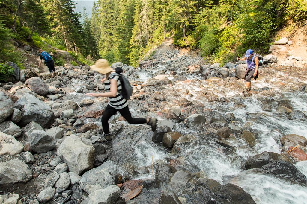
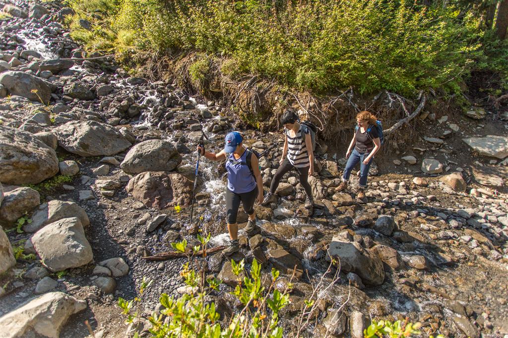
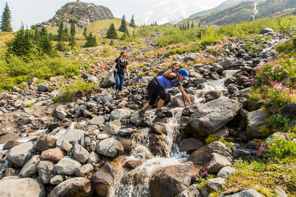
The hike is moderate in distance and elevation gain, but glacier-fed stream crossings can make it considerably more challenging. When I completed this hike, there were four unbridged crossings along the route. Their locations and difficulty can change from year to year as channels shift and water levels vary.
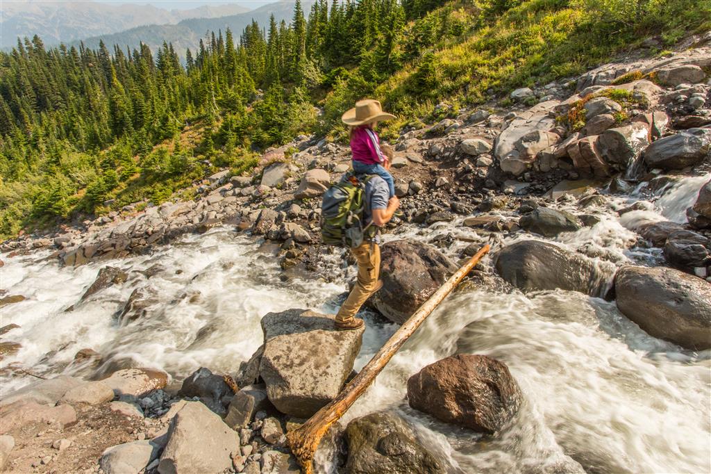
Stream conditions can change dramatically with temperature, snowmelt, rainfall, and the time of day. Glacier-fed streams may be substantially higher and faster later on warm afternoons. Do not attempt a crossing simply because other hikers have crossed successfully. If you cannot safely cross and return, turn around. Trekking poles can provide additional stability, but they are not a substitute for good judgement.
Trail Stats
These statistics are based on my recorded GPS route and include some additional exploring near the upper end of the hike.
- Distance: approximately 8.7 km return
- Recorded elapsed time: approximately 5 hours 18 minutes
- Low point: approximately 1,097 m
- High point: approximately 1,656 m
- Elevation gain: approximately 559 m
- Cumulative elevation gain: approximately 750 m
- Difficulty: Moderate, but potentially difficult when stream levels are high
- Route: Out and back
The Washington Trails Association currently describes the standard Heliotrope Ridge hike as approximately 8.9 km return with about 427 m of elevation gain. My GPS route reached somewhat higher terrain because of additional exploring near the end of the hike.
Glacier Creek Road has experienced significant storm damage and closures in the past, so always check current access conditions before leaving home. The Washington Trails Association Heliotrope Ridge page is useful for recent road, trail, snow, and stream-crossing reports.
Parking Pass
A Northwest Forest Pass or an accepted America the Beautiful Interagency Pass is required at the Heliotrope Ridge trailhead. A Northwest Forest Pass can also be purchased online through Recreation.gov. Purchase or download anything you need before driving into the mountains because cellular service can be unreliable.
Interesting Facts
- Mount Baker is an active volcano: Mount Baker is the youngest volcano within a volcanic field that has been active for more than one million years. Much of the present volcanic cone formed during the last approximately 30,000 to 40,000 years.
- A heavily glaciated mountain: After Mount Rainier, Mount Baker is the most heavily glaciated volcano in the Cascade Range in the United States.
- Coleman Glacier: The enormous glacier visible from Heliotrope Ridge is the Coleman Glacier. Like other glaciers on Mount Baker, its position has changed repeatedly as climate and snowfall have varied. Historical records document periods of both retreat and advance.
- Why “Heliotrope” Ridge? According to the Washington Trails Association, early explorers apparently mistook local valerian flowers for heliotrope, and the Heliotrope name remained.
- Mount Baker Wilderness: The trail quickly enters the Mount Baker Wilderness, where the landscape becomes progressively less developed as the route approaches the mountain.
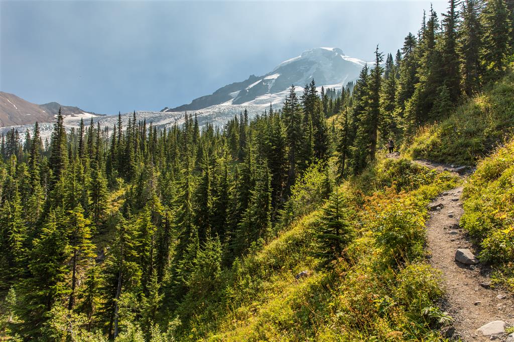
- Ecological setting: The trail climbs from high-elevation conifer forest into subalpine meadows and rocky alpine terrain. Forests in this part of the North Cascades commonly include Pacific silver fir and mountain hemlock, with trees becoming progressively more open as the trail approaches the glacier.
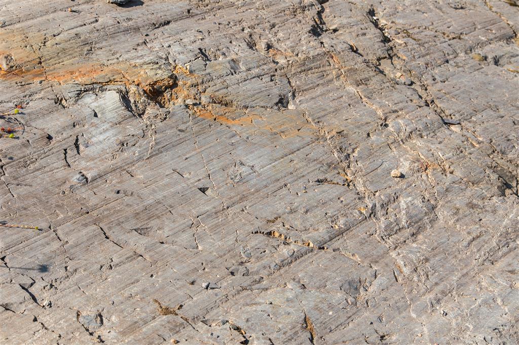
- Glacial landscape: The exposed rock near Coleman Glacier displays evidence of glacial erosion, including striations created when rock fragments frozen into moving ice scratched and gouged the underlying bedrock.
The Route
The interactive map below shows my actual GPS track. My route included a small amount of exploring near the upper end of the hike. Use the layer control in the upper-right corner to switch between the regular map and satellite imagery.
Hiking Heliotrope Ridge
The trail begins in forest and climbs steadily but generally moderately toward Mount Baker. As elevation increases, the forest begins to open and views of the surrounding mountains become increasingly impressive.
The route is also used by climbers heading toward the Coleman-Deming climbing route on Mount Baker, so it is common to encounter people carrying ropes, ice axes, crampons, and overnight equipment.
Stream Crossings
When I completed the hike, there were four unbridged stream crossings. Three were relatively straightforward that day, while one required considerably more care. These crossings are fed by snow and glacier melt, so their depth, speed, and exact channels can be very different on another day or in another year.
Water levels often increase as temperatures rise through the day. A crossing that looks manageable in the morning may be more difficult on the return trip. If conditions do not look safe, turning around is the correct decision.
Coleman Glacier
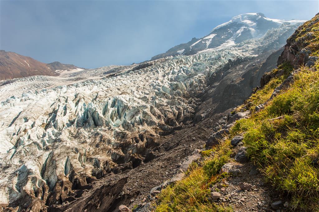
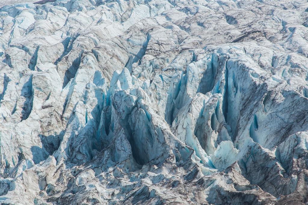
The main attraction is the extraordinary close-up view of Coleman Glacier. The glacier descends the northwest side of Mount Baker in a chaotic landscape of fractured ice, crevasses, seracs, moraines, and meltwater streams.
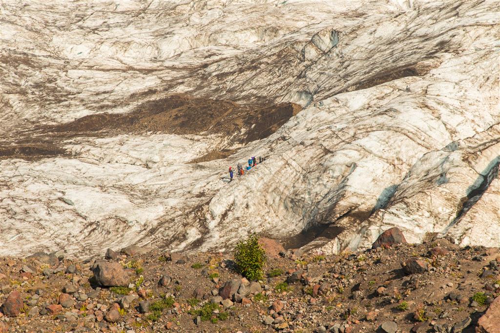
Crevasses may be hidden by snow bridges and can be extremely deep. The people visible on the glacier in some of my photographs should not be taken as an indication that walking onto the ice is safe for ordinary hikers.
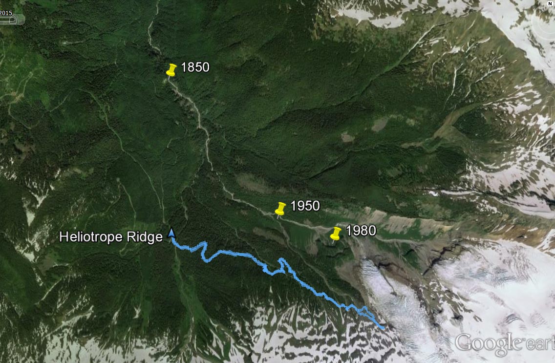
Coleman Glacier Through Time
Mount Baker’s glaciers have repeatedly advanced and retreated in response to changing climate and snowfall. Coleman Glacier retreated substantially during the first half of the twentieth century, later experienced a period of advance beginning around 1949, and has continued to change since then.
The historical graphic below illustrates how dramatically the position of the glacier has changed over time.
Mountain and Valley Views
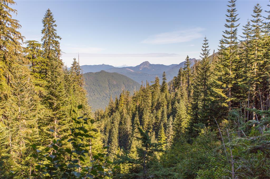
Although Mount Baker and Coleman Glacier dominate the hike, remember to look in the opposite direction as well. The elevated terrain provides broad views across the North Cascades and the forested valleys below.
Trail Maintenance
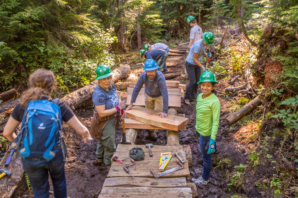
Heliotrope Ridge is a popular trail and receives regular maintenance. During my hike, several volunteers were working on the trail. Washington Trails Association crews have continued to work on Heliotrope Ridge in subsequent years.
Evidence of Glaciation
Near the upper part of the route, exposed bedrock shows clear signs of glacial erosion. Parallel scratches and grooves known as glacial striations form when rocks carried at the base of moving glacier ice scrape across the bedrock.
Wildflowers and Waterfalls
Summer brings wildflowers to the open areas along Heliotrope Ridge. During my visit, fireweed was blooming in large patches beside the trail.
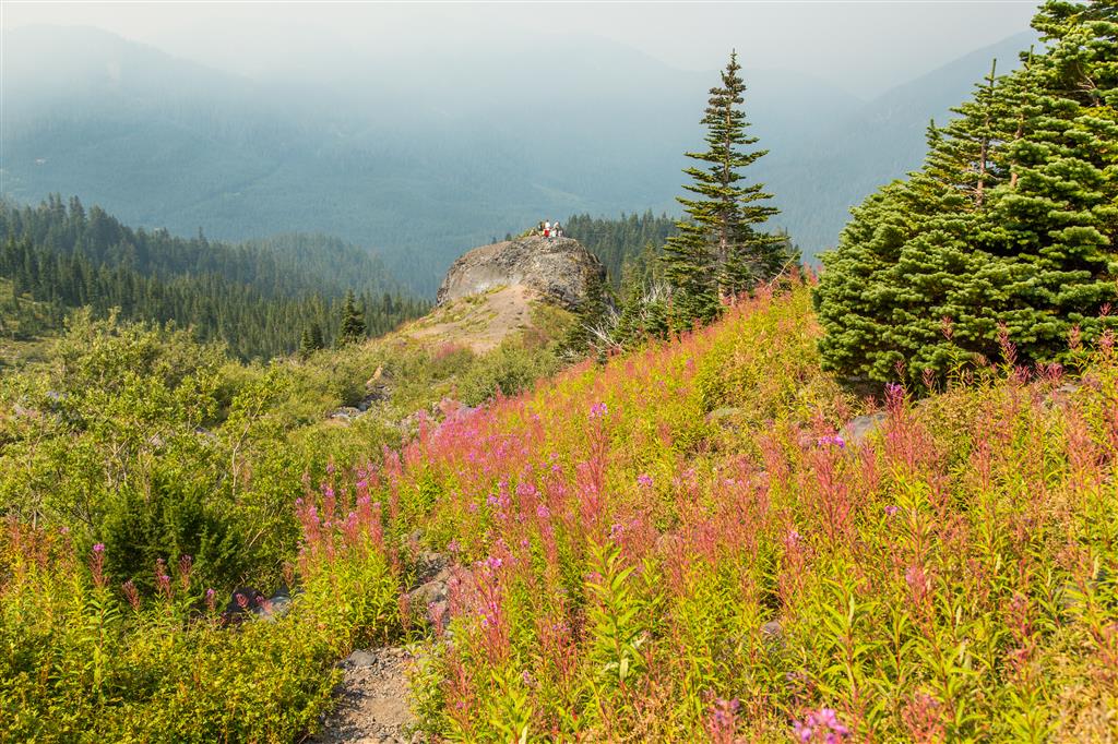
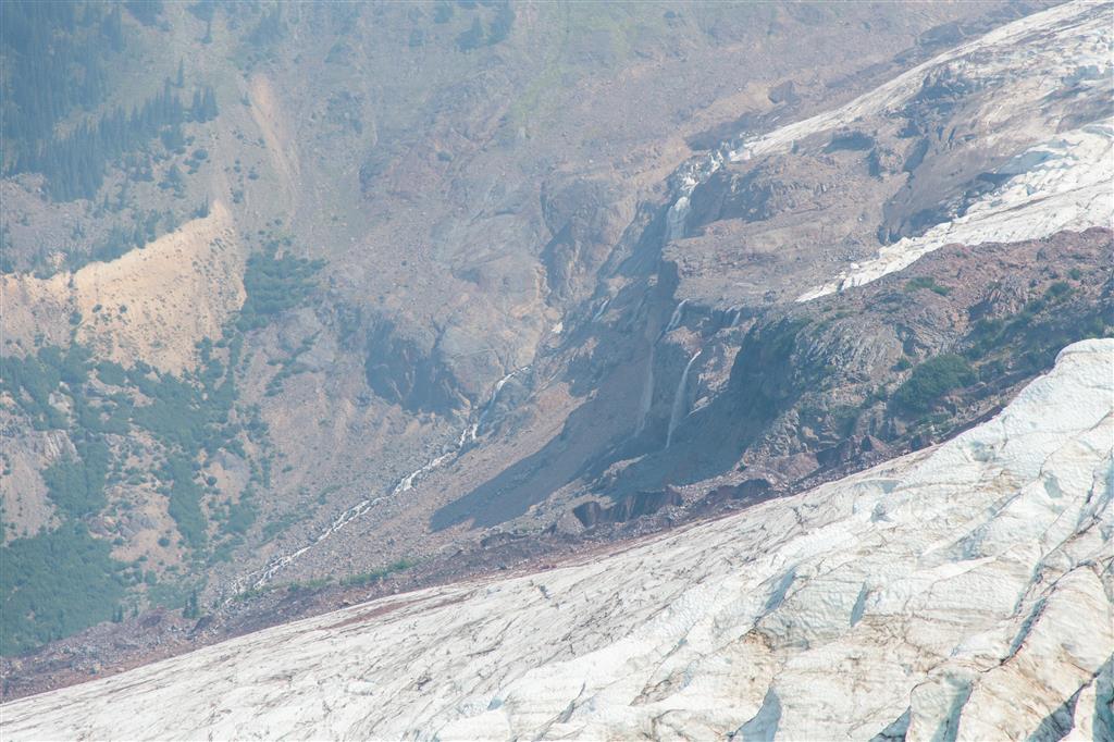
Snowfields and glaciers on the slopes of Mount Baker also feed numerous streams and waterfalls throughout the area.
What to Bring
Although Heliotrope Ridge is not an exceptionally long hike, its mountain location, stream crossings, rapidly changing weather, and distance from immediate help make good preparation important.
For this hike I recommend carrying the Ten Essentials, including reliable navigation, a headlamp, sun protection, first-aid supplies, emergency shelter, extra food, extra water or a suitable method of water treatment, extra clothing, and appropriate emergency equipment. Trekking poles are particularly useful for the stream crossings.
Carry a fully charged phone and backup power, but do not rely on cellular service. Download an offline map or GPS route before leaving the Mount Baker Highway, and leave a trip plan with someone you trust.
Leave No Trace
Please follow Leave No Trace principles throughout the hike. Stay on established trails and durable surfaces, pack out everything you bring in, do not pick wildflowers, avoid trampling the fragile subalpine meadows, and leave rocks and other natural features where you find them.
The area near Coleman Glacier is particularly sensitive. Avoid creating new paths across vegetation and do not approach wildlife or leave food behind.
Before You Go
Check current road, trail, snow, weather, and stream conditions before heading to Heliotrope Ridge. Glacier Creek Road is vulnerable to washouts, and conditions at the stream crossings can change quickly. Late-season snow and early autumn snowfall are also possible at these elevations.
The Washington Trails Association is an excellent source for recent trip reports and current trail information.