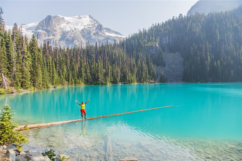
Joffre Lakes is one of British Columbia’s most spectacular mountain hikes, with three glacier-fed turquoise lakes, waterfalls, old-growth forest, rugged peaks, and close views of Matier Glacier. The park is located east of Pemberton along the Duffey Lake Road.
Lower Joffre Lake is only about a five-minute walk from the parking area, making it accessible even if you do not plan to complete the full hike. The trail to Middle and Upper Joffre lakes is considerably more demanding, climbing steadily through forest and increasingly rugged subalpine terrain.
When I completed this hike in August 2015, our group continued beyond Upper Joffre Lake and explored part of the lateral moraine before returning. My GPS track therefore extends beyond the normal hiking route.
BC Parks now manages Joffre Lakes with seasonal day-use passes, designated parking, camping reservations, and periodic temporary closures. For 2026, free day-use trail passes are required from May 11 through October 25 when the park is open. Check current BC Parks information before making the drive, as requirements and closure dates can change from year to year.
My 2015 route includes additional exploration toward the moraine above the lake. BC Parks now strongly discourages scrambling farther uphill from Upper Joffre Lake because of unstable terrain, rockfall, and icefall from the surrounding slopes and glacier. The normal day hike ends at Upper Joffre Lake.
Trail Stats
These statistics are based on my uploaded GPS recording and include the additional exploring we did beyond Upper Joffre Lake.
- Distance: approximately 10.2 km return
- Recorded elapsed time: approximately 5 hours 55 minutes, including breaks and exploring
- Low point: approximately 1,200 m
- High point: approximately 1,640 m
- Elevation gain to high point: approximately 440 m
- Cumulative elevation gain: approximately 575 m
- Difficulty: Moderate to challenging
- Route: Out and back
The normal hiking route to Upper Joffre Lake is shorter than my GPS track. BC Parks describes the campground at Upper Joffre Lake as approximately 4.5 km from the parking lot, with about 400 m of elevation gain from the parking area to Upper Joffre Lake.
Parking and Day-Use Passes
Parking is available in designated lots beside Highway 99 at the trailhead. Parking along the edge of the highway is not permitted. The park is extremely popular, particularly during summer weekends.
BC Parks operates a seasonal day-use pass system for Joffre Lakes. For the 2026 season, free passes are required from May 11 through October 25 when the park is open. Passes become available online beginning at 7:00 a.m. Pacific time two days before your visit. Requirements can change, so check the current BC Parks information before leaving home.
There are pit toilets at the parking area and additional toilets along the trail. Toilet paper may not be supplied, so bring your own. There is no treated drinking water in the park.
Interesting Facts
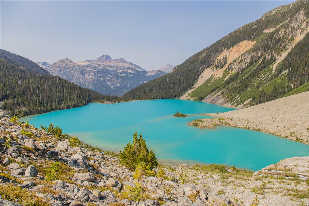
- Why are the lakes turquoise? The striking blue-green colour comes from extremely fine particles of ground rock known as rock flour or glacial silt. Glaciers grind the underlying rock into fine powder, which is carried into the lakes by meltwater. The suspended particles scatter sunlight and produce the vivid turquoise colour.
- Three lakes: The hiking trail passes Lower, Middle, and Upper Joffre lakes. Lower Lake is only a short walk from the parking area, while Middle and Upper lakes require a sustained climb.
- Matier Glacier: Upper Joffre Lake sits directly below the glaciated mountain basin, with dramatic views toward Matier Glacier and the surrounding peaks.
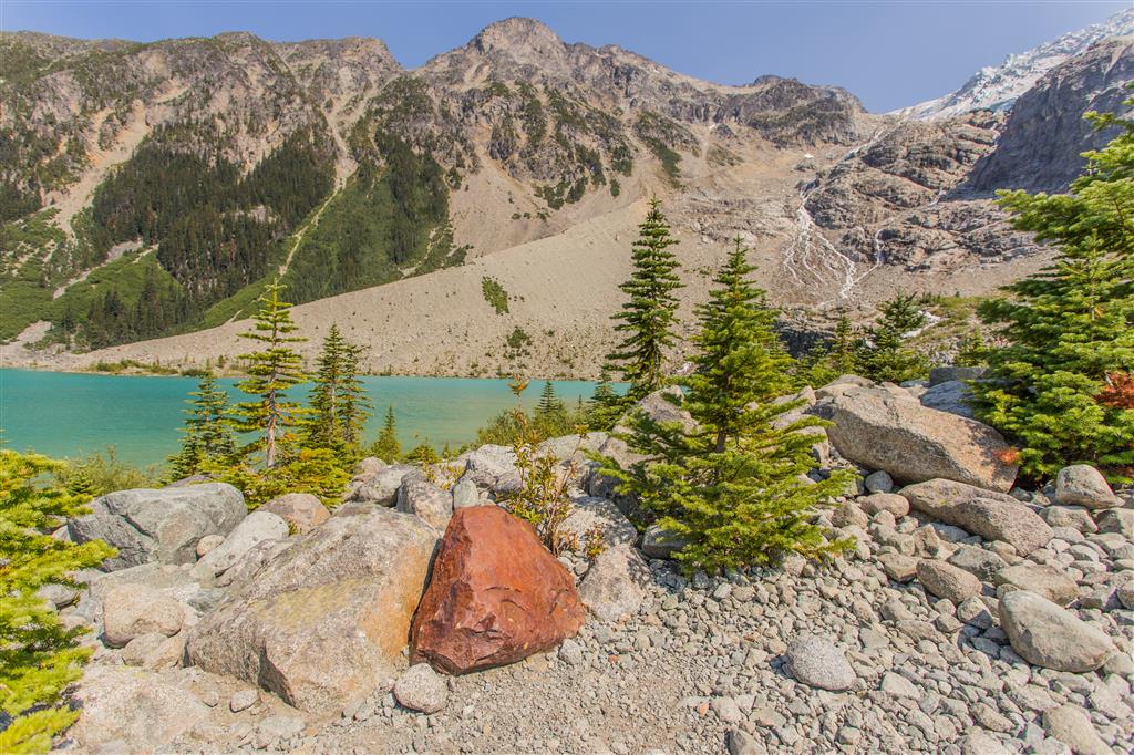
- Glacial landscape: The valley has been extensively shaped by glaciers. Moraines, talus slopes, glacially transported boulders, rushing meltwater streams, and steep U-shaped terrain are visible throughout the hike.
- Biogeoclimatic zones: Joffre Lakes Park contains several of British Columbia’s biogeoclimatic zones. The park includes Coastal Western Hemlock and Mountain Hemlock forests, while higher and more easterly terrain also extends into Engelmann Spruce–Subalpine Fir and Interior Mountain-heather Alpine ecosystems. The hiking trail shows the transition from moist forest into increasingly open subalpine terrain.
- Old-growth forest: Portions of the park protect old-growth forest, including trees more than 250 years old.
- Wildlife: Black bears, grizzly bears, mountain goats, deer, and pikas occur in the park. Keep food secure and observe wildlife from a distance.
- No pets: Dogs and other domestic animals are not permitted anywhere in Joffre Lakes Park.
- Extremely cold water: Despite their inviting colour, the lakes are glacier-fed and remain extremely cold. BC Parks does not recommend swimming.
The Route
The interactive map below shows my actual GPS recording from the hike. It includes the additional exploration we did beyond Upper Joffre Lake in 2015. The normal hiking route should end at Upper Joffre Lake rather than following the entire upper portion of my recorded track.
Use the layer control in the upper-right corner of the map to switch between the regular map and satellite imagery.
Lower Joffre Lake
Lower Joffre Lake is reached by an easy walk of only about five minutes from the parking area. This makes it possible to experience one of the park’s turquoise lakes without completing the full hike.
From Lower Lake, the character of the hike changes considerably. The trail begins climbing through forest toward Middle Joffre Lake, with steeper sections, roots, rocks, and constructed steps along the way.
Middle Joffre Lake
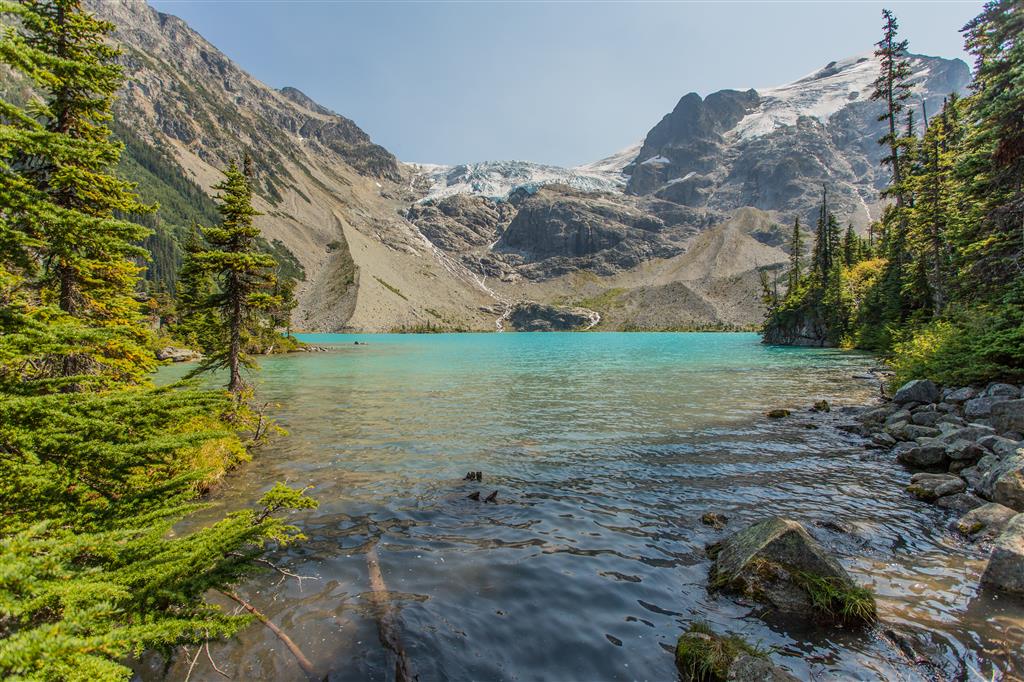
Middle Joffre Lake is one of the highlights of the route. The turquoise water, subalpine forest, surrounding peaks, and glacier views make this a popular place to stop before continuing toward Upper Lake.
Waterfalls and Meltwater
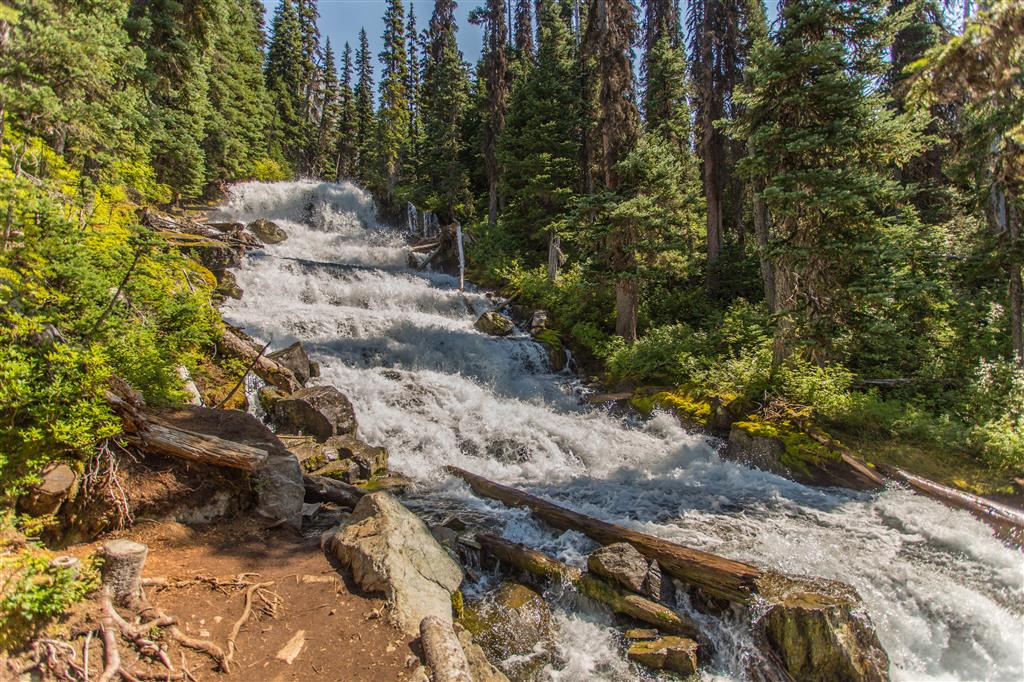
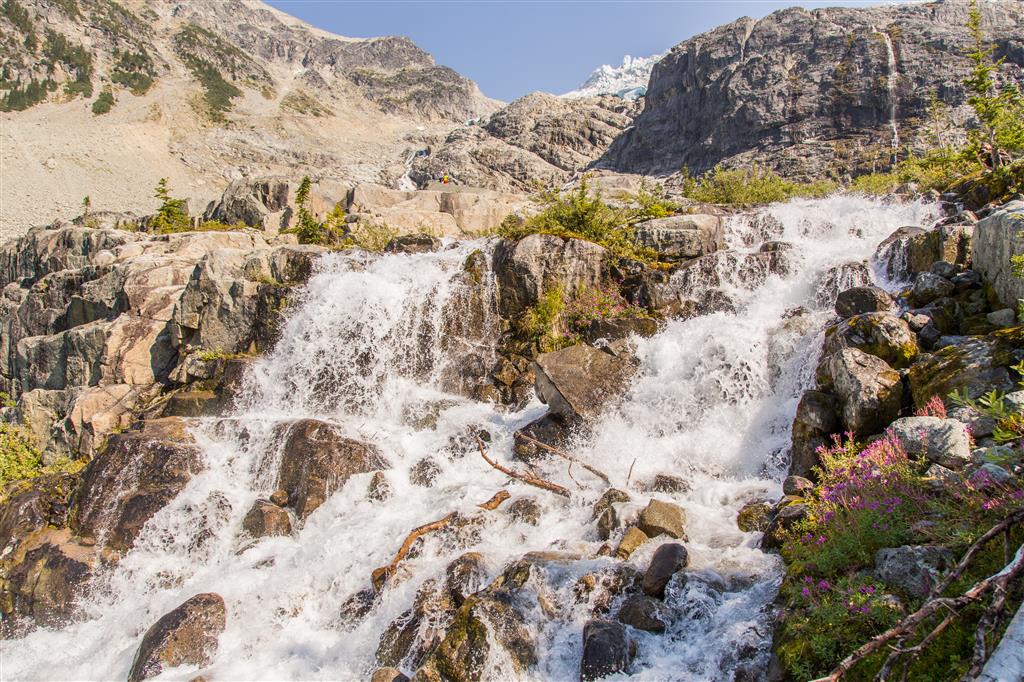
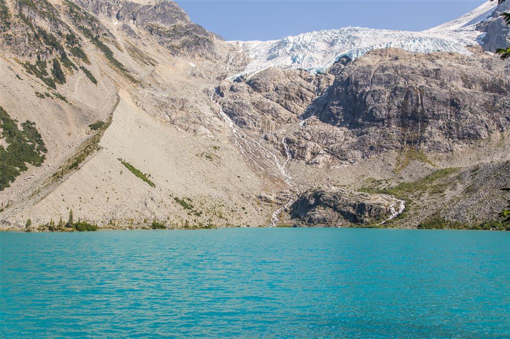
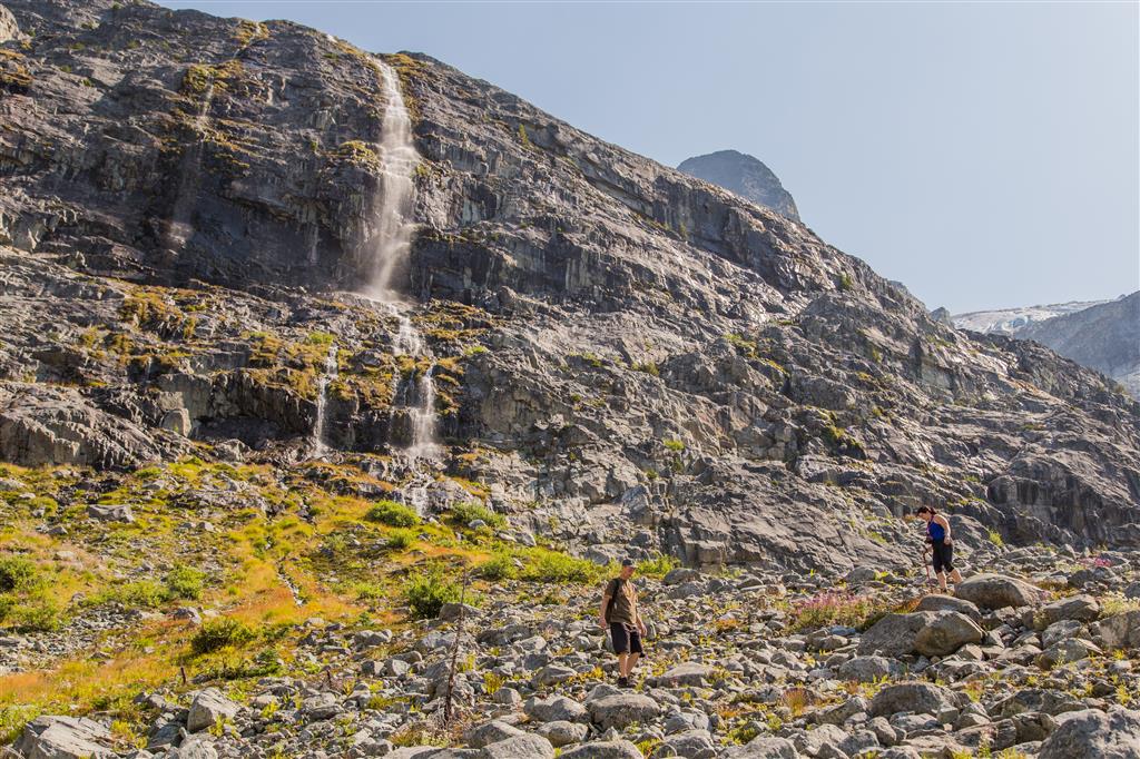
The trail passes several streams and waterfalls carrying snowmelt and glacial meltwater down through the valley. Flow varies considerably with temperature, recent weather, and the time of year.
Upper Joffre Lake
Upper Joffre Lake is the largest and most dramatic of the three lakes. The trail reaches the lake beneath steep mountain slopes and Matier Glacier, with turquoise water filling the glacial basin below.
This is the appropriate turnaround point for the normal day hike. Rockfall and icefall can occur in the upper basin, and BC Parks strongly discourages scrambling farther uphill toward the glacier.
Matier Glacier
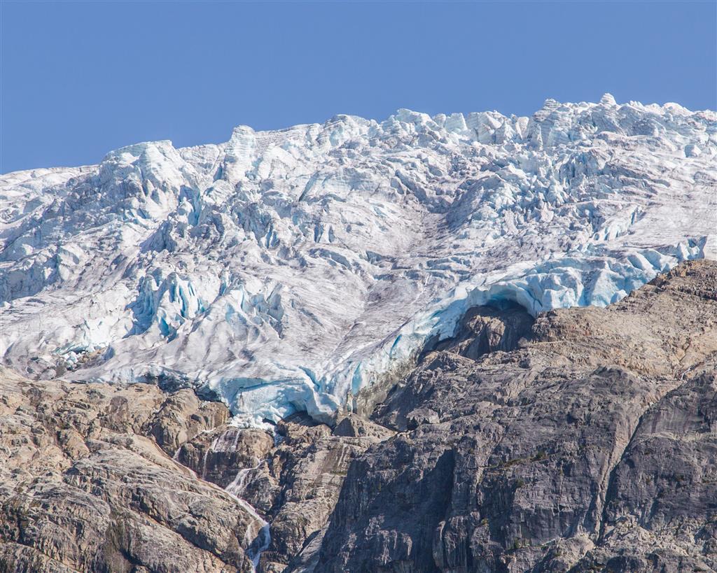
The glacier above Upper Joffre Lake dominates the upper basin. Even from the hiking trail, you can see heavily fractured ice, snow, exposed rock, and meltwater descending toward the lake.
Glaciers and the steep slopes around them are dynamic environments. Falling ice and rock can occur without warning, particularly during warm weather.
Camping at Upper Joffre Lake
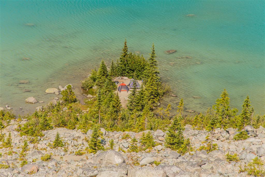
Backcountry camping is permitted only at the Upper Joffre Lake Campground and only on designated tent pads. Reservations are required during the operating season. The campground has 26 tent pads, toilets, and bear-proof food storage.
Campfires are permanently prohibited throughout Joffre Lakes Park. Campers must use a portable stove for cooking and pack out all garbage.
Wildflowers
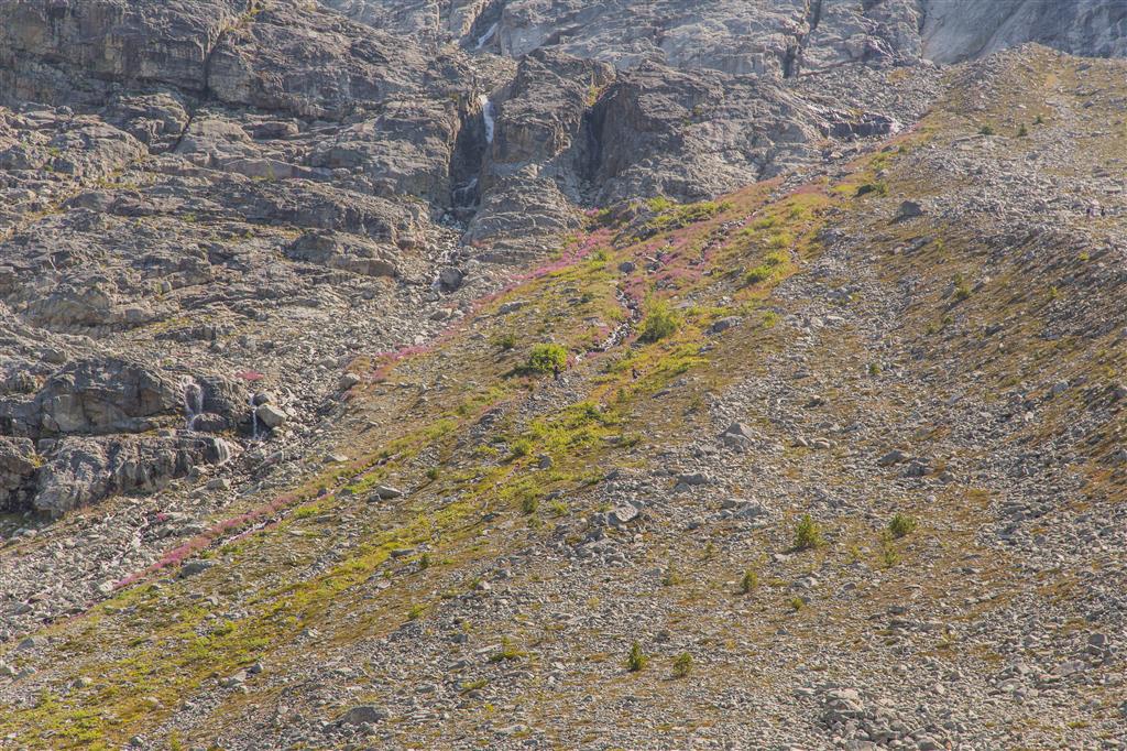
During the summer, wildflowers appear in open areas and along the subalpine slopes. The growing season is short at these elevations, so flowering times vary considerably with snowmelt and weather.
What to Bring
The hike to Upper Joffre Lake is not an extreme backcountry expedition, but it is long and steep enough to require proper preparation. The park is remote, there is no cell service, and BC Parks advises that emergency services are not available within the park.
For the full hike to Upper Lake, I recommend carrying the Ten Essentials, including navigation, a headlamp, sun protection, first-aid supplies, extra clothing, emergency shelter, extra food, and sufficient water. There is no treated drinking water in the park, so bring your own or carry an appropriate method of water treatment.
Carry a fully charged phone and backup power, but do not rely on cellular reception. Download an offline map before your trip and leave your route and expected return time with someone you trust.
Leave No Trace
Joffre Lakes receives heavy visitor use and contains fragile forest and subalpine ecosystems, so Leave No Trace practices are especially important here. Stay on designated trails, use established viewpoints and camping areas, and avoid shortcuts that damage vegetation and cause erosion.
Pack out everything you bring in, do not pick wildflowers or other plants, keep wildlife at a distance, and never leave food behind. Camping is permitted only in designated sites, and campfires are not allowed anywhere in the park.
Before You Go
Check current BC Parks information immediately before your trip. Day-use pass requirements, temporary closures, camping reservations, parking conditions, snow, trail conditions, and access can change.
Winter and shoulder-season conditions are very different from a summer hike. Snow can remain well into spring, and avalanche hazard exists during much of the fall, winter, and spring. This page describes my summer hiking experience.