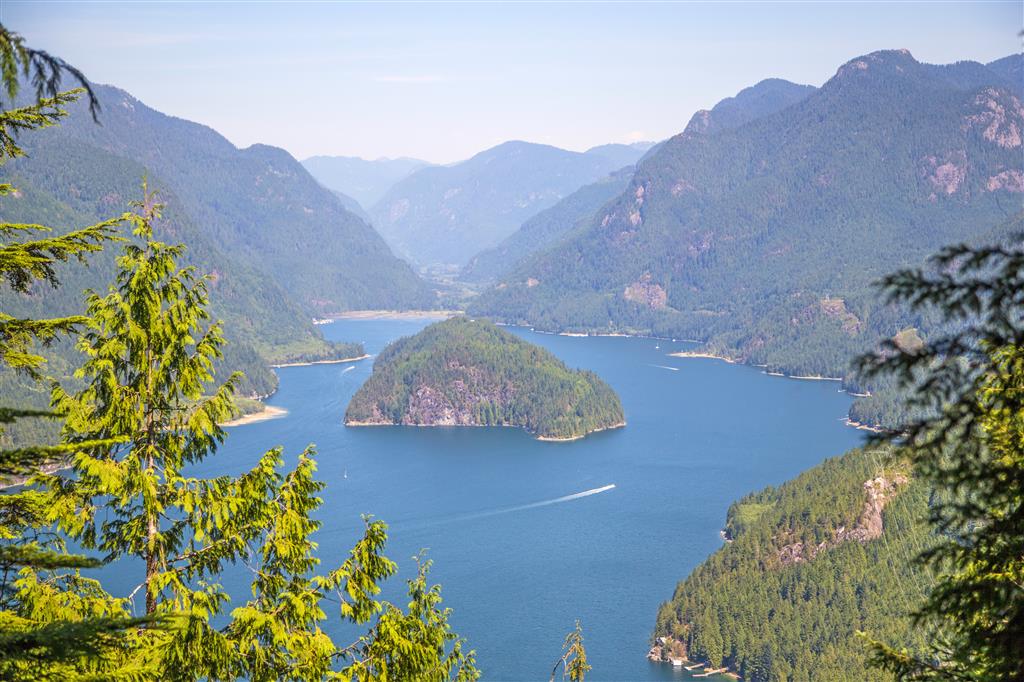
Croker Lookout is a viewpoint north of Buntzen Lake overlooking Indian Arm and Croker Island. It is reached from the northern portion of the Dilly Dally Trail and offers a much shorter objective than completing the full Dilly Dally route.
When I completed this hike, I approached from the north end of Buntzen Lake, travelling around the west side of the lake and returning on the east side. That route is no longer the recommended access because current BC Hydro closures affect Powerhouse Road and the northern Dilly Dally approach.
The route shown on this page reflects the hike I completed in 2015. BC Hydro currently prohibits pedestrian access on Powerhouse Road between North Beach and Buntzen Dam, and the Dilly Dally route is partially closed. Do not rely on this GPS track as a current access route. Check the latest BC Hydro trail information before planning a hike to Croker Lookout.
Trail Stats
These statistics are based on my original outing and uploaded GPS track. The route shown is historical and should not be treated as the current recommended approach.
- Distance: approximately 16.5 km return
- My hiking time: approximately 6 hours 45 minutes, including a 30-minute swim break
- Low point: approximately 117 m
- High point: approximately 443 m
- Net elevation gain: approximately 325 m
- Cumulative elevation gain: approximately 550 m
- Difficulty: Moderate to challenging because of the distance and repeated ups and downs
- Route: Historical loop-style approach with out-and-back spur to Croker Lookout
- 📍 Buntzen Lake parking: Google Maps and navigation
The cumulative climbing is noticeably greater than the difference between the lowest and highest elevations because the route includes many smaller climbs and descents along the way.
Interesting Facts
- Croker Lookout: The viewpoint sits on a short spur from the Dilly Dally Trail and looks north along Indian Arm toward Croker Island.
- Croker Island: The island lies near the northern end of Indian Arm and is the most prominent feature visible from the lookout.
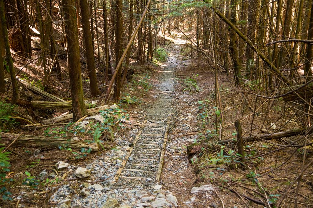
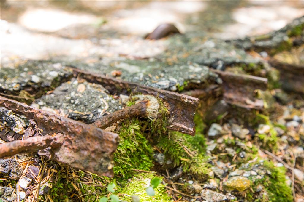
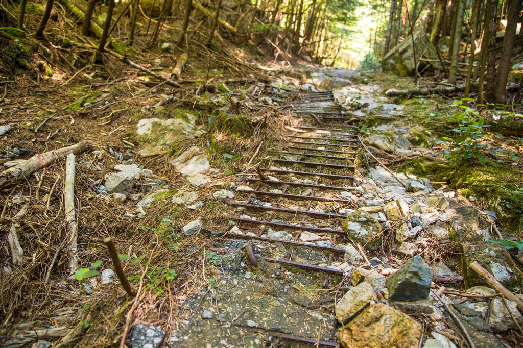
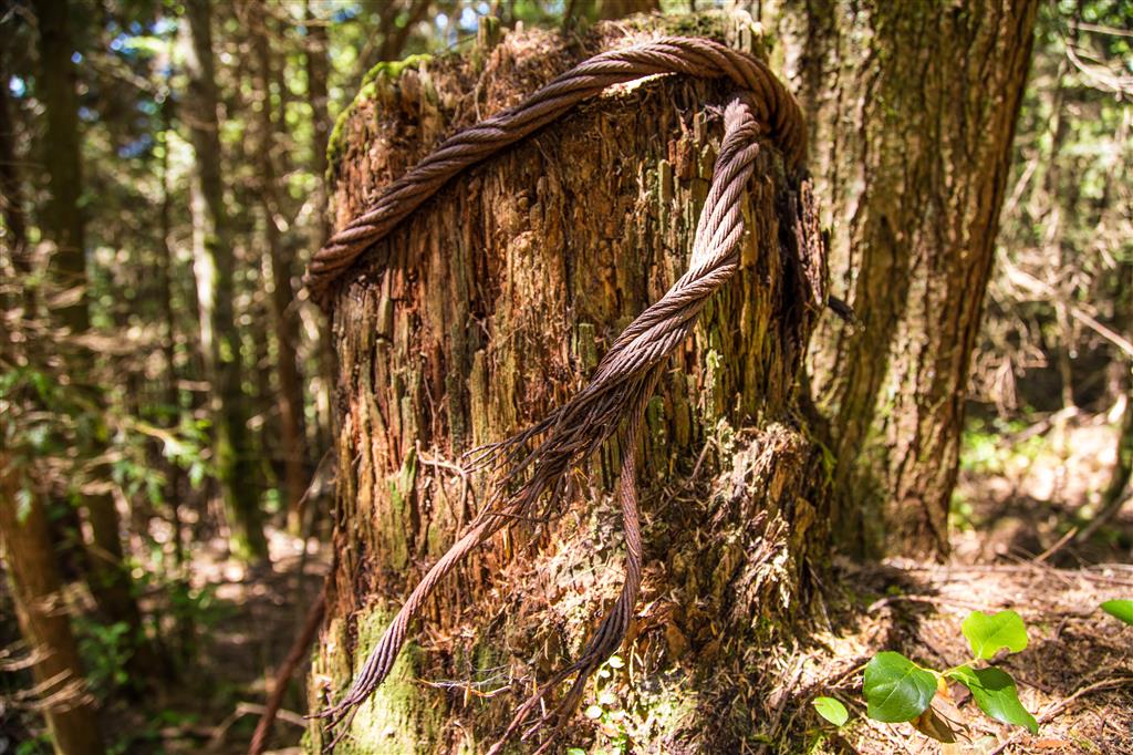
- Old logging landscape: Sections of the route pass remnants of earlier logging activity, including old road surfaces, steel cable, rebar, and timber supports. Similar logging-era remains can be found elsewhere around Eagle Ridge and Buntzen Lake.
- Biogeoclimatic zone: This lower-elevation part of the Buntzen Lake area lies within the Coastal Western Hemlock biogeoclimatic zone, characterized by moist coastal forest dominated by species such as western hemlock, western redcedar, Douglas-fir, mosses, ferns, and other shade-tolerant vegetation.
- Dilly Dally connection: Croker Lookout sits below the much higher Dilly Dally ridge route. The full Dilly Dally hike is a significantly more demanding undertaking and is recommended only for experienced, fit hikers.
- Croker Island naming: The island was reportedly named during nineteenth-century hydrographic surveying of the coast, probably in reference to James L. Croker of HMS Plumper.
The Route
The interactive map below shows the GPS route from my 2015 hike. Because current trail closures affect the northern approach, this map is included as a record of my hike rather than as a recommended present-day route.
Approaching Croker Lookout
On my hike, the route eventually left the road and entered the forest on the lower Dilly Dally Trail. The first section climbed steeply before easing into more rolling terrain.
Farther along, the trail followed portions of an old logging road. This was one of the more interesting parts of the hike because remnants of the former road and logging infrastructure were still visible in the forest.
Croker Lookout
The short spur to Croker Lookout leads to a bluff overlooking Indian Arm. Croker Island lies almost directly below and is the dominant feature in the view.
Logging Relics
Several unusual remnants of old road and logging infrastructure were visible along the route. These included timber supports, sections of asphalt containing steel reinforcement, and old steel cable.
These features are part of the industrial history of the area and should be left undisturbed.
Creeks and Forest
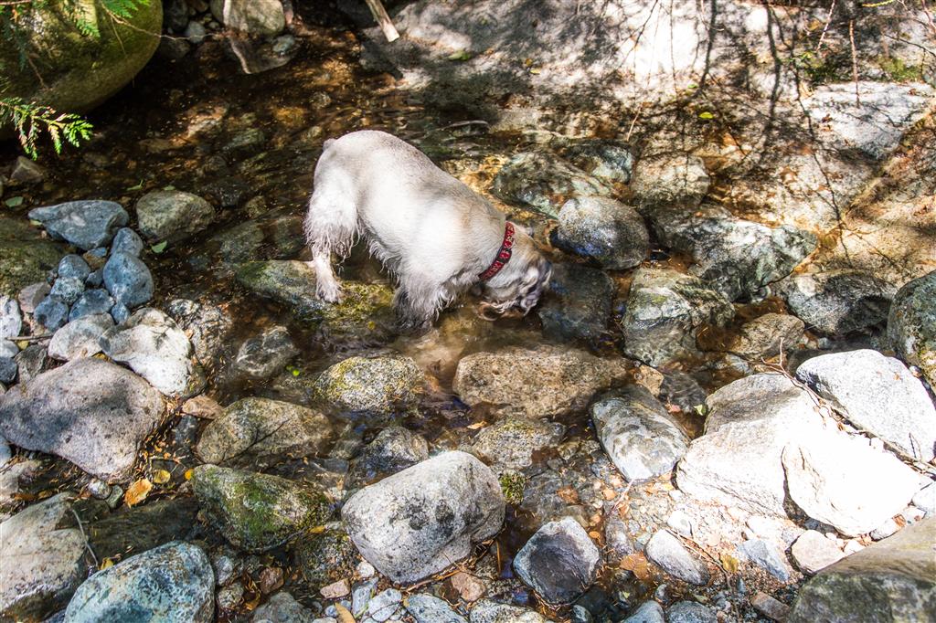
Several small creeks cross the lower part of the route. Flow varies through the year, and water should never be assumed to be available during dry periods.
Wild Blueberries
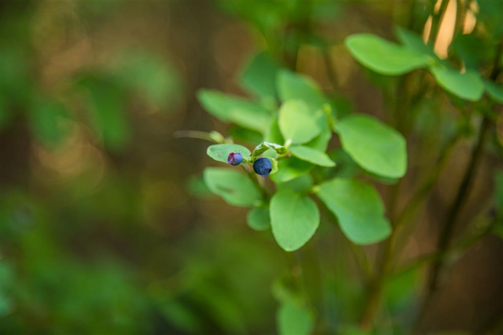
Wild blueberries were growing near the lookout during my summer hike. Berry production varies considerably from year to year depending on weather and growing conditions.
An Unexpected Find
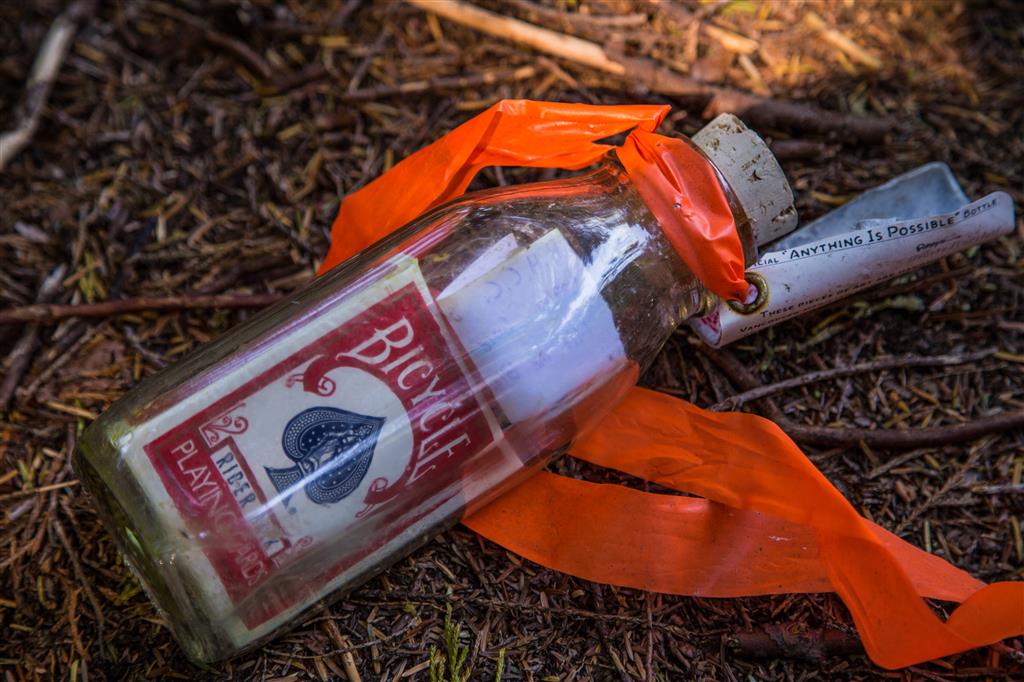
One of the more unusual things we found was a full deck of playing cards left inside a bottle near the trail.
What to Bring
Croker Lookout is a substantial hike from the Buntzen Lake recreation area and travels well beyond the heavily used lakeside trails. For a hike of this length, I recommend carrying the Ten Essentials.
Carry reliable navigation, a headlamp, sun protection, first-aid supplies, extra food, sufficient water, emergency shelter, and extra clothing. Download an offline map before starting and leave your route and expected return time with someone you trust.
Gate closing times are particularly important at Buntzen Lake. Allow enough time to return to the parking area well before the recreation area closes.
Leave No Trace
Please follow Leave No Trace principles throughout the hike. Stay on established trails, pack out everything you bring in, leave historic logging artifacts where you find them, avoid damaging vegetation, and keep wildlife at a distance.
Do not build new shortcuts or bypasses around difficult trail sections. BC Hydro specifically asks visitors to remain on established trails because informal routes damage soil and vegetation.
Before You Go
Check the current BC Hydro Buntzen Lake trail information before attempting this hike. The access route I used in 2015 is affected by current closures, including the closure of Powerhouse Road between North Beach and Buntzen Dam.
Also check current Buntzen Lake gate hours and parking requirements before leaving home. Summer parking reservations may be required during the peak season.