The Coquitlam Crunch is one of the most popular outdoor fitness trails in the Tri-Cities. Located in northeast Coquitlam, the trail climbs steeply beneath the BC Hydro transmission lines towards Westwood Plateau, offering a great workout and some impressive views along the way. I’ve walked the Crunch many times, and although it’s not a wilderness hike, it’s an excellent place to get some exercise without travelling far from home.
Status: No Known Restrictions
No specific trail access restrictions are currently known. Conditions may change due to weather, maintenance, or other factors. Check current information before heading out.
Coquitlam Crunch Trail Stats
🥾 Distance: 2.2 km one way (my original recorded route); the City’s newer trail map shows 2.9 km
⛰️ Original low point: 38 m
🏔️ Original high point: 289 m
📈 Original elevation gain: 251 m; the City’s current map lists 261 m
⏱️ Time: Approximately 1 to 1.5 hours for a return walk, depending on pace and route
💪 Difficulty: Moderate to challenging because of the steep incline and stairs
🔄 Route type: Uphill fitness trail; return via the same route or available connecting paths
🪜 Stairs: 894 across two stair sections
📍 Trail access: Lansdowne Drive access (Google Maps)
🅿️ Parking: Lansdowne Drive parking area (Google Maps)
My original hiking statistics reflect the route I recorded when this article was first published. The trail has undergone improvements and changes since then, so the City’s newer measurements differ slightly.
Coquitlam Crunch Trail Map
Although I don’t have my original GPS track available, the City of Coquitlam provides an official map showing the trail alignment, road crossings, parking areas, and access points.
📍 View the Official Coquitlam Crunch Trail Map (PDF)
The route follows a BC Hydro transmission corridor through northeast Coquitlam, climbing from the lower residential neighbourhoods towards the upper part of Westwood Plateau.
The Crunch can be accessed from several locations, including Eagle Ridge Park, Guildford Way, Lansdowne Drive, David Avenue, and Bramble Park near Panorama Drive. If you prefer a shorter workout, you can start from one of the intermediate access points.
Hiking the Coquitlam Crunch
Starting the Climb
One of the things I like about the Coquitlam Crunch is that you know you’re getting a workout almost immediately. Unlike many trails that begin with a gentle walk through the forest, the Crunch heads uphill and keeps climbing!
The trail follows the BC Hydro right-of-way, which creates a wide, open corridor through the surrounding residential neighbourhoods. Because there are relatively few trees directly beneath the transmission lines, you can enjoy views across Coquitlam while climbing.
Here’s one of my photographs from near the beginning of the trail.
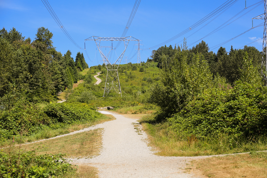
The Coquitlam Crunch climbing uphill beneath the transmission lines.
The trail is popular with walkers, runners, and fitness enthusiasts. Some people complete the entire climb, while others concentrate on the stair sections, repeating them several times for a more intense workout.
The Trail Near Runnel Drive
Runnel Drive is one of the landmarks along the lower section of the Crunch. As the trail climbs, there are several road crossings and access points connecting the route with nearby neighbourhoods.
Here is a photograph I took looking along the route from Runnel Drive.
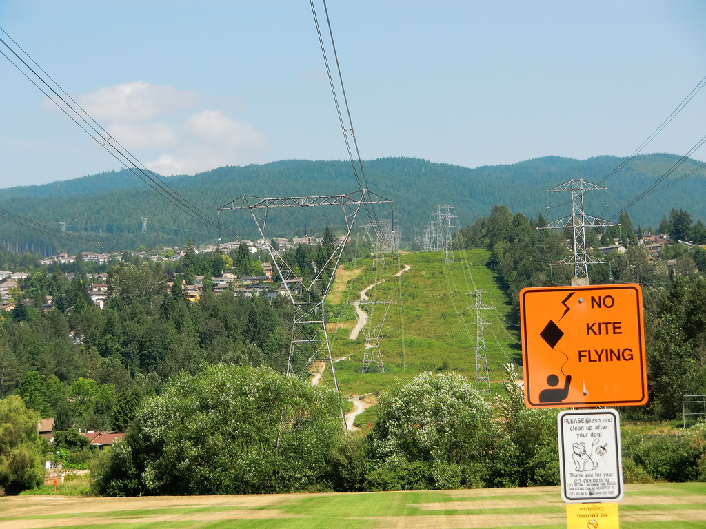
Looking along the Coquitlam Crunch from Runnel Drive.
Be particularly careful at the road crossings. Although the Crunch is primarily a recreational trail, several sections intersect public roads carrying regular vehicle traffic.
The Stairs and Trail Improvements
When I first started hiking the Crunch, some sections consisted of steep gravel slopes that could become slippery, particularly when descending. The trail underwent improvements in 2014, including new stairs, signage, and other upgrades.
The improvements made a noticeable difference, and the Crunch has continued to evolve over the years.
Below is one of my earlier photographs showing a newly constructed stair section.
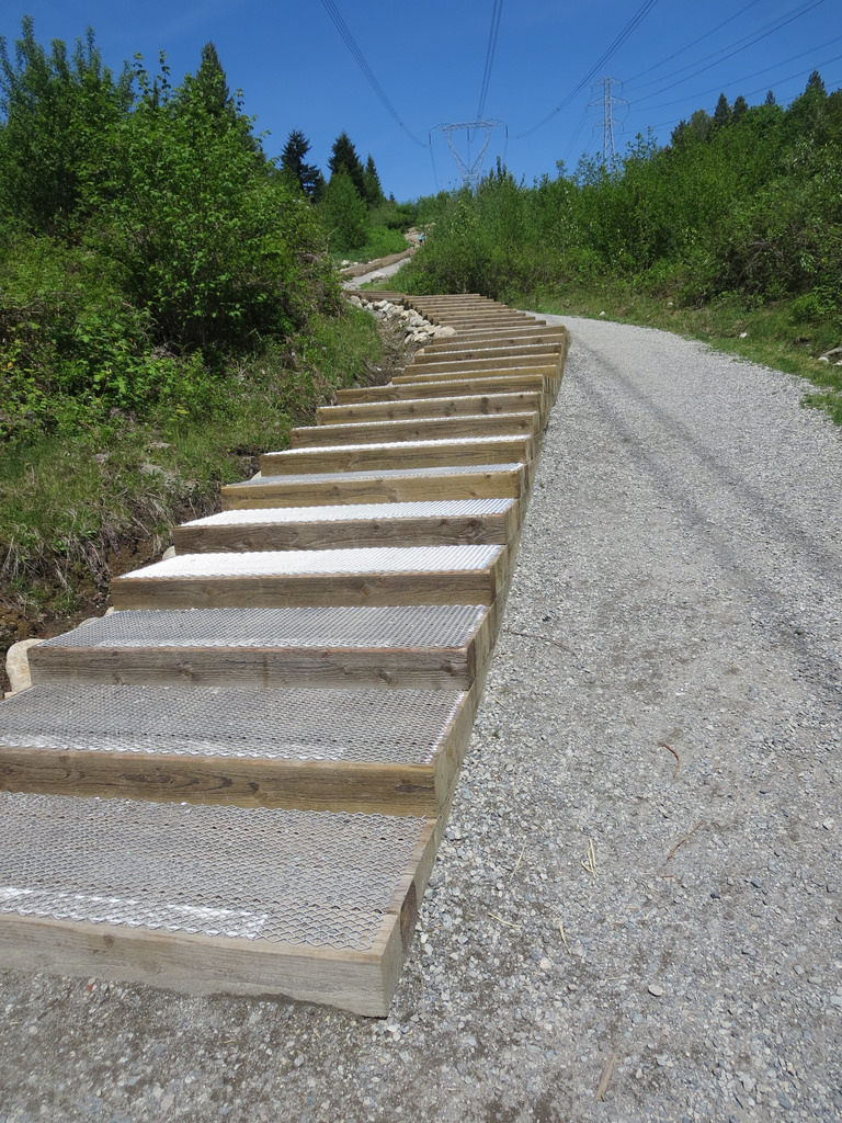
One of the stair sections added during earlier trail improvements.
The modern Crunch has two sets of stairs containing a combined 894 steps. For anyone looking for a serious cardio workout, completing both stair sections is a great challenge.
Despite the improvements, some gravel sections can still be slippery, particularly during wet weather. Take extra care when descending, especially if you’re tired after the climb.
Approaching the Top
As you climb higher, the trail becomes more rewarding. The views gradually open up, and on a clear day you can look across Coquitlam and towards the surrounding mountains.
Here’s one of my photographs taken near the upper portion of the trail.
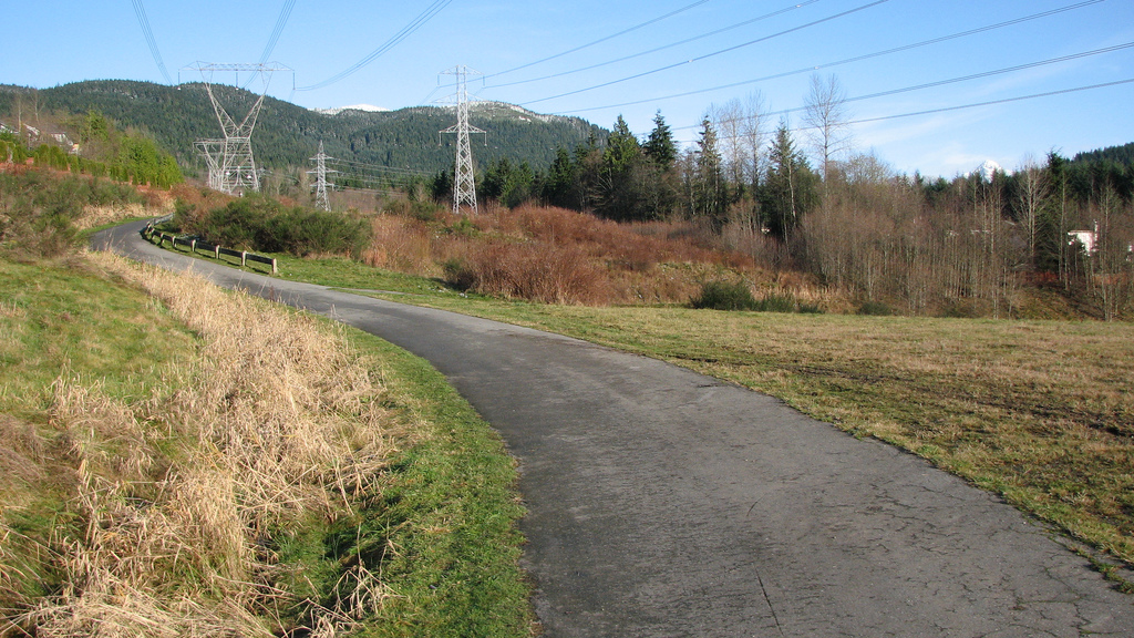
The trail nearing the top of the Coquitlam Crunch.
One advantage of the Crunch is that you can make your workout as easy or difficult as you like. A single climb is plenty for many people, while fitter hikers and runners sometimes repeat sections of the route.
Because it’s so accessible, the Crunch is also a convenient way to build fitness for longer hikes in the nearby mountains.
Interpretive Signs Along the Trail
Another feature I noticed during my earlier walks was the interpretive signage installed along the route.
At the time of my photographs, there were five interpretive signs providing information about the surrounding area and trail.
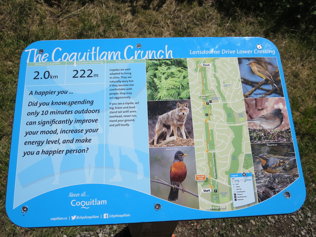
One of the interpretive signs along the Coquitlam Crunch.
These signs add a little interest to the climb and provide an opportunity to stop and catch your breath!
Coquitlam Crunch in Winter
Although the Crunch is particularly popular during warmer months, it can be enjoyed throughout much of the year.
Winter can be especially scenic when fog settles over the lower parts of Coquitlam while the upper section remains clear.
Here’s one of my favourite winter photographs, showing the view from near the top with a layer of fog below.
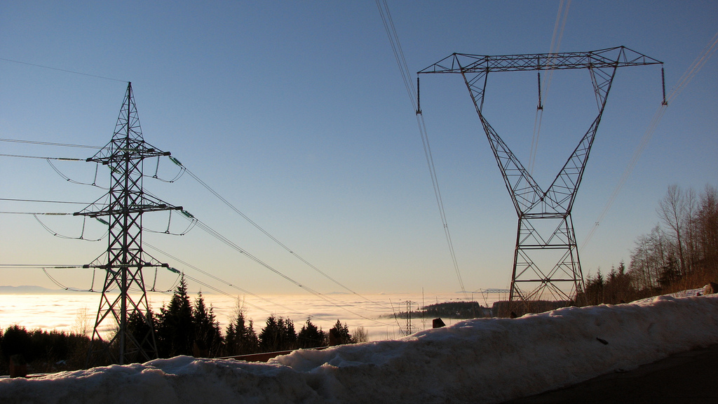
A beautiful winter view from the Coquitlam Crunch, with fog below.
Snow and ice can occasionally affect the upper sections of the trail, while wet leaves and gravel can make the descent slippery. Check the weather and trail conditions before heading out, particularly during colder periods.
Interesting Facts About the Coquitlam Crunch
- 894 stairs: The Coquitlam Crunch now features two sets of stairs containing a combined 894 steps, making it a popular destination for stair workouts.
- A substantial climb: The City’s newer trail map identifies a route approximately 2.9 km long with 261 m of elevation gain, although other official descriptions still refer to a 2.2 km climb.
- Built beneath power lines: Much of the Crunch follows a BC Hydro transmission right-of-way. The open corridor creates the steep, relatively unobstructed route that makes it so popular for fitness training.
- Approximately 50,000 monthly users: The City of Coquitlam has reported around 50,000 visits per month during the peak summer season, making it one of the area’s busiest recreational trails.
- The Coquitlam Crunch Diversity Challenge: The event originated in 2010 when local resident Alex Bell began climbing the Crunch repeatedly to raise money for a community diversity initiative. The event subsequently developed into a popular annual fitness fundraiser.
- Future expansion plans: The City has considered extending the trail system towards Eagle Mountain in the north and Mundy Park in the south, with longer-term connections towards the Fraser River. The extension planning project was placed on hold following funding changes in 2024.
- Different ways to exercise: Some people complete the entire trail, while others repeat the stairs or use the intermediate access points for shorter workouts.
- Biogeoclimatic Zone: The lower-elevation Coquitlam area lies within the Coastal Western Hemlock biogeoclimatic zone. Although much of the Crunch follows a cleared utility corridor, nearby forested areas support vegetation typical of southwestern BC’s mild, wet coastal climate.
Best Time to Walk the Coquitlam Crunch
The Crunch is accessible throughout the year under normal conditions, although the experience varies by season.
- Spring: Pleasant temperatures, fresh vegetation, and sometimes muddy conditions.
- Summer: Longer daylight hours and generally drier footing. However, the exposed corridor can become quite hot on sunny days.
- Autumn: Cooler temperatures and attractive views, with some slippery leaves and wet gravel.
- Winter: Often quieter, with occasional snow, frost, or icy stair sections.
Early mornings and weekdays can be good choices if you’d prefer to avoid the busiest periods.
Hiking Preparation and the Ten Essentials
The Coquitlam Crunch is an urban fitness trail rather than a remote mountain hike, so you don’t need the same level of preparation as you would for a wilderness outing. However, the steep grades and stairs can still be physically demanding.
Wear comfortable shoes with good traction, dress for the weather, and bring a charged phone. A light jacket is useful in cooler weather, and a small first-aid kit can come in handy.
For longer hikes or more demanding outdoor adventures, I recommend becoming familiar with North Shore Rescue’s Ten Essentials, including navigation, illumination, extra clothing, first aid, emergency shelter, and other basic safety equipment.
Remember that descending steep stairs can be just as challenging as climbing them, particularly when your legs are tired.
Leave No Trace and Trail Etiquette
Even though the Crunch runs through an urban area, Leave No Trace principles still apply.
- Stay on designated paths: Avoid cutting across slopes or creating shortcuts that damage vegetation and encourage erosion.
- Pack out your garbage: Keep the trail clean for other visitors.
- Share the stairs: Allow faster walkers and runners to pass safely, and avoid blocking narrow sections while resting.
- Respect wildlife: Don’t feed or approach animals that may be encountered along the route.
- Keep dogs under control: Follow posted leash requirements and clean up after your pet.
- Be considerate of neighbours: The trail passes through residential areas, so respect nearby properties and avoid unnecessary noise.
Final Thoughts
The Coquitlam Crunch is a great place to get a serious workout without travelling far from home. It’s steep enough to get your heart pumping, but short enough that you can fit it into a busy day.
I’ve enjoyed watching the trail evolve over the years, particularly the addition of stairs and other improvements that have made it more enjoyable for walkers and runners.
Whether you climb the entire route, concentrate on the stairs, or simply enjoy the scenery, the Crunch is a worthwhile local destination.
Trail Conditions and Disclaimer
This article describes my earlier walks on the Coquitlam Crunch and includes photographs taken at that time. Trail alignments, stairs, access arrangements, and conditions may have changed since then. Steep gravel, wet surfaces, snow, and ice can create hazards. Before heading out, check the latest City of Coquitlam trail information and follow posted signs.