Swan Falls Loop in the Snow was my first long cold-weather hike on Eagle Ridge above Buntzen Lake. The route follows the Halvor Lunden Trail past Polytrichum Lookout and the high mountain lakes, continues north across Eagle Ridge to Mount Beautiful, and historically descends the Swan Falls Trail to the north end of Buntzen Lake.
Status: Closed
BC Hydro currently advises that Swan Falls Trail is inaccessible to hikers. Pedestrian access on Powerhouse Road between North Beach and Buntzen Dam is also closed because of a rockslide.
🌦️ Mountain-Forecast: Eagle Mountain 1,050 m
🌦️ Windy.com: route-area forecast
I had previously explored much of Eagle Ridge, but this was my first time continuing north beyond Lindsay Lake in winter conditions. Temperatures were around -6 to -9°C early in the hike, and fresh snow covered much of the upper route.
For my snow-free experience on this same route, see my Swan Falls Loop via Mount Beautiful hiking guide.
Powerhouse Road is currently closed to pedestrians between North Beach and Buntzen Dam. This means the historical Swan Falls Loop shown on this page cannot presently be completed in the same way. For a current Mount Beautiful hike, plan an out-and-back route via the Halvor Lunden Trail unless BC Hydro confirms that the northern connection has reopened.
Trail Stats
These statistics are from my original winter outing on the Swan Falls Loop.
- Distance: approximately 16.2 km
- Low point: approximately 134 m
- High point: approximately 1,238 m
- Net elevation gain: approximately 1,104 m
- Cumulative elevation gain: approximately 1,508 m
- Difficulty: Difficult, with substantially increased difficulty in snow
- Route: Historical loop via Halvor Lunden Trail, Mount Beautiful, and Swan Falls Trail
- 📍 Trailhead and parking: Google Maps and navigation
Snow can hide the trail and markers, daylight is short, temperatures can fall rapidly, and travel is considerably slower than in summer. Reliable navigation, winter traction, appropriate clothing, a headlamp, and sufficient emergency supplies are essential.
Interesting Facts
- Halvor Lunden Trail: The trail climbs steeply from Buntzen Lake onto Eagle Ridge and provides access to Polytrichum Lookout, Lindsay Lake, Mount Beautiful, and the higher Dilly Dally ridge.
- Winter navigation: Trail markers that are easy to see in summer can become difficult to locate when snow covers the ground, vegetation, and lower sections of trees. On my hike, the route became particularly difficult to follow beyond Tangled Summit.
- Mount Beautiful: Mount Beautiful reaches approximately 1,260 m and provides broad views toward Coquitlam Lake and the surrounding mountains when weather permits.
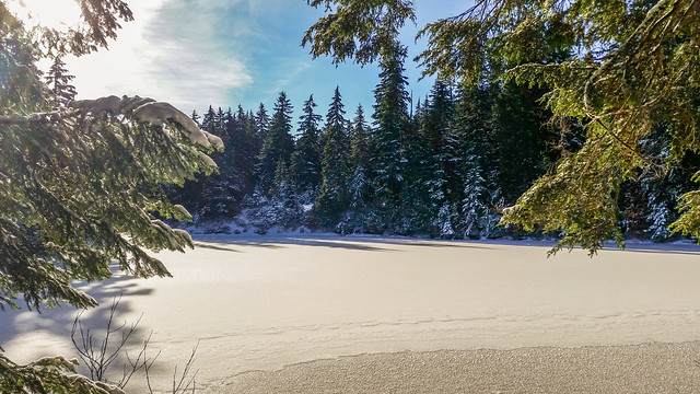
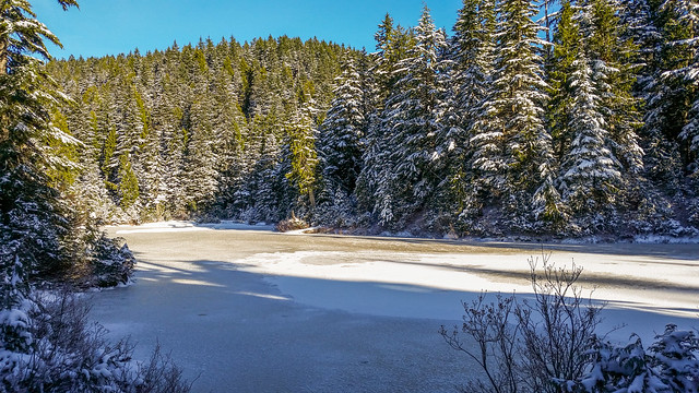
- Lakes district: Lindsay Lake, Chickadee Lake, Wren Lake, and several smaller tarns sit high on Eagle Ridge. During my winter hike, the lakes were snow-covered and partially frozen.
- Biogeoclimatic zones: The route begins in the Coastal Western Hemlock biogeoclimatic zone and climbs into the colder Mountain Hemlock zone. The higher elevation forest receives substantially more snow and has a much longer winter season than the Buntzen Lake shoreline.
- Short winter days: A route that is comfortable as a long summer day hike can become much more serious in late autumn or winter simply because there are fewer daylight hours available.
- Swan Falls Trail: The descent from Eagle Ridge toward Buntzen Lake is very steep and can become particularly challenging when covered by snow or ice.
The Route
The interactive map below shows the same historical Swan Falls Loop used on my snow-free hike. It climbs the Halvor Lunden Trail, passes through the Lindsay Lake area, continues to Mount Beautiful, and descends the Swan Falls Trail toward the north end of Buntzen Lake.
The traditional loop currently cannot be completed because of the Powerhouse Road closure near the north end of Buntzen Lake.
Starting in the Cold
We started at 8:45 a.m. on November 30 in temperatures around -6 to -9°C. This was my first long hike in conditions that cold.
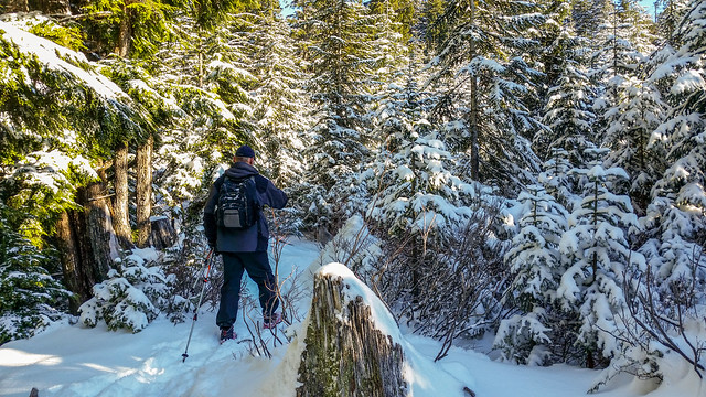
I initially wore several layers, including merino wool and a jacket, but the steep climb quickly generated plenty of heat and I removed layers soon after starting. Managing moisture and body temperature is especially important during cold-weather hiking because becoming soaked with sweat can quickly become a problem once you stop moving.
Polytrichum Lookout
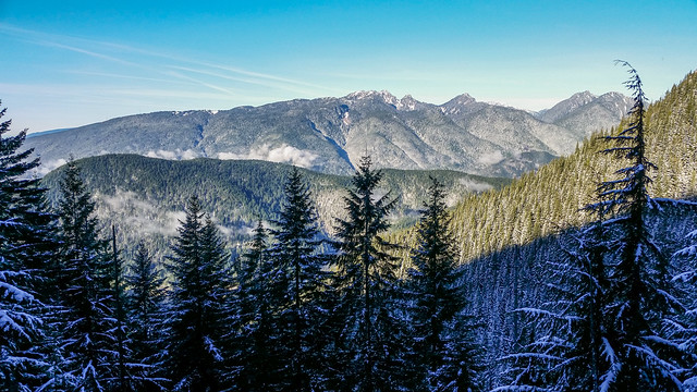
The early climb followed the Halvor Lunden Trail toward Polytrichum Lookout. Even in cold weather, the initial ascent provides a substantial workout.
The Lakes District
After El Paso Junction, we continued through fresh snow on the East Loop. Snow depth was generally about 8 to 15 cm, with deeper sections approaching 20 to 25 cm.
Lindsay Lake, Chickadee Lake, and Wren Lake looked completely different under their winter covering of snow and ice.
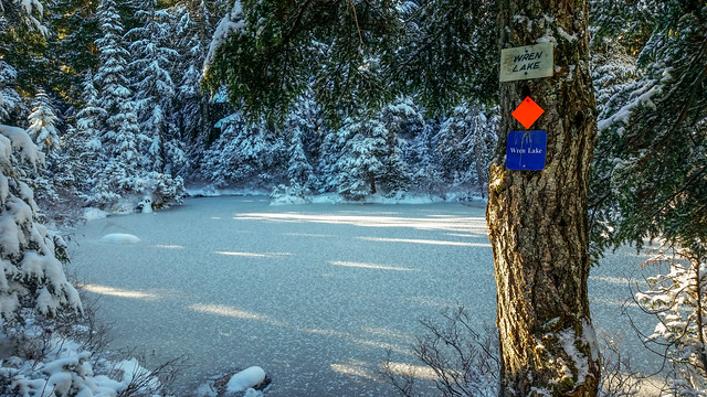
Lindsay Lake Junction
We reached Lindsay Lake Junction shortly after 11:00 a.m. and continued north toward Mount Beautiful.
Winter conditions made navigation increasingly important. Snow covered much of the normal tread, and beyond Lindsay Lake some markers became difficult to locate.
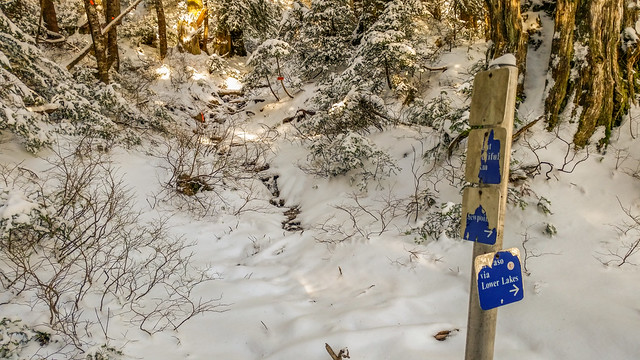
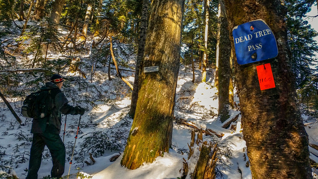
Dead Tree Pass and Tangled Summit
Roughly 30 minutes beyond Lindsay Lake Junction, we passed through Dead Tree Pass and continued toward Tangled Summit.
We reached Tangled Summit around 11:45 a.m. This is where route-finding became much more difficult. The snow made the normal trail hard to distinguish, and markers were not always obvious.
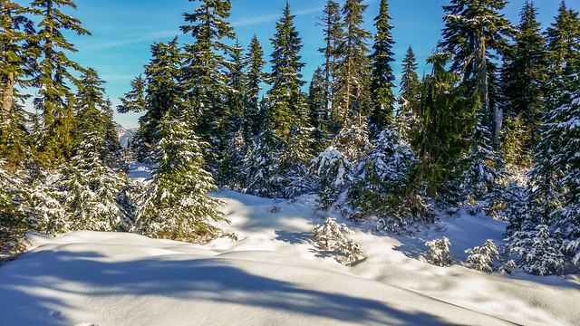
Navigation in the Snow
I had two GPS devices with the route loaded, which allowed us to repeatedly confirm our location when the trail disappeared beneath the snow.
At several points we had to estimate where the trail continued and then verify our direction using the GPS track. This added considerable time to the hike.
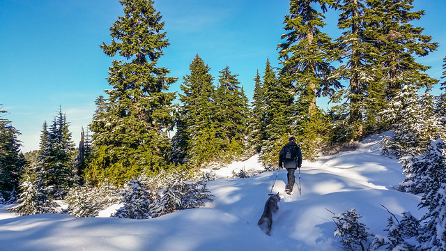
Snow can completely hide the trail and obscure markers. Do not depend on following footprints because they may lead off-route or disappear. Carry reliable offline navigation and know how to use it before heading into the Eagle Ridge backcountry.
Mount Beautiful
After spending extra time locating the route, we reached Mount Beautiful around 1:45 p.m. We had already used much more daylight than planned, so we did not spend much time at the summit.
We continued toward the Swan Falls and Dilly Dally junction and reached the top of the Swan Falls Trail around 2:15 p.m.
Descending Swan Falls
The Swan Falls Trail was much easier to follow on the descent because the markers were more obvious, but the terrain remained steep and conditions were becoming darker as the afternoon progressed.
By about 3:45 p.m., we were still around 350 m elevation. I contacted the Buntzen Lake Warden’s office to advise that we were likely to return after the gate closing time.
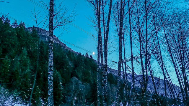
We reached Powerhouse Road around 4:20 p.m. and completed the final walk back to the parking area in moonlight.
Winter Equipment
Microspikes were extremely useful on this hike and provided additional traction on the packed snow and icy sections. However, microspikes are only one piece of winter equipment and are not appropriate for every snow or ice condition.
Depending on conditions, snowshoes, crampons, an ice axe, or avalanche equipment may be necessary on mountain routes. Equipment should always match the actual terrain and snow conditions.
What to Bring
For a winter route of this length and difficulty, carry the full Ten Essentials. Navigation, a headlamp, emergency shelter, extra food, warm clothing, first-aid supplies, and sufficient water are particularly important.
Carry extra insulating layers even if you expect to remain warm while climbing. Avoid becoming excessively sweaty during the ascent, because damp clothing can cool rapidly when you stop.
A headlamp is mandatory for a winter hike of this length. Do not rely on completing the route before sunset.
Download an offline map before starting, carry backup power, and leave a detailed trip plan and expected return time with someone you trust.
Leave No Trace
Please follow Leave No Trace principles throughout the Eagle Ridge backcountry. Pack out everything you bring in, avoid damaging vegetation, keep wildlife at a distance, and remain on established routes where conditions allow.
Before You Go
Check current BC Hydro Buntzen Lake trail information before planning this route. The traditional Swan Falls Loop is currently interrupted by the Powerhouse Road pedestrian closure between North Beach and Buntzen Dam.
Also check weather, snow conditions, avalanche conditions where applicable, gate hours, parking requirements, and available daylight before heading into the mountains.