Category Archives: Buntzen Lake Hikes

Buntzen Lake Loop


The Buntzen Lake loop is the most popular trail in the park. This 10 km route can be done as fast as 45 min if you’re running and up to 6 hours if you just take your time, enjoy the views and have a picnic.

Route from GPSIES (click on ‘Details’ for large image)…

Route from Google Earth…

Untitled-1

Buntzen Lake is situated at roughly 130 m above sea level and the highest point on the trail is around 225 m. The single highest elevation gain on the trail is 70 m over 1.1 km.

I usually do the loop starting on the west side of the lake (starting at the old floating bridge area, now mostly a land bridge); some people prefer the other way. The west side is hillier, longer and more shaded. When taking this route, you’ll see this view at the half way point…

Buntzen Lake Trail

Also, starting on the west side, once you reach North Beach, you will have completed 60% of the loop. Here is North Beach…

North Beach

Below are a few random trail photos…

Trail2 (Medium)

BL Trail

Stump on Trail

BL Trail 2

BL Trail 3

Buntzen Lake Trail

BL Trail 4

Early morning hike

Here’s a little video of one of my hikes around the trail in February 2014…

★★★★★★★★★★★

Before heading out on your hike, make sure you are well prepared. This means, having the TEN ESSENTIALS. It is also important to leave a trip plan (route details and estimated return time) with someone you trust.

Bring your smartphone, fully charged and put it in airplane mode while hiking. I always bring back-up battery packs for extra piece of mind. It is highly recommended that you bring a GPS device; I use my smartphone with a GPS app (Backcountry Navigator). The GPS will work in airplane mode. Learn how to use it before your hike.

For anyone new to hiking, there is a rule to which hikers follow; it is called “Leave No Trace” or LNT. The concept is generally to pack out what you pack in and respect nature, so all future visitors can enjoy what you have enjoyed.
To learn more about LNT, please check out this BLOG by a certified LNT Trainer.

★★★★★★★★★★★

Lakeview Trail


Lakeview Trail is, in my opinion, Buntzen Lake Trail’s bigger brother.  This trail is an alternate route to traverse the west side of Buntzen Lake.  There are more ups and downs and it’s about 1km longer than the Buntzen lake Trail. After completing Lakeview Trail, I usually take the east side of Buntzen Lake back to the parking lot. There is a great viewpoint of Swan Falls and the North Beach area near the end of the west side traverse.

The stats…

Distance: 12 km
Time: 2-4 hours
Low point: 125 m
High point: 220 m
Elevation gain: 95 m
Cumulative Elevation gain: 500 m
Trailhead: 49° 20’ 11.3” by 122° 51’ 29.7” (Google Map)

Here are the photos…

Lakeview Trail

Lakeview Trail commences at the Pump House.
See location HERE (its the left route option).

Here is the route (click on ‘details’ for larger image)…

Here’s a map of the area from Google Earth (click on image for large size)…

lakeview trail

A comparison of the Lakeview Trail / West Side of the Buntzen Lake Trail shows:
Total one-way distance from the pumphouse to the suspension bridge is 4.9 km vs. 4.1 km;
Maximum elevation gain is 150 m vs. 100 m; and
Cumulative elevation gain is 240 m vs. 130 m

The route statistics, when returning on the east side of Buntzen Lake, are:
Distance: 10.9 km
Maximum elevation gain: 150 m
Cumulative elevation gain: 340 m

Besides a more strenuous hike, Lakeview Trail is much less busy than the Buntzen Lake Trail and it is also used by bikers and horses, which I have seen very few. You’ll see more large trees (1 m diameter) and fewer large tree stumps.

Below is a nice view you’ll see on the hike…

Nice View

There are signs for two viewpoints, but the southern ‘viewpoint’ is obstructed by trees. The northern viewpoint is at 250 m elevation and you see a great view of North Beach, Swan Falls, the Tunnel and Eagle Mountain. See below…

Viewpoint from Lakeview Trail

Below is a view of the Lakeview trail as it passes along the hydro right-of-way, before entering the forest again…

Old sign

Here is an old Lakeview Trail sign…

Lakeview Trail sign

This photo shows where the Lakeview Trail runs close to the Buntzen Lake Trail…

Trails almost collide

Below is a creek that flows alongside a section of the Lakeview Trail…

Creek

Next is a large downed tree alongside the trail…

Large tree alongside trail

Here are a couple more serene Lakeview Trail photos…

Lakeview Trail

Lakeview Trail

★★★★★★★★★★★

Before heading out on your hike, make sure you are well prepared. This means, having the TEN ESSENTIALS. It is also important to leave a trip plan (route details and estimated return time) with someone you trust.

Bring your smartphone, fully charged and put it in airplane mode while hiking. I always bring back-up battery packs for extra piece of mind. It is highly recommended that you bring a GPS device; I use my smartphone with a GPS app (Backcountry Navigator). The GPS will work in airplane mode. Learn how to use it before your hike.

For anyone new to hiking, there is a rule to which hikers follow; it is called “Leave No Trace” or LNT. The concept is generally to pack out what you pack in and respect nature, so all future visitors can enjoy what you have enjoyed.
To learn more about LNT, please check out this BLOG by a certified LNT Trainer.

★★★★★★★★★★★

Swan Falls

Today, I ventured up on Eagle Mountain for the first time. Specifically, I went up the Swan Falls trail. I knew the possibility of snow at high elevations was likely, so the plan was to go up as far as I can and turn around when the snow makes trekking difficult. Unfortunately, the cell phone could not get a GPS signal, so I couldn’t determine the elevation at the turn-around point, but I’d guess it to be 800 or 900 m. Below is my route for today…


Today was an amazing April day. It was sunny with a high close to 20C. However, on the ascent, it was cool (still shaded) and there was breeze, but it was all good. I would say the highlight was the view from the Falls, which are at about 300-350m elevation. Below is a view from the falls looking west, towards Buntzen Lake…

View from Swan Falls

Just before reaching the falls, there is a 45 degree incline, where there is a rope to assist you; see below…

Rope Climb

Here is a view on the falls…

Swan Falls

And here is another scenic view…

Great View

Below is a random trail picture…

Trail


Next is our traverse through the Lower Gully…

Lower Gully

And here is our traverse through the Upper Gully 30 mins after the Lower Gully…

Upper Gully

Next is a photo near where we turned around. The snow was getting quite deep…

Deep Snow

At the trailhead, on the service road, you can see the falls and the creek, which drains into McCombe Lake…

Swan Falls Creek

Below is a view of Swan Falls from across McCombe Lake and the next one is when the falls were frozen in early February 2014…


Swan Falls 2

Frozen Swan Falls

Here is the sign at the trailhead, with a warning…

Sign at Trailhead

Diez Vistas


The Diez Vistas hike is one of the most popular day hikes in Metro Vancouver.
It has been featured in several publications, including:

  • CBC News “5 great Lower Mainland hikes from Vancouver Trails
  • The Province “Hiking in Vancouver: 7 day hikes to try
  • Super Natural British Columbia “5 Hidden Hikes Near Vancouver
  • Spirit Quest Adventures’ “10 Amazing Day Hikes Near Vancouver, British Columbia

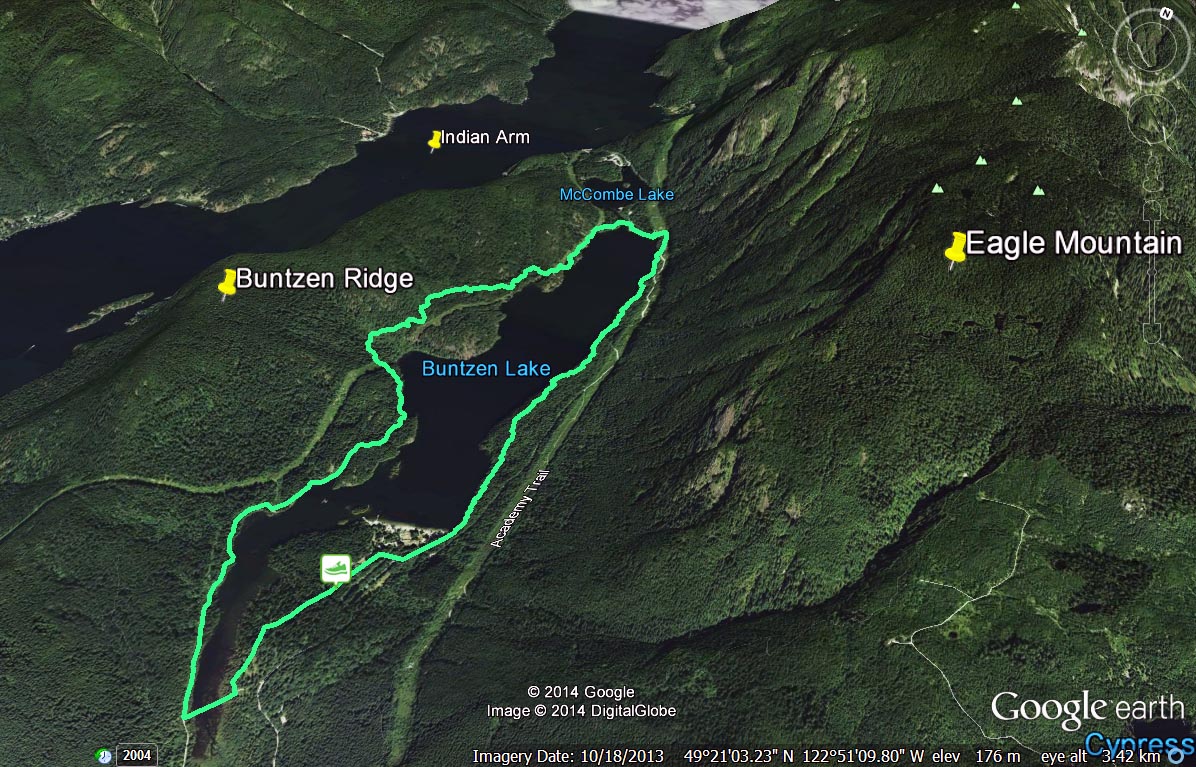
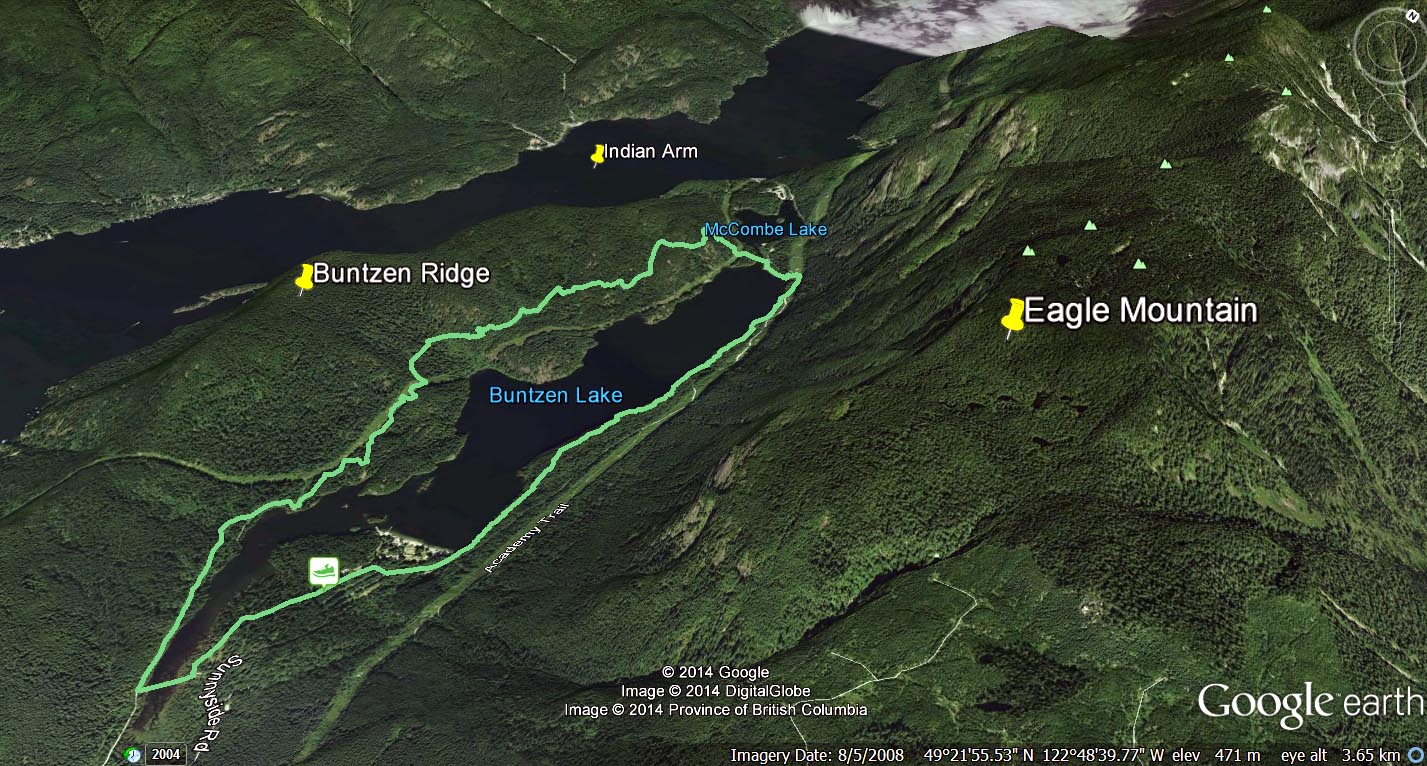
Personally, I have done this hike over 3 dozen times and I know it well. To get a description see the hiking page. To get more tips and insight read here ! ‘Diez Vistas’ is Spanish for ‘ten views’.  Sometimes the hike is referred to as ‘Sendero Diez Vistas’; ‘Sendero’ is Spanish for ‘path’ or ‘trail’.  The actual Diez Vistas trail is 7 km long; however, to make the full loop, most people come back via the east side of Buntzen Lake.  The trail length, taking the east side of Buntzen Lake to the end, is roughly 13 km; there is a 430 m ascent to the top and a cumulative elevation gain of about 875 m.  The BC Hydro description states that it is a 6 to 8 hour hike. Very fit hikers can do this hike in under 3 hours with minimal rest stops.  Elite trail runners can do it in under 1 hour 15 mins.

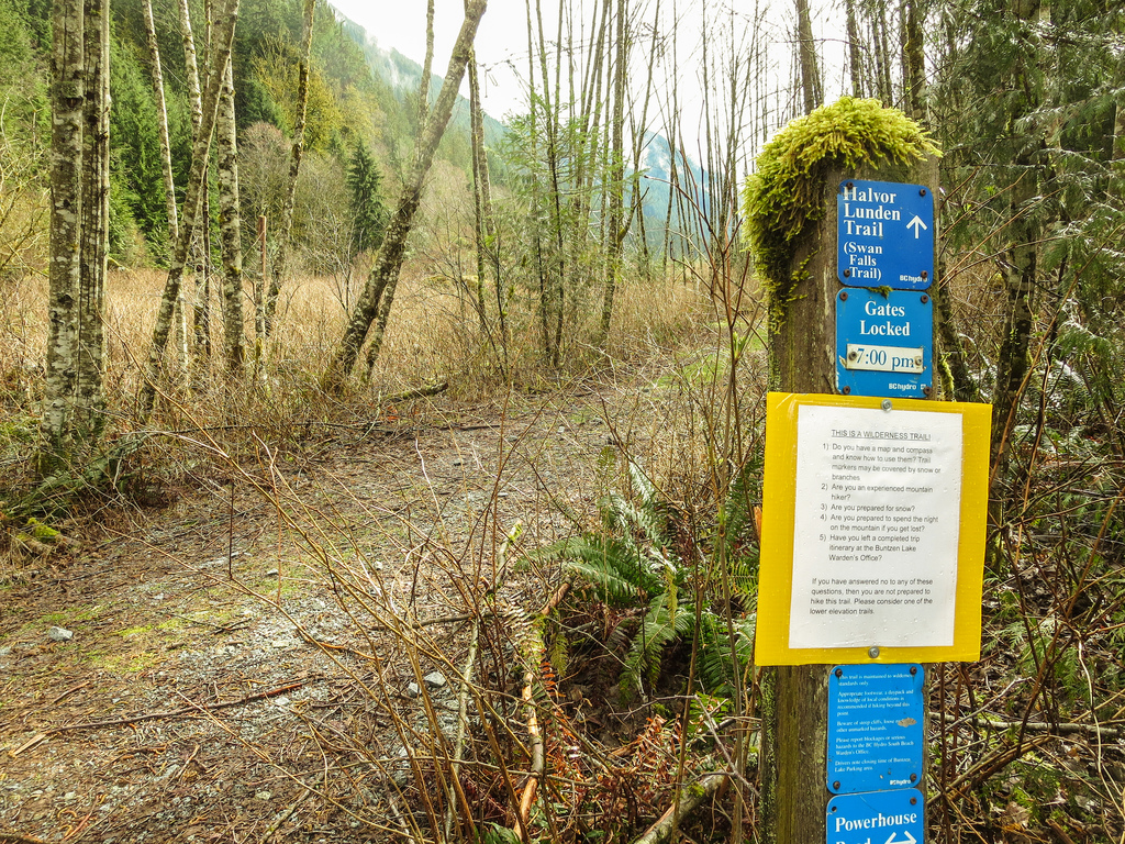
The Diez Vistas Trail was built by Halvor Lunden, an outdoorsman and mountaineer, who volunteered his time to make this and many other great hiking trails. He was born in Norway on 9 July 1915 and he came to Canada in 1951. Halvor passed away on 30 July 2008.

Diez Vistas Trail Fun Fact:

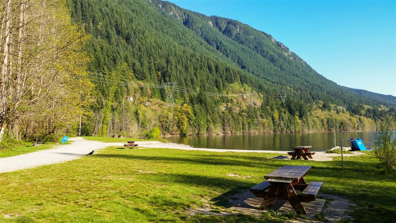
The 7 km long Diez Vistas trail starts and ends in the Buntzen Lake Recreation Area (which is administered by BC Hydro) – a 1.7 km section of the trail winds through Belcarra Regional Park (which is administered by Metro Vancouver) – about 3 km of the trail goes through Indian Arm Provincial Park (which is administered jointly by the Province of British Columbia [BC Parks] and the Tsleil-Waututh Nation). The entire trail is maintained by BC Hydro.

Here is the route with waypoints…


IT SHOULD BE NOTED THAT VISTA NUMBERING MAY BE CONFUSING.

The trail dates back to the 1980s and 5 of the original vistas are obscured by trees (yes, how dare the trees grow !!). On the other hand, there are 5 viewpoints on the trail that were never official ‘Vistas’.

Please check out my post, called Nuevo Diez Vistas to understand vista numbering.

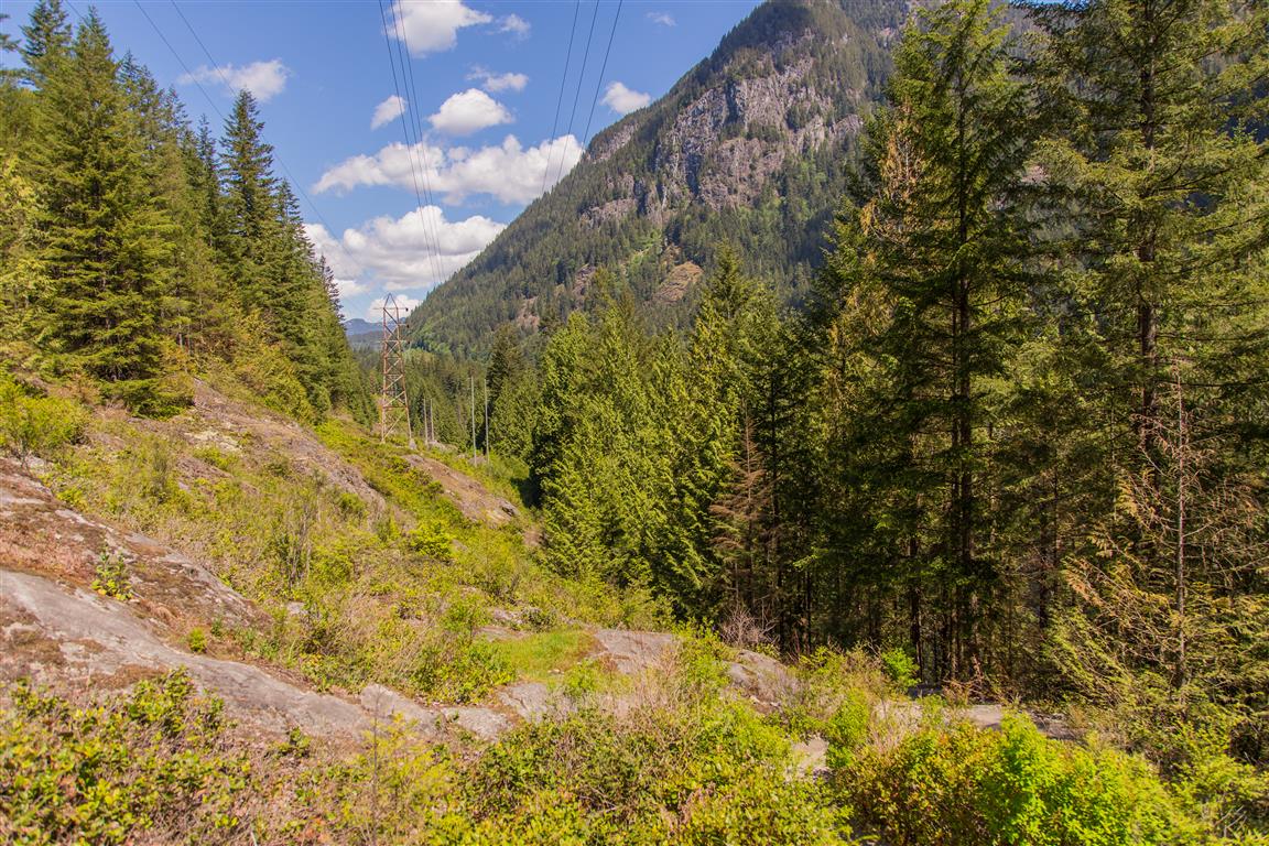
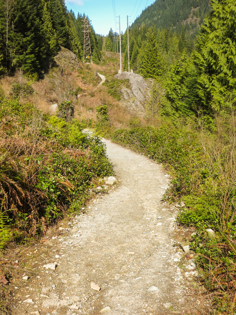
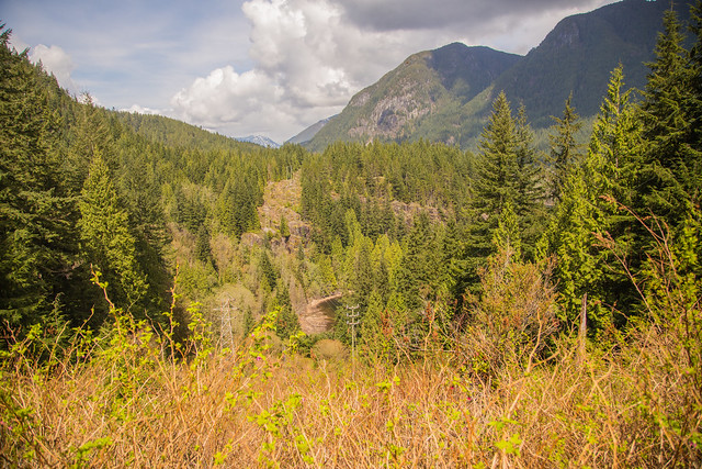
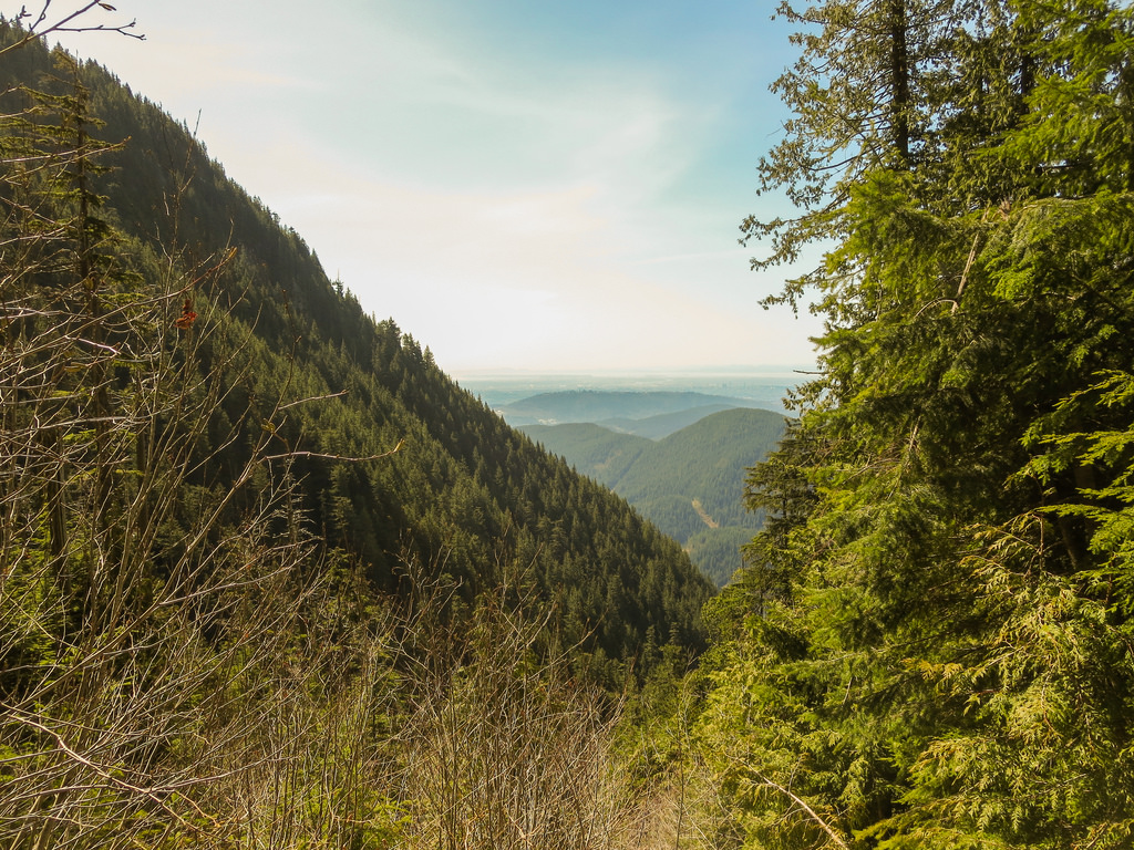
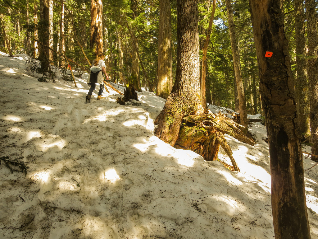
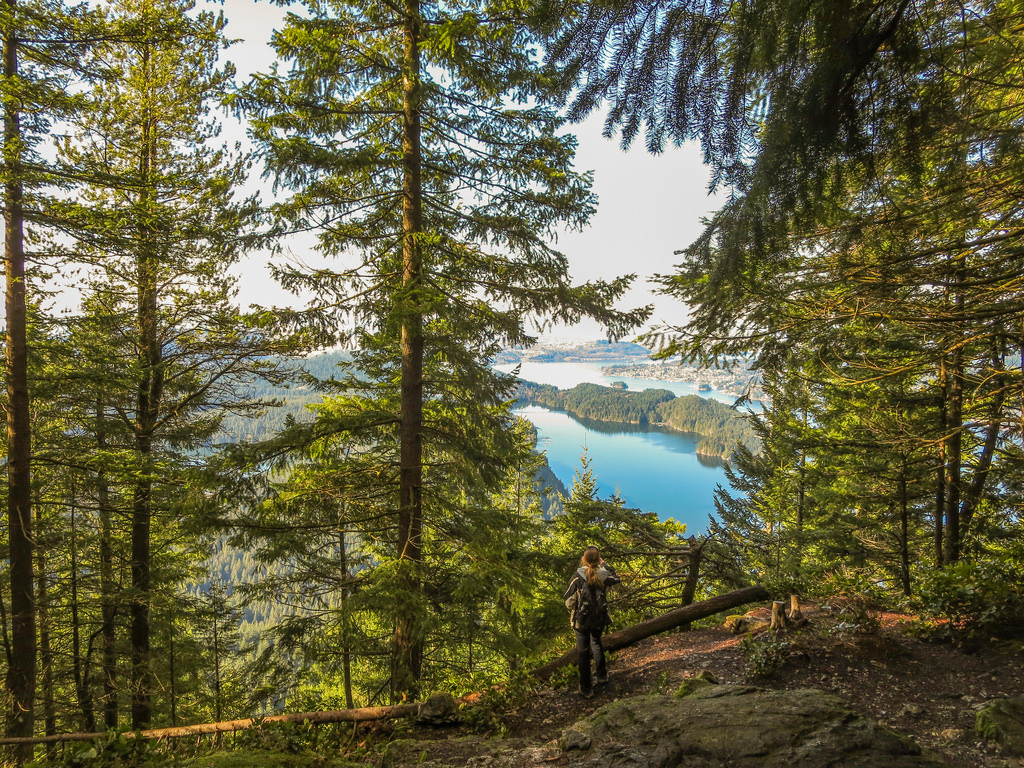
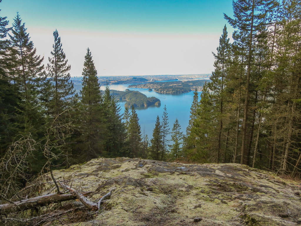
If you do the hike in a clockwise direction (i.e. starting at the old floating bridge area), the first vista (unofficial) is roughly a 3.5 km hike from the parking lot (conversely, if doing the loop in a counter-clockwise direction, you won’t see your first vista until about 8 km). I always do the hike in a clock-wise direction – this way, you’ll do the toughest part of the hike when you have the most energy! – Save the easy walking for the end of the hike!! The first leg of the hike is uphill, with some flat areas to catch your breath. A short distance after you pass the powerlines/pipeline, you’ll hit a number of switchbacks – this is the steepest part of the hike. Below is a view from the first viewpoint (not an official vista)…

First Vista

After resting and checking out this vista (which I named Vista #1 on map below), one has a choice to go to the 3 East Point viewpoints (usually skipped due to poor signage) or take the bypass route (see image below). If you choose to see the 3 East Point viewpoints, you’ll head back about 10 m or so and take a left turn onto a new path – shortly thereafter, you’ll see a viewpoint called Punta Aprecio (Appreciation Point) – shortly after that, you’ll see an unnamed viewpoint – shortly after that, you’ll reach Punta Del Este (East Point) – a view of Buntzen Lake and Eagle Mountain. After viewing East Point, you’ll continue on the trail and meet up with the bypass route at the trail junction.

See image below for loop detail…

Loop detail 2
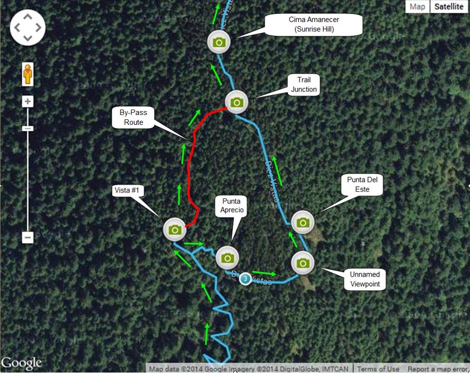
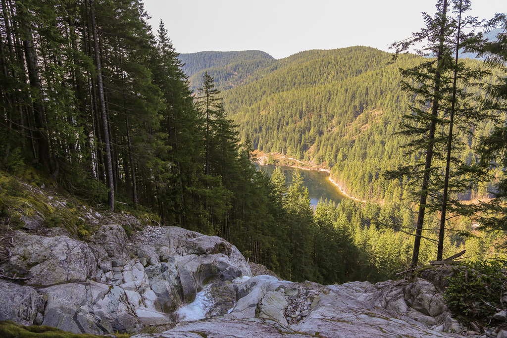
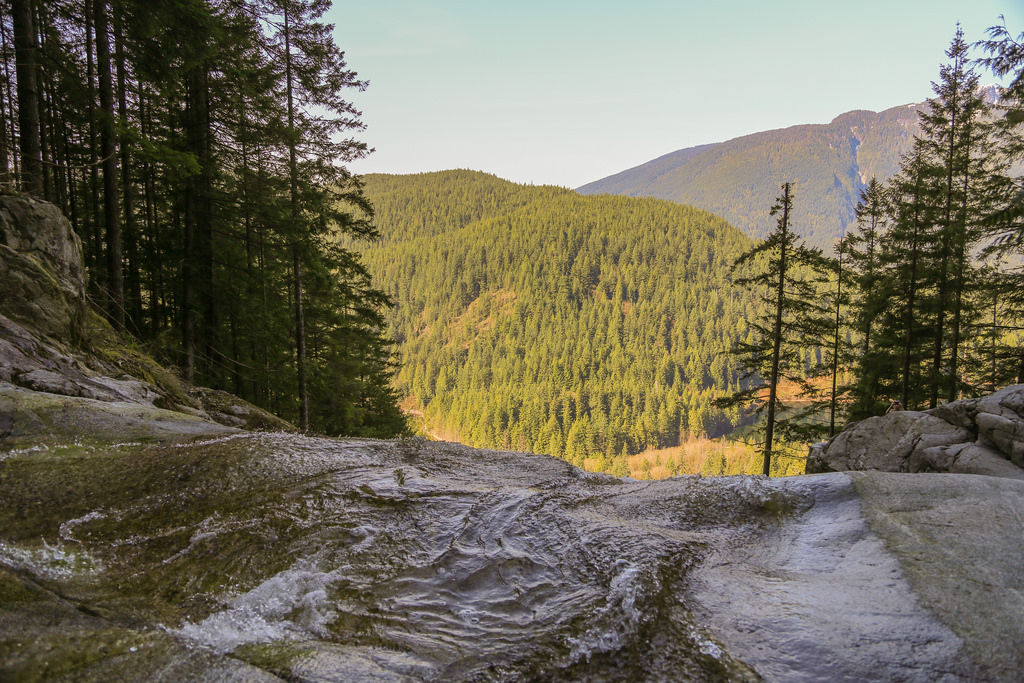
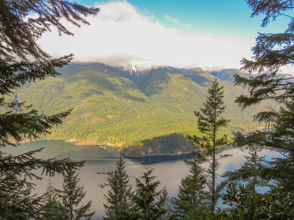
After another 1 km hike from the trail junction (shown above), you’ll find the next vista, which was originally Vista # 1. This 2nd ‘west view’ Vista shows the south part of Indian Arm and Bedwell Bay. This is my favourite vista…

Best view from Diez Vistas Trail

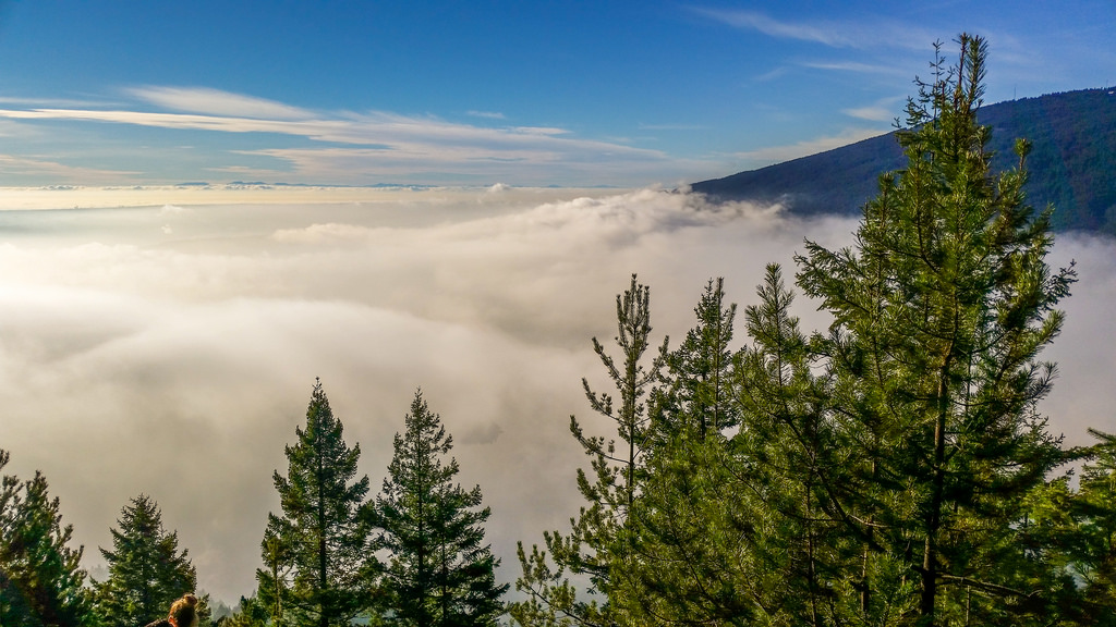
Some days, you’re above the clouds…

Above the Clouds Diez Vistas

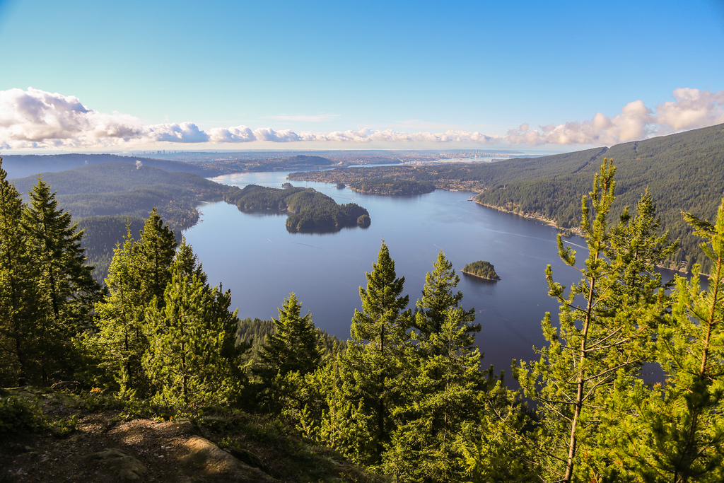
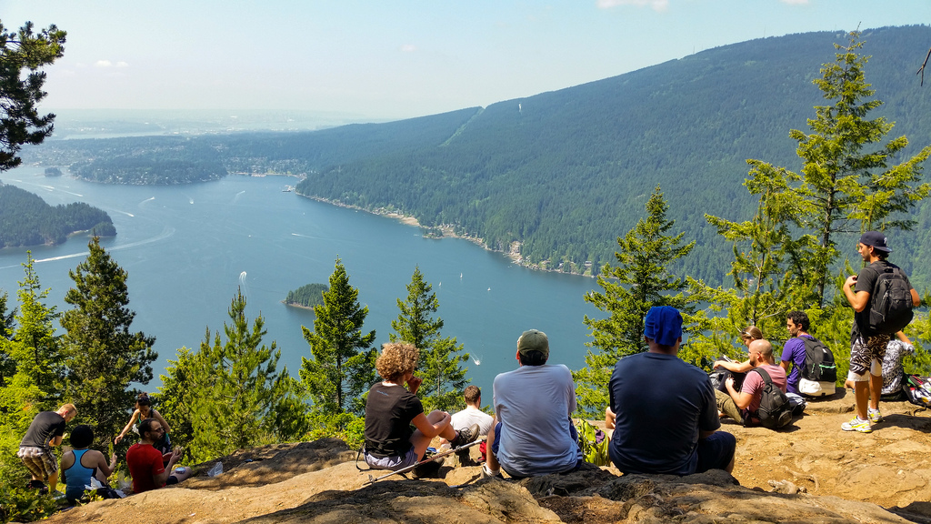
On nice summer days, large groups of people can sometimes be seen at first two west view vistas as seen in the photo below…

Large gathering

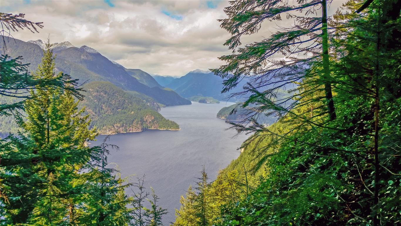
Here’s a view from Vista #5 looking north down Indian Arm…

Indian Arm From Vista #5

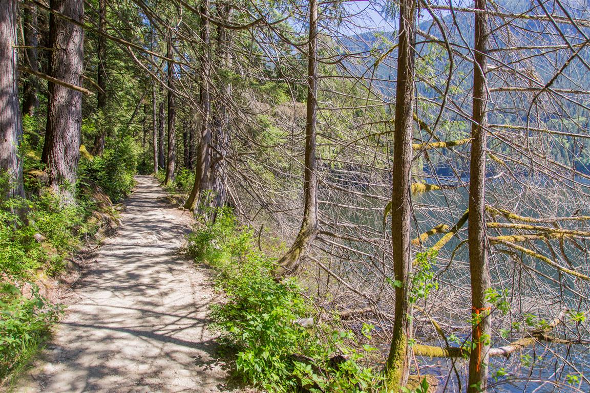
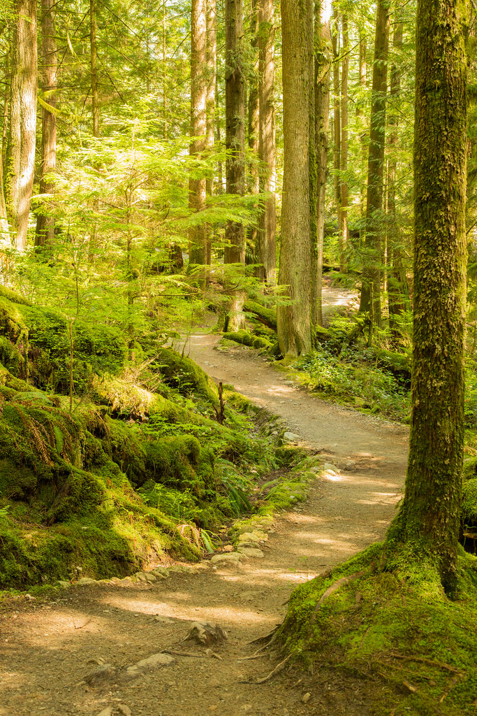
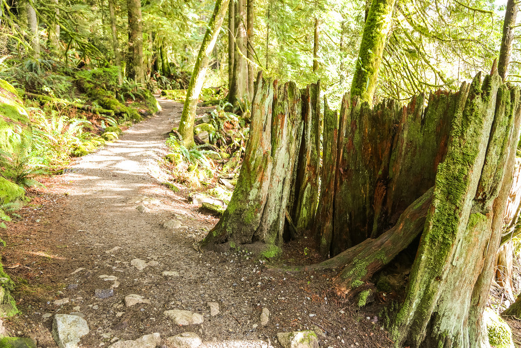
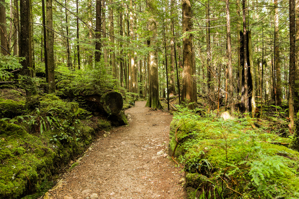
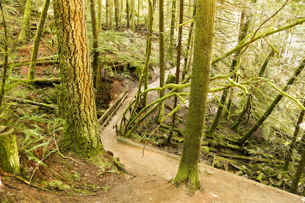
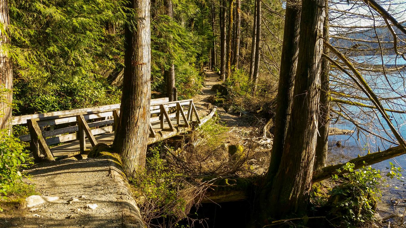
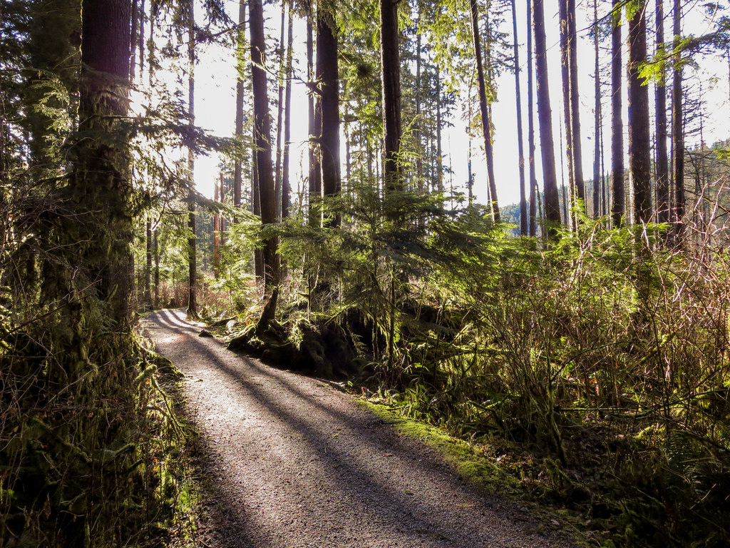
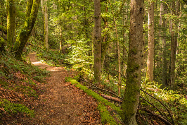
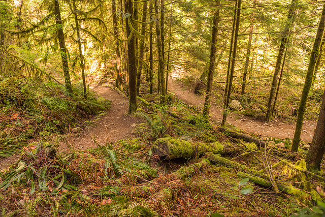
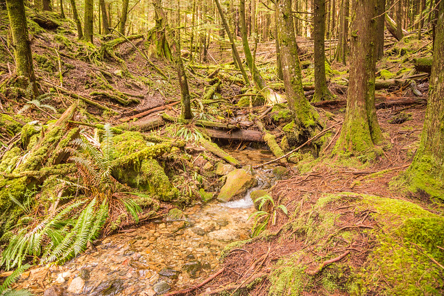
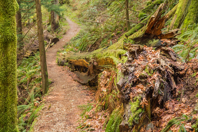
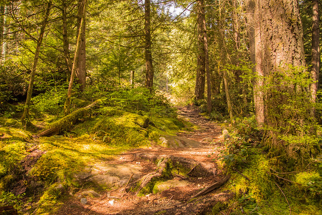
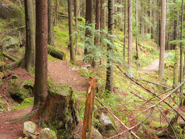
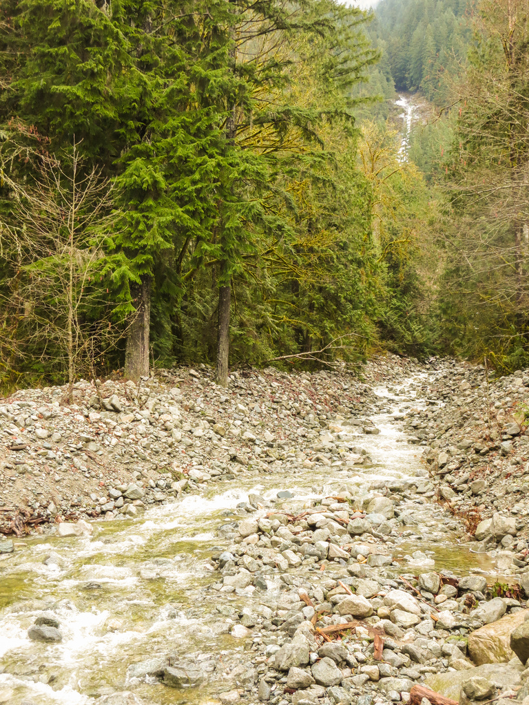
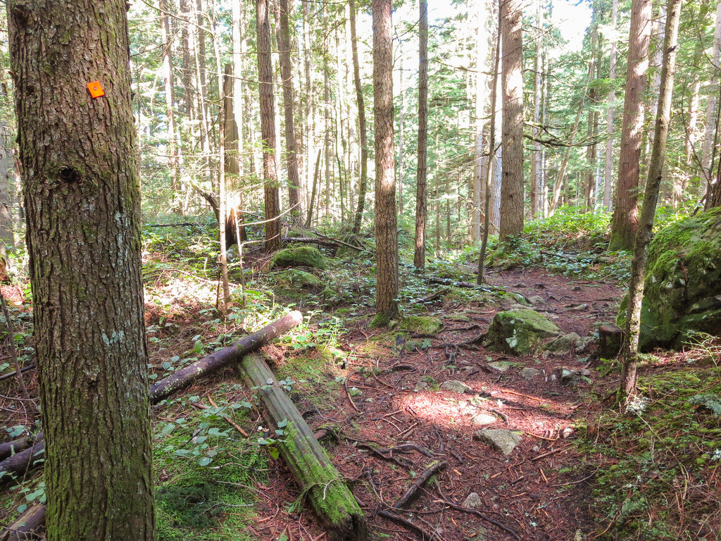
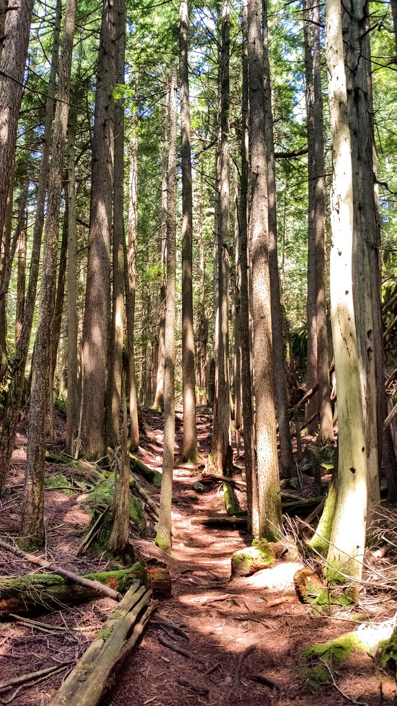
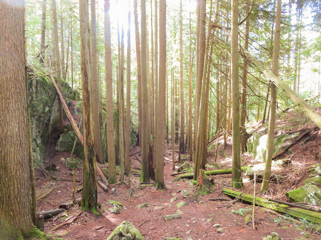
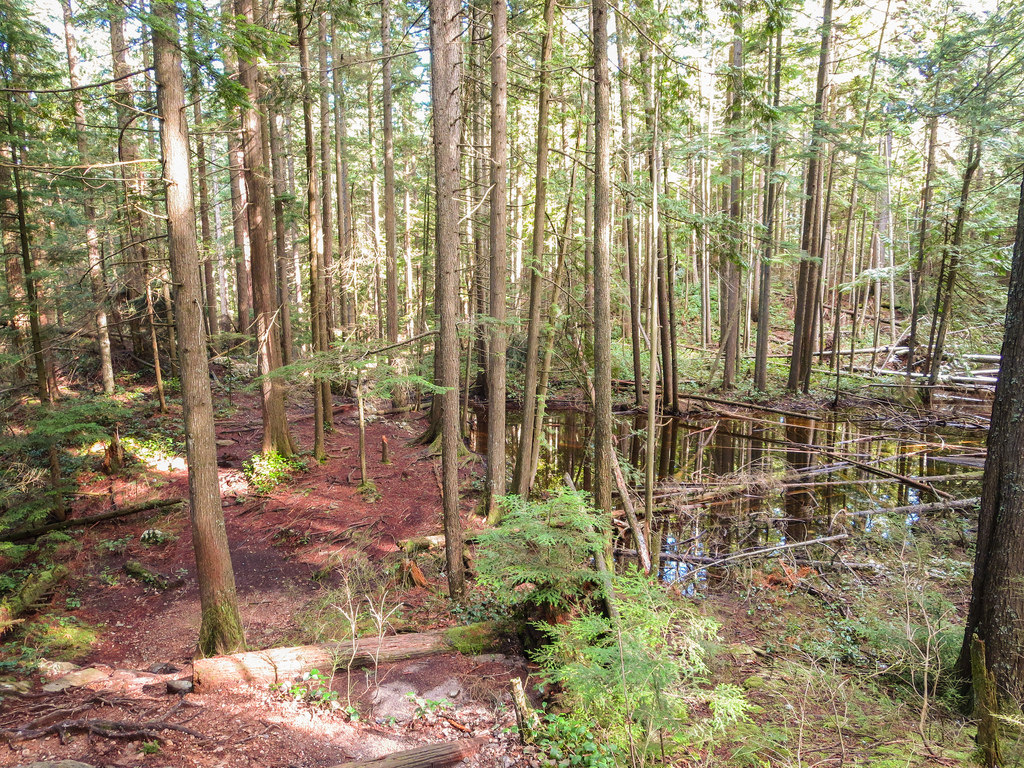
Here are some trail pictures…

DV Trail

DV Trail 2

DV Trail 3

DV Trail 4

You will see some more Vistas; however, some will have obstructed views. Below are 2 more of the Vistas…

13371616835_da29beec13_b

13371984615_16f70b1941_b

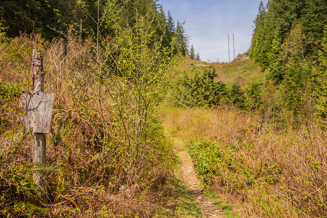
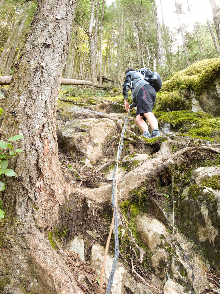
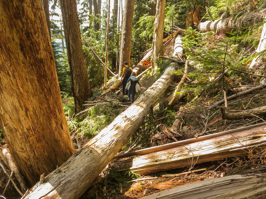
After your first big descent, you will reach, what kind of looks like an old forestry road – just go right and you will reach another trail and go left.

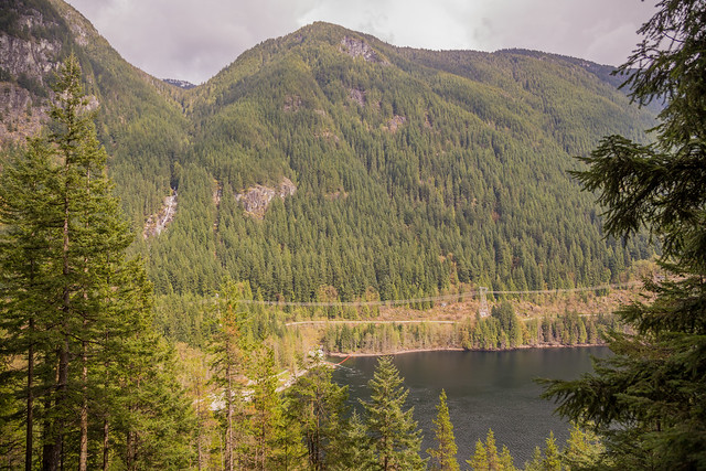
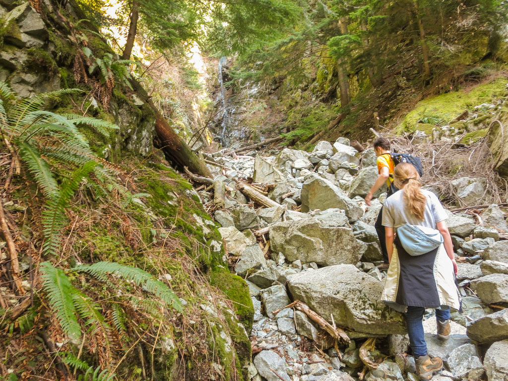
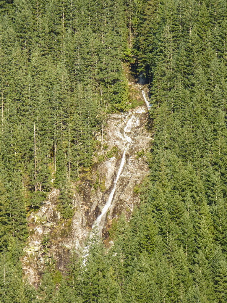
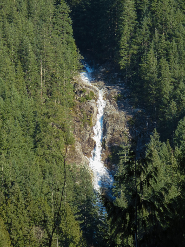
You will continue to wind through the forest and do some serious descents. This trail eventually leads onto a service road, at which you’ll go right; follow this road for 250 m until you meet up with the Old Buntzen Lake Trail SEE LOCATION HERE – you’ll see the trail on your right just before the old water intake building. This trail can get overgrown in the late spring and summer and bears love the salmonberries and blackberries – so keep an eye out. The lake on your left is McCombe Lake and make sure to check the great waterfalls – there is a really high seasonal falls coming out of the rocky slopes (furthest north) and the next one is Swan Falls (See below)…

Swan Falls

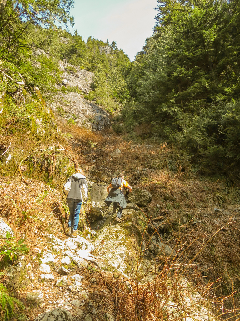
The trail will eventually join the Buntzen Lake Trail.
I have many more photos of Diez Vistas and Buntzen Lake HERE

★★★★★★★★★★★

Before heading out on your hike, make sure you are well prepared. This means, having the TEN ESSENTIALS. It is also important to leave a trip plan (route details and estimated return time) with someone you trust.

Bring your smartphone, fully charged and put it in airplane mode while hiking. I always bring back-up battery packs for extra piece of mind. It is highly recommended that you bring a GPS device; I use my smartphone with a GPS app (Backcountry Navigator). The GPS will work in airplane mode. Learn how to use it before your hike.

For anyone new to hiking, there is a rule to which hikers follow; it is called “Leave No Trace” or LNT. The concept is generally to pack out what you pack in and respect nature, so all future visitors can enjoy what you have enjoyed.
To learn more about LNT, please check out this BLOG by a certified LNT Trainer.

★★★★★★★★★★★