Tag Archives: buntzen lake

Hiking to lose Weight


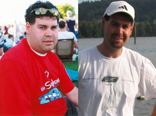
Hiking is an amazing way to get fit and stay fit. If you are over-weight and want to shed some pounds, try my tips. They worked for me. I was 240 pounds and I came down to 170.

Here are my before and after photos…

before and after

I started walking 5 km on flat trails about 3 times a week. I would time myself and try to better my times.

Here are some useful exercise tips I’ve learned…

  • Start Easy – Don’t run. Don’t hike up steep hills
    (Too fast too early will increase the chance of injury and motivation loss)
  • Gradually work your way up to more and more challenging walks/hikes
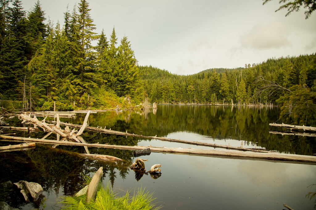
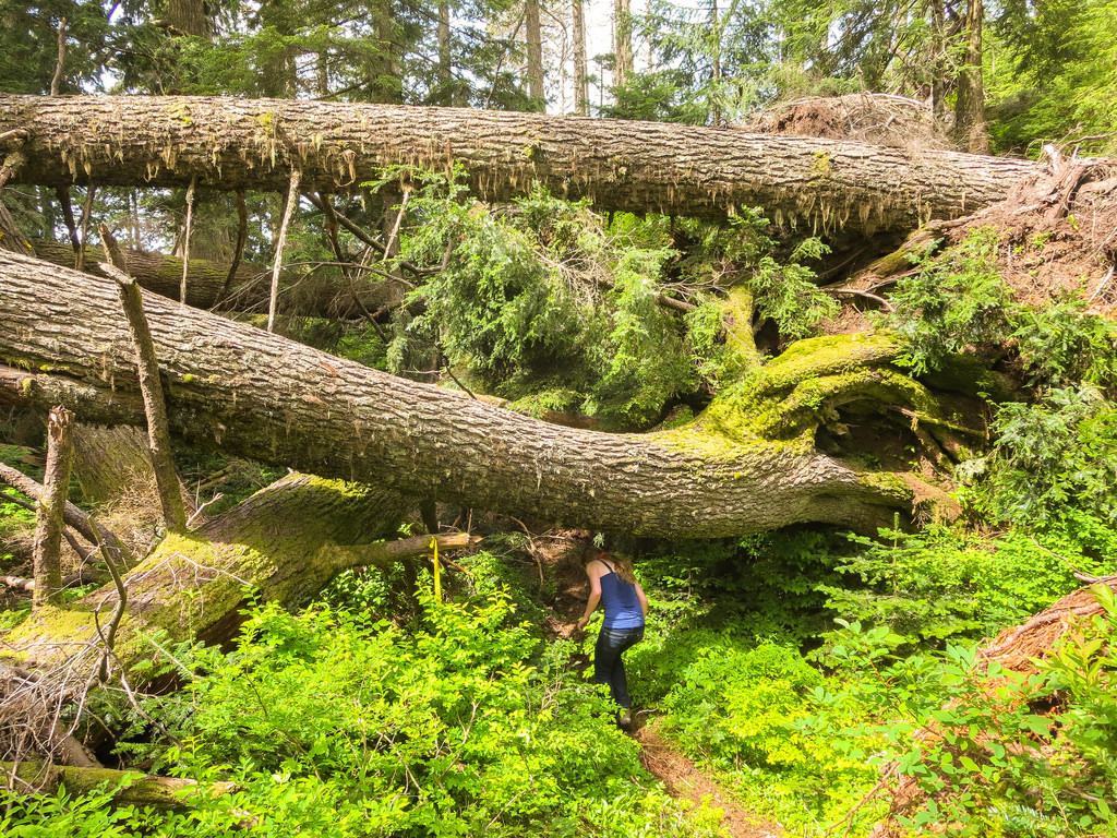
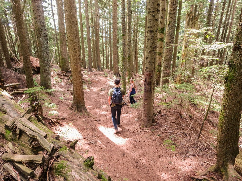
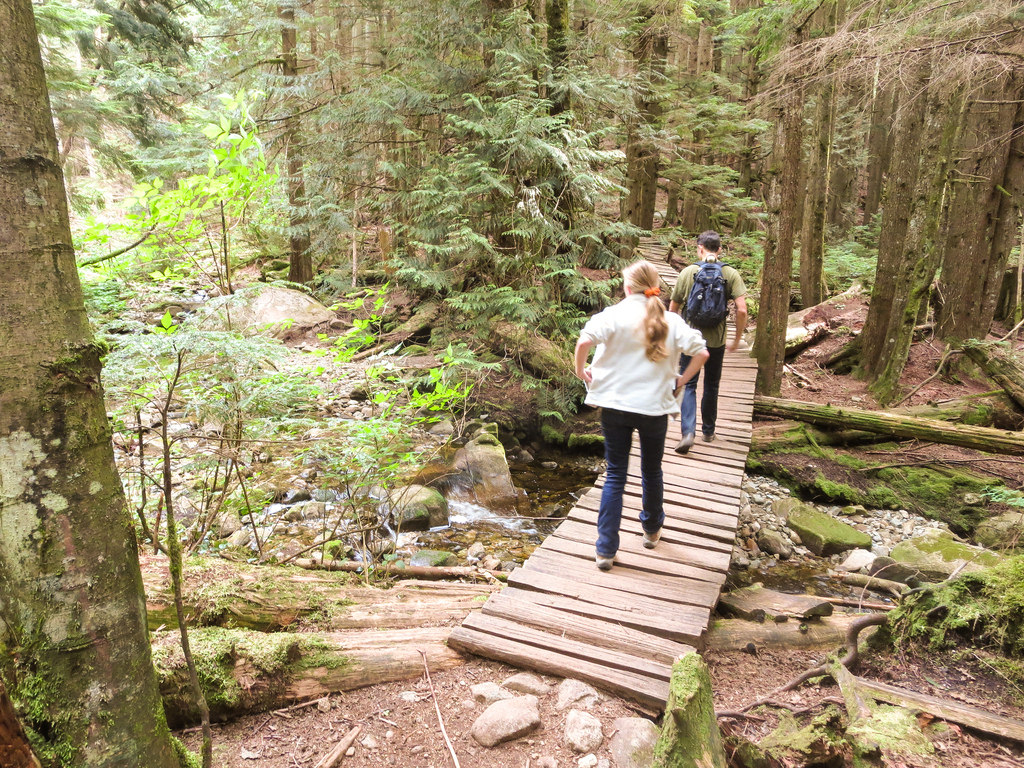
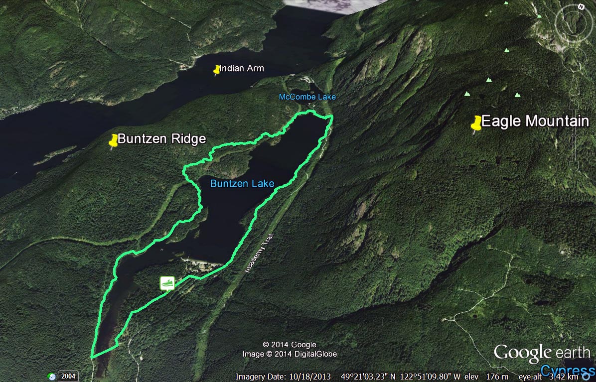
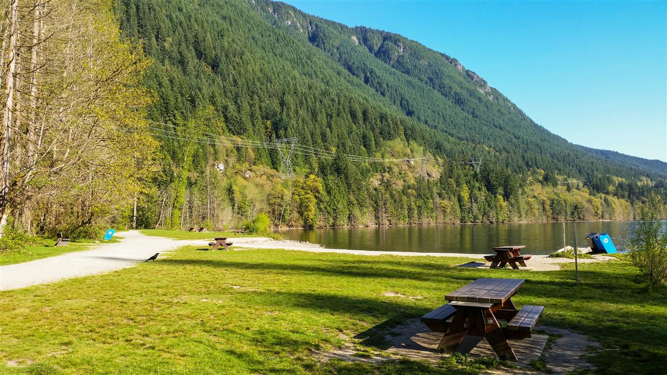
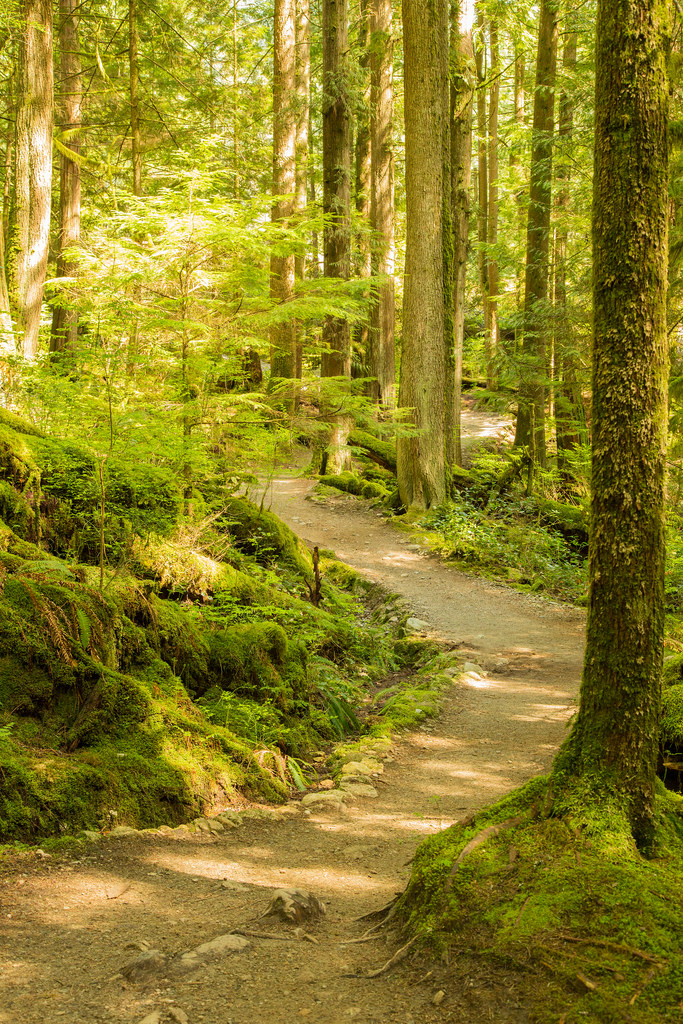
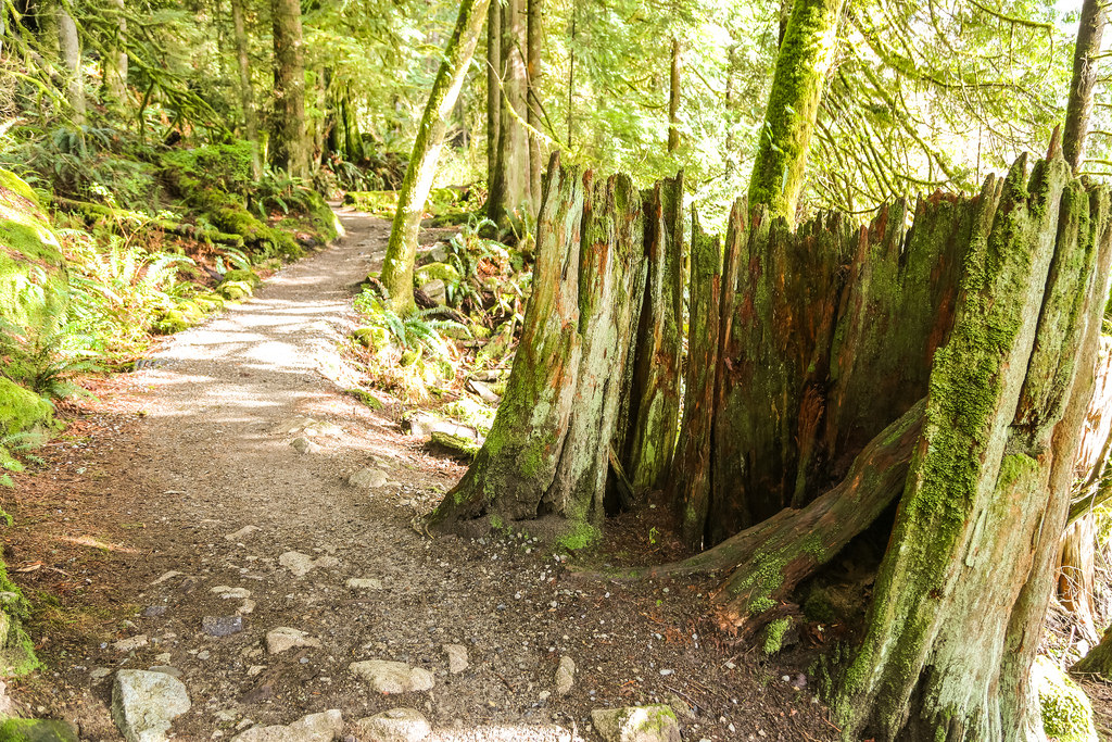
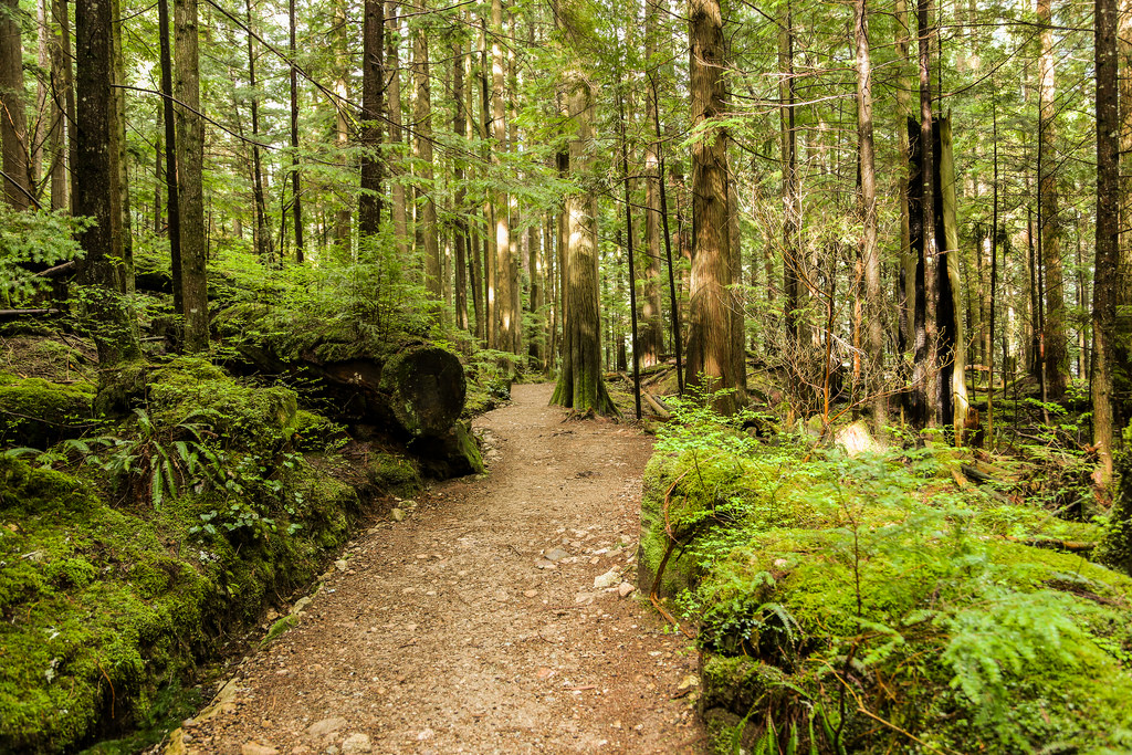
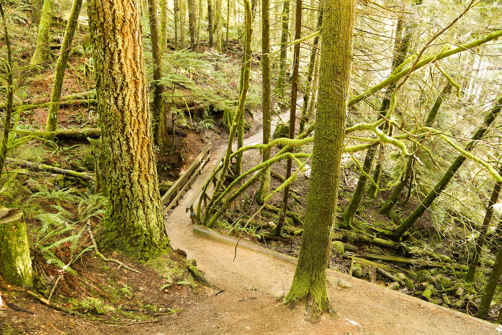
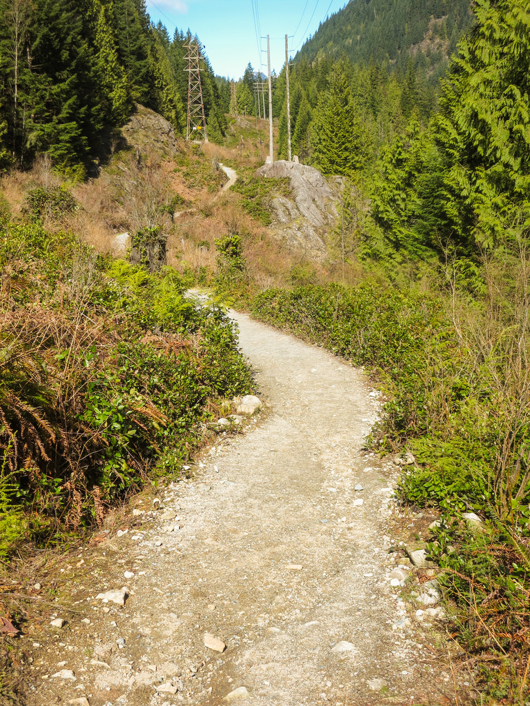
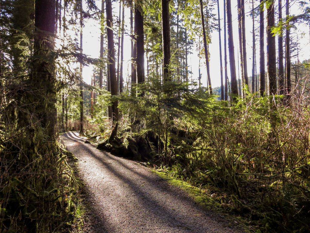
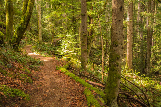
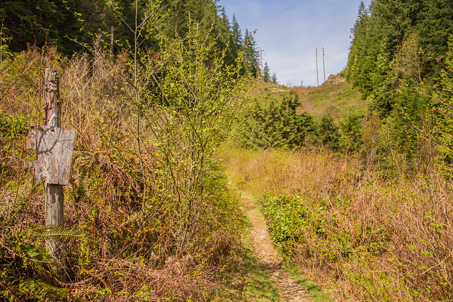
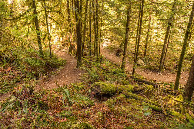
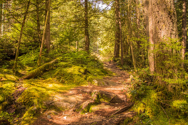
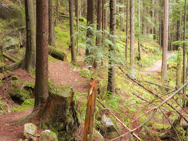
  • The Energy Trail at Buntzen Lake is a great place .
  • Log your workouts (time, distance and date)
    (I use Endomondo to track my workouts)
  • If you wish, find a partner to help push and motivate you
  • It’s more difficult to lose weight than to eat junk food
  • Lift weights
  • Weigh yourself only once/week and do it in the morning

Here are some useful dieting tips…

  • Drink lots of water
  • Lower the sugar in your diet (see below)
  • ‘Low Fat’ advertising is tricky. Low fat foods often have high sugar
  • Have small meals, with healthy snacks in between, such as trailmix or WASA Light Rye Crispbread, with peanut butter (non-hydrogenated)
  • Nuts are a good snack and they help to make you feel full
  • Too much alcohol is bad. Don’t waste your liver’s time breaking down alcohol, when it could be breaking down sugars. Plus alcohol contains empty calories.
  • Avoid buffets
  • Don’t eat out too much
  • Low fat milk makes you feel less full; consider using 2% or homo unless you have a cholesterol problem
  • Good sugar substitutes are: Stevia; Erythritol; Xylitol
  • Close your kitchen down 2 hours prior to bedtime
  • Have one treat a week (but not a 2 lb sundae !)
  • Use spices, mustard or hot sauce for flavour
  • Substitute Hummus for Mayo
  • Always eat breakfast
  • Have lots of fibre
  • Don’t eat the skin from chicken
  • Have a consultation with a dietitian

Some high sugar foods to avoid or cut back:

  • Soda
  • Fruit juices
  • Frappuccino (Venti Mocha from Starbucks = 76 grams of sugar)
  • Candy
  • Syrup
  • Dried fruit, canned fruit
  • Cookies, cakes, pies and donuts
  • Jams, preserves & spreads
  • Many cereals (try below 6 gr/serving);
    Cheerios, bran flakes and oatmeal are good
  • Sauces, like ketchup and BBQ
  • Ice cream

These tips are all great, but what makes it so hard to stick to a diet plan and lose weight ? Motivation, confidence and mood are key factors.

Things that can motivate you to lose weight and get in shape:

  • Health reasons
  • More energy
  • Enhance your appearance
  • Increase your confidence
  • Save money

Many health plans fail due to lack in confidence.
Confidence will naturally increase once you start exercising, but try this tip that was useful for me:

Challenge yourself – for me it was cutting back on Starbucks Mocha Frappuccinos (Tall is 40 grams of sugar). I challenged myself to not have them for a month. After a month, it turned into 3 months. Once you realize you can beat the demons that lead you to food, your confidence will naturally increase.

The challenge doesn’t have to be a food challenge either – you can challenge yourself to cut back on watching TV or the challenge can be walking 1, 2 or 3 km… every day.

White Rock Viewpoint

Today was my second venture up Eagle Mountain. The route started at the end of Hickory Drive in Port Moody and went as far as the White Rock Viewpoint (Not a view of White Rock, the town). The white rock is a large rock, whitish in colour and there is a large platform to sit, have a snack or lunch and take in the great views.

Here is the route from Hickory Drive, Port Moody…

The stats:

Distance: 14.7 km
Starting elevation: 327 m
Max elevation: 984 m
Elevation gain: 657 m
Cumulative elevation gain: 889 m
Time: 5-7 hours

Here are two great views from the viewpoint (950 m elevation)…

White Rock Viewpoint on Eagle Mountain

White Rock Viewpoint on Eagle Mountain2

This was my first time up this route and there are many many trails and they’re not marked well. I had a GPS unit and my smartphone for back up. As it turns out the smartphone had a GPS signal all day and that was the go to device. I highly recommend using one or both of these devices up here.

On the way up, you’ll see Cypress Lake at about the 5km mark. Here is a picture of the peaceful Cypress Lake at 800 m elevation…

Cypress Lake on Eagle Mountain

Also on the way up, you’ll pass through a network of mountain biking trails and there are some serious jumps here. See below…

Killer mountain bike ramp

There is a rope on one steep section of the trail…

Rope Climbing

The next photo is a serene little marsh…

Marsh on Eagle Mountain

I’ll end with some various trail pictures…

Blow downs

Trail

Trail 2

★★★★★★★★★★★

Before heading out on your hike, make sure you are well prepared. This means, having the TEN ESSENTIALS. It is also important to leave a trip plan (route details and estimated return time) with someone you trust.

Bring your smartphone, fully charged and put it in airplane mode while hiking. I always bring back-up battery packs for extra piece of mind. It is highly recommended that you bring a GPS device; I use my smartphone with a GPS app (Backcountry Navigator). The GPS will work in airplane mode. Learn how to use it before your hike.

For anyone new to hiking, there is a rule to which hikers follow; it is called “Leave No Trace” or LNT. The concept is generally to pack out what you pack in and respect nature, so all future visitors can enjoy what you have enjoyed.
To learn more about LNT, please check out this BLOG by a certified LNT Trainer.

★★★★★★★★★★★

Buntzen Lake Loop


The Buntzen Lake loop is the most popular trail in the park. This 10 km route can be done as fast as 45 min if you’re running and up to 6 hours if you just take your time, enjoy the views and have a picnic.

Route from GPSIES (click on ‘Details’ for large image)…

Route from Google Earth…

Untitled-1

Buntzen Lake is situated at roughly 130 m above sea level and the highest point on the trail is around 225 m. The single highest elevation gain on the trail is 70 m over 1.1 km.

I usually do the loop starting on the west side of the lake (starting at the old floating bridge area, now mostly a land bridge); some people prefer the other way. The west side is hillier, longer and more shaded. When taking this route, you’ll see this view at the half way point…

Buntzen Lake Trail

Also, starting on the west side, once you reach North Beach, you will have completed 60% of the loop. Here is North Beach…

North Beach

Below are a few random trail photos…

Trail2 (Medium)

BL Trail

Stump on Trail

BL Trail 2

BL Trail 3

Buntzen Lake Trail

BL Trail 4

Early morning hike

Here’s a little video of one of my hikes around the trail in February 2014…

★★★★★★★★★★★

Before heading out on your hike, make sure you are well prepared. This means, having the TEN ESSENTIALS. It is also important to leave a trip plan (route details and estimated return time) with someone you trust.

Bring your smartphone, fully charged and put it in airplane mode while hiking. I always bring back-up battery packs for extra piece of mind. It is highly recommended that you bring a GPS device; I use my smartphone with a GPS app (Backcountry Navigator). The GPS will work in airplane mode. Learn how to use it before your hike.

For anyone new to hiking, there is a rule to which hikers follow; it is called “Leave No Trace” or LNT. The concept is generally to pack out what you pack in and respect nature, so all future visitors can enjoy what you have enjoyed.
To learn more about LNT, please check out this BLOG by a certified LNT Trainer.

★★★★★★★★★★★

Lakeview Trail


Lakeview Trail is, in my opinion, Buntzen Lake Trail’s bigger brother.  This trail is an alternate route to traverse the west side of Buntzen Lake.  There are more ups and downs and it’s about 1km longer than the Buntzen lake Trail. After completing Lakeview Trail, I usually take the east side of Buntzen Lake back to the parking lot. There is a great viewpoint of Swan Falls and the North Beach area near the end of the west side traverse.

The stats…

Distance: 12 km
Time: 2-4 hours
Low point: 125 m
High point: 220 m
Elevation gain: 95 m
Cumulative Elevation gain: 500 m
Trailhead: 49° 20’ 11.3” by 122° 51’ 29.7” (Google Map)

Here are the photos…

Lakeview Trail

Lakeview Trail commences at the Pump House.
See location HERE (its the left route option).

Here is the route (click on ‘details’ for larger image)…

Here’s a map of the area from Google Earth (click on image for large size)…

lakeview trail

A comparison of the Lakeview Trail / West Side of the Buntzen Lake Trail shows:
Total one-way distance from the pumphouse to the suspension bridge is 4.9 km vs. 4.1 km;
Maximum elevation gain is 150 m vs. 100 m; and
Cumulative elevation gain is 240 m vs. 130 m

The route statistics, when returning on the east side of Buntzen Lake, are:
Distance: 10.9 km
Maximum elevation gain: 150 m
Cumulative elevation gain: 340 m

Besides a more strenuous hike, Lakeview Trail is much less busy than the Buntzen Lake Trail and it is also used by bikers and horses, which I have seen very few. You’ll see more large trees (1 m diameter) and fewer large tree stumps.

Below is a nice view you’ll see on the hike…

Nice View

There are signs for two viewpoints, but the southern ‘viewpoint’ is obstructed by trees. The northern viewpoint is at 250 m elevation and you see a great view of North Beach, Swan Falls, the Tunnel and Eagle Mountain. See below…

Viewpoint from Lakeview Trail

Below is a view of the Lakeview trail as it passes along the hydro right-of-way, before entering the forest again…

Old sign

Here is an old Lakeview Trail sign…

Lakeview Trail sign

This photo shows where the Lakeview Trail runs close to the Buntzen Lake Trail…

Trails almost collide

Below is a creek that flows alongside a section of the Lakeview Trail…

Creek

Next is a large downed tree alongside the trail…

Large tree alongside trail

Here are a couple more serene Lakeview Trail photos…

Lakeview Trail

Lakeview Trail

★★★★★★★★★★★

Before heading out on your hike, make sure you are well prepared. This means, having the TEN ESSENTIALS. It is also important to leave a trip plan (route details and estimated return time) with someone you trust.

Bring your smartphone, fully charged and put it in airplane mode while hiking. I always bring back-up battery packs for extra piece of mind. It is highly recommended that you bring a GPS device; I use my smartphone with a GPS app (Backcountry Navigator). The GPS will work in airplane mode. Learn how to use it before your hike.

For anyone new to hiking, there is a rule to which hikers follow; it is called “Leave No Trace” or LNT. The concept is generally to pack out what you pack in and respect nature, so all future visitors can enjoy what you have enjoyed.
To learn more about LNT, please check out this BLOG by a certified LNT Trainer.

★★★★★★★★★★★

Rough-skinned Newt

Today on the Buntzen Lake Trail, I saw a little Rough-skinned Newt.  It was on Pump House Road, just steps from the bridge. When I posted this on Flickr, someone thought it was a Western Redback Salamander, but Ivan Phillipsen, of Wild Pacific Northwest, informed me that it was a Rough-skinned Newt.


It blended in with the road so well, I almost walked right past it.

Rough-skinned Newt (Taricha granulosa)

Luckily, I took my good camera today so I could get a good shot.

After I finishing taking my photos, I used a stick to take him to the side of the trail. He was stiff as a board. I hope that is a defence mechanism !


This amphibian is much more commonly seen than the Western Red-backed Salamander, because the newt walks around in the open, whereas the salamander is much more secretive.

Toxin-resistant garter snakes are the only known animals today that can eat a rough-skinned newt and survive.

In evolutionary theory, the relationship between the rough-skinned newt and the common garter snake is considered an example of co-evolution. The mutations in the snake’s genes that conferred resistance to the toxin have resulted in a selective pressure that flavors newts which produce more potent levels of toxin. Increases in newt toxicity then apply a selective pressure favouring snakes with mutations conferring even greater resistance. This cycle of a predator and prey evolving to one another is sometimes termed an evolutionary arms race and has resulted in the newts producing levels of toxin far in excess of what is needed to kill any other conceivable predator.