Buntzen Lake sits between Eagle Mountain to the east and Buntzen Ridge to the west. With all the rain and snow these mountains receive, it’s no surprise that numerous creeks drain down their forested slopes towards the lake.
I’ve crossed these creeks hundreds of times during my hikes around Buntzen Lake. Some have substantial wooden or metal footbridges, while others pass beneath the trails through culverts. A few have signs identifying a creek even when there is little or no visible water.
One thing I’ve always found interesting is the naming of these creeks. Many have names based on trees, shrubs, and other plants, and the names generally follow an alphabetical sequence when travelling counter-clockwise around the lake.
Over the years, I’ve photographed quite a variety of crossings, including some that have changed considerably. This article takes a closer look at the named creeks, the smaller trail bridges, and the two larger crossings that make the Buntzen Lake Loop possible.
Named Creeks Around Buntzen Lake
Many of the creek names around Buntzen Lake follow an alphabetical sequence, although not every letter is represented. The names are associated with the creeks or drainage crossings, rather than necessarily being the formal names of the bridges themselves.
My list of 23 names recorded along the trail system is divided into 17 on the eastern side and six on the western side of Buntzen Lake.
East Side (17)
- Birch Creek
- Cypress Creek
- Dogwood Creek
- Elderberry Creek
- Fir Creek
- Gooseberry Creek
- Hemlock Creek
- Ivy Creek
- Juniper Creek
- Kinnikinnick Creek
- Lodgepole Creek
- Maple Creek
- Ninebark Creek
- Oregon Grape Creek
- Poplar Creek
- Queen’s Cup Creek
- Rhododendron Creek
West Side (6)
- Sitka Creek
- Trillium Creek
- Umbrellawort Creek
- Valentine Creek
- Willow Creek
- Xanthoria Creek
These names are based on my observations of the trail crossings and their signs. They should not be taken as a complete list of officially recognized geographical names. Some also appear on online maps, including Mapcarta’s Buntzen Lake map, although the mapped watercourses and names do not always correspond exactly with the crossings along the trail.
Some Creeks Join Before Reaching the Lake
Looking more closely at the surrounding drainage system reveals another interesting detail: not every named creek flows independently into Buntzen Lake.
For example, Gooseberry Creek joins Fir Creek before the combined flow reaches the lake. Both creeks cross the hiking trail separately, but the downstream watercourse is identified as Fir Creek.
Similarly, Kinnikinnick Creek joins Lodgepole Creek before reaching Buntzen Lake. Both have their own trail crossings, but the watercourse downstream of their junction is identified as Lodgepole Creek.
Why this matters: The number of named creek crossings along the trail doesn’t necessarily correspond with the number of individual streams entering Buntzen Lake. Some streams merge before reaching the shoreline.
Other small drainage channels are unnamed on the maps I’ve examined. The drainage system is more complicated than it first appears, particularly where smaller streams join or pass beneath trails through culverts.
What About Trillium Creek?
Trillium Creek is one of the more puzzling names along the western side of the lake.
In the past, there was a substantial wooden crossing at this location. Today, the feature looks more like a trail railing than a conventional bridge, and I haven’t observed an obvious flowing creek beneath it.
It’s possible that drainage passes beneath the trail through a culvert, or that the original crossing was built over a channel that is frequently dry. I haven’t established exactly what happened to the creek, so I wouldn’t want to speculate.
Kinnikinnick Creek is another example where the crossing doesn’t resemble a conventional bridge. At that location, a large round culvert carries drainage beneath the trail.
These are good reminders that a named creek crossing doesn’t always mean there’s an obvious bridge or even visible flowing water.
Bridges Over the Named Creeks
Many of the smaller creeks around Buntzen Lake have wooden footbridges that make the trail crossings straightforward. Some are relatively short, while others span deeper drainage channels.
The following photographs show six of the crossings around the lake. The names identify the creeks, not necessarily the formal names of the bridge structures.


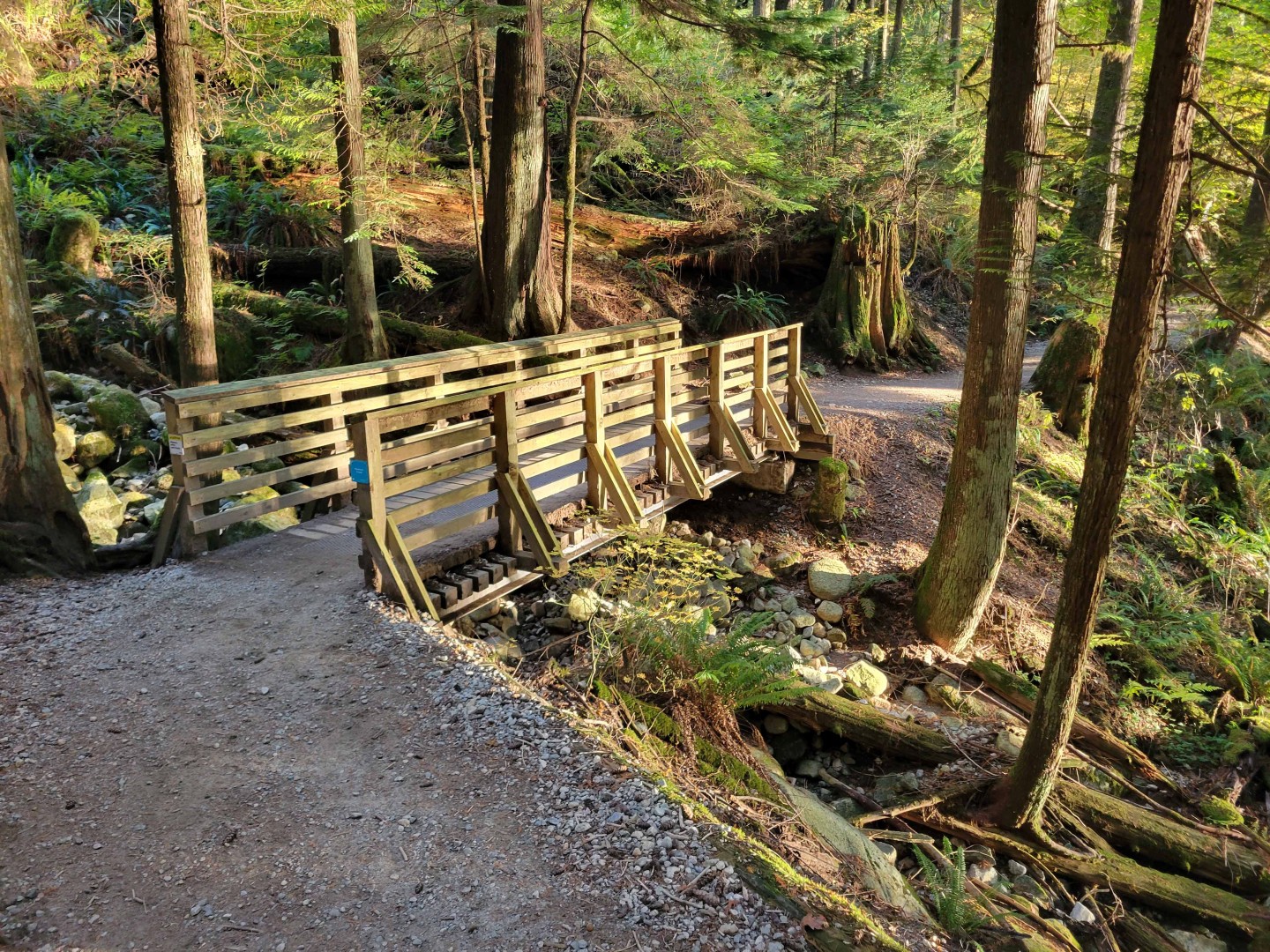

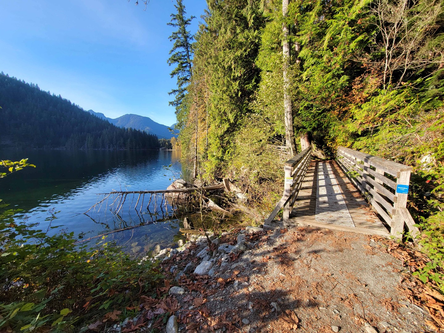
Most hikers probably cross these little bridges without giving them much thought. But they’re an important part of the trail system, particularly during periods of heavy rainfall when even a small creek can carry a surprising amount of water.
Buntzen Creek: From Dry Rocks to Rushing Water
Buntzen Creek is one of the more substantial creek crossings near the southern end of Buntzen Lake. BC Hydro refers to the crossing near South Beach as the Buntzen Creek Bridge.
One thing I’ve always found a little strange is that many of the smaller creeks have individual identification signs, while I haven’t seen the same kind of creek marker at this much larger crossing.
Another interesting thing about Buntzen Creek is how dramatically its flow can change.
During the hundreds of hikes I’ve made around the lake, the creek bed downstream of the bridge has been dry, or nearly dry, the vast majority of the time.
After heavy rainfall, however, it can be a completely different sight. Water rushes over the rocks and flows towards Buntzen Lake.

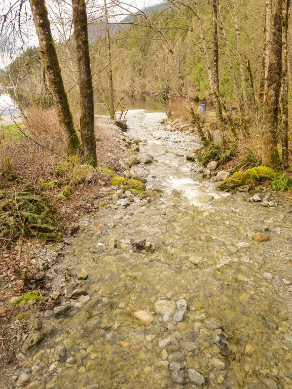

The contrast between a dry, rocky creek bed and a rushing stream is remarkable. It’s one of those things I’ve noticed over the years that casual visitors might never see, depending on when they visit.
The Buntzen Lake Suspension Bridge
Of course, the most recognizable bridge at Buntzen Lake is the suspension bridge at the northern end of the lake, crossing the narrow channel between Buntzen Lake and McCombe Lake.
The original suspension bridge was constructed in 1991 and officially opened on 5 June 1992. It was approximately 50 metres long, was designed by Siefken Engineering, and was constructed by military field engineers associated with CFB Chilliwack.
After approximately 30 years of service, the original bridge was closed for replacement in September 2022. The work took longer than originally anticipated, and the replacement suspension bridge opened to the public on 28 April 2023.
The bridge is an important part of the Buntzen Lake Loop, connecting the eastern and western sides of the lake.
For historical photographs, construction details, and information about the replacement, see my separate article on the Buntzen Lake Suspension Bridge.
The Floating Bridge at the South End
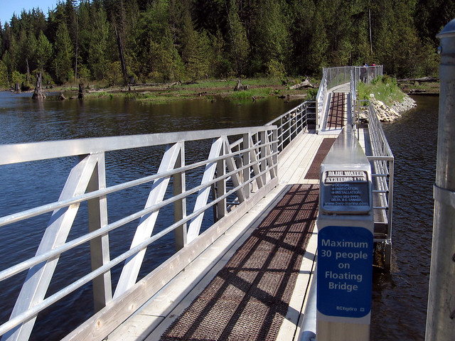
Another interesting crossing is the floating bridge near the southwestern end of Buntzen Lake. Over the years, this crossing has changed considerably.
Although it’s still commonly called the floating bridge, much of the crossing is now a raised land connection, or causeway, with a relatively short floating section remaining.
The Raised Land Crossing
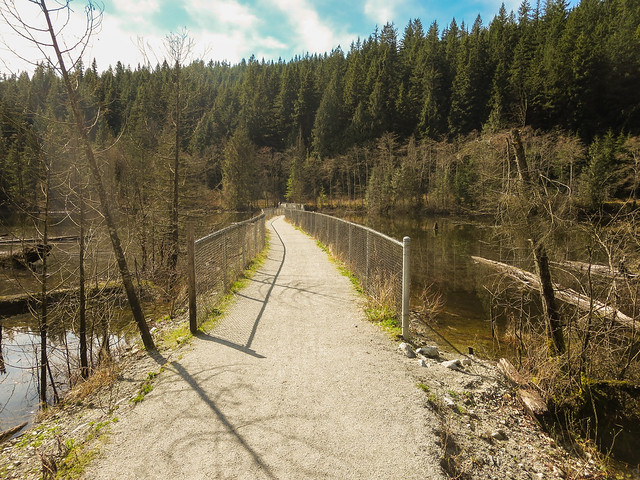
The Remaining Floating Section
A short floating section remains as part of the crossing.
The Original Floating Bridge
The crossing looked quite different in the past. The photograph below, taken in 2005, shows the original floating bridge extending across a much greater portion of the water.
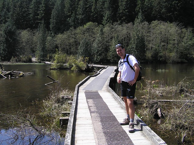
It’s interesting to compare the original bridge with the later crossing. The route still serves the same general purpose, connecting the western side of the Buntzen Lake Loop with the South Beach area, but its appearance has changed substantially.
Because Buntzen Lake is an active hydroelectric reservoir, water levels can change in response to rainfall, snowmelt, and reservoir operations. High water can affect the floating bridge and nearby low-lying trails.
I’ve documented some of these conditions in my article on high water and flooding at Buntzen Lake.
Old and New Footbridges
One thing I’ve noticed over the years is how much the construction of the smaller bridges varies. Some are entirely wooden, while others use steel girders or aluminum framing.
Major East-Side Bridge Upgrades, 2016–2017
Between late 2016 and spring 2017, BC Hydro undertook a major upgrade of the wooden footbridges along the eastern side of Buntzen Lake.
Much of the lakeside trail was closed for an extended period while the work was underway. Hikers were diverted onto Powerhouse Road instead of following the usual lakeside route. The detour remained in place into spring 2017, with the upgraded bridges in use by that summer.
The work substantially changed the appearance of many of the creek crossings. It’s particularly interesting to compare photographs of the older wooden bridges with the structures that replaced them.
Steel-Supported Footbridges
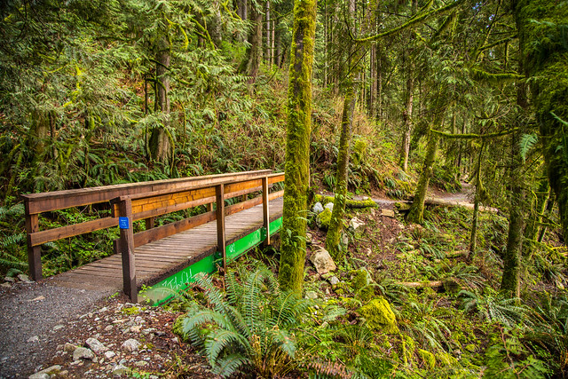
The bridge over Queen’s Cup Creek is an example of a crossing that has used steel girders to support the walkway. The photograph below shows an earlier view of this bridge.
Older Wooden Footbridges
Other bridges have been built entirely of wood, like this older example photographed along the trail system.
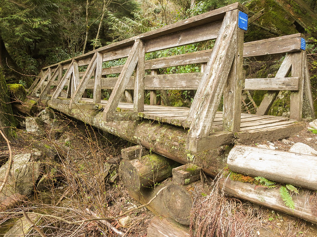
These older wooden structures show how bridge construction has changed over the years. Some have been repaired or replaced, and historical photographs don’t necessarily represent the structures visitors will encounter today.
An Aluminum Bridge on Lakeview Trail
I also photographed an aluminum bridge on the Lakeview Trail, on the western side of Buntzen Lake.
The manufacturer’s label identifies Riptide Marine, a company based in Parksville, BC, that manufactures aluminum bridges, ramps, gangways, and other marine structures.

Aluminum is lightweight and corrosion-resistant, making it a practical alternative to traditional wooden structures, particularly in a wet environment such as Buntzen Lake.
A Reinforced Section of Trail
Not every reinforced trail crossing is a conventional bridge. The photograph below shows the underside of a timber-supported section of trail that I photographed in the past.
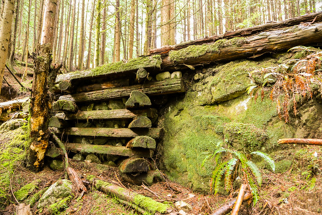
These kinds of structures can provide support across uneven or poorly drained ground while helping keep hikers on the established trail.
Interesting Facts About Buntzen Lake’s Creeks and Bridges
- The creek names follow an alphabetical pattern. Many of the smaller streams around Buntzen Lake are named after plants, including trees, shrubs, and wildflowers. Not every letter of the alphabet is represented.
- Not every creek crossing has a bridge. Some streams flow through culverts beneath the trail, while other named crossings have little or no visible water for much of the year.
- Some named streams merge before reaching the lake. Gooseberry Creek joins Fir Creek, while Kinnikinnick Creek joins Lodgepole Creek. Each has its own upstream crossing, even though the streams combine farther downstream.
- Xanthoria is a genus of lichens. Unlike most of the plant-inspired names, Xanthoria refers to lichens, many of which have distinctive yellow or orange colouring. Lichens are associations involving fungi and photosynthetic organisms, such as algae.
- The original suspension bridge was built by military engineers. Designed by Siefken Engineering and constructed by field engineers associated with CFB Chilliwack, it officially opened in 1992.
- Hikers once followed a different route around the lake. Before the original suspension bridge was constructed, the Old Buntzen Lake Trail provided a route around the northern end of the lake. The suspension bridge created a more direct connection between the eastern and western trails.
- The floating bridge has changed considerably. A much longer floating structure once crossed the southwestern end of the lake. Most of the crossing was later replaced by a raised land connection, although a short floating section remains.
- Buntzen Lake is a working reservoir. Water enters from Coquitlam Lake through a tunnel beneath Eagle Mountain. Reservoir levels can fluctuate because of weather and hydroelectric operations, affecting shorelines and low-lying crossings.
- There are drainage systems beyond Buntzen Lake itself. For example, the watercourse associated with Swan Falls drains towards nearby McCombe Lake. I’ve not established an official name for that particular watercourse.
Planning a Walk Around Buntzen Lake?
Many of the creek crossings shown in this article are found along the main Buntzen Lake Loop. Other structures are located on trails such as Lakeview Trail, which travels along the western side of the lake.
The bridges, culverts, and creek channels can change over time. Trail repairs, erosion, heavy rainfall, and reservoir operations can all affect conditions. Some of the historical photographs in this article show structures that may since have been altered or replaced.
Before heading out, check BC Hydro’s Buntzen Lake trail information and closures. Follow posted trail signs, bridge capacity limits, and any construction detours.
For more information about hiking routes, see my Buntzen Lake Hiking Guide.
After all my years hiking around Buntzen Lake, I still find these creek crossings interesting. Most people probably walk across them without giving them much thought, but there’s quite a bit of variety and history hidden along the trails.