Monthly Archives: August 2013

DeBoville Slough


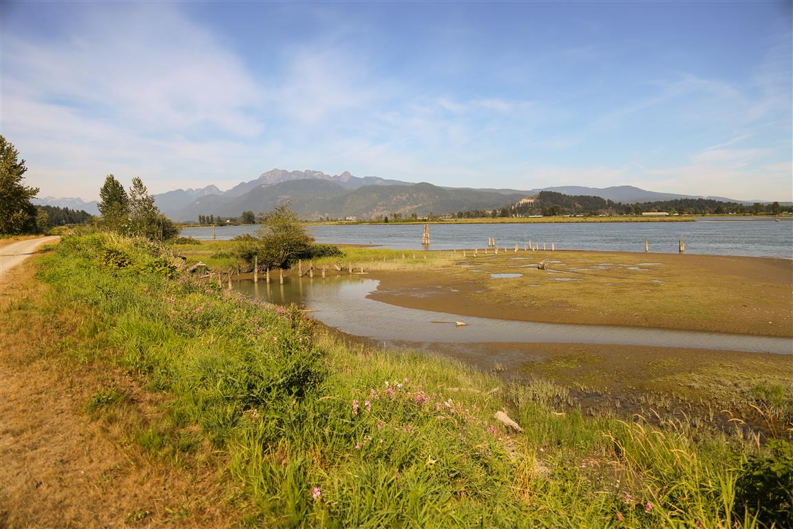
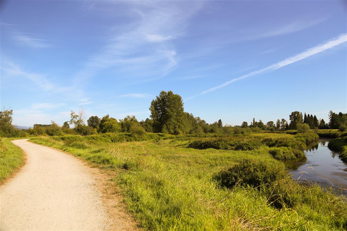
The DeBoville Slough is a 2.2 km long body of water linking the Pitt River with Hyde Creek.
There are dykes on both sides of the slough which make great walking and biking paths.
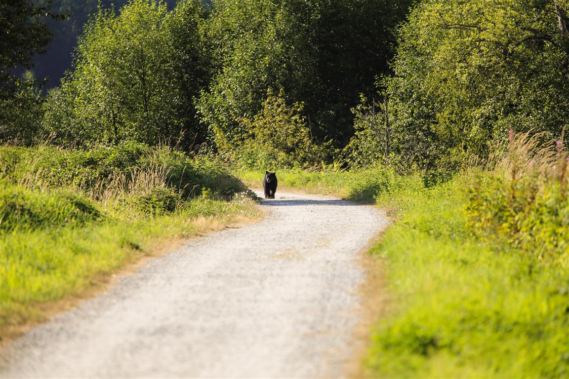
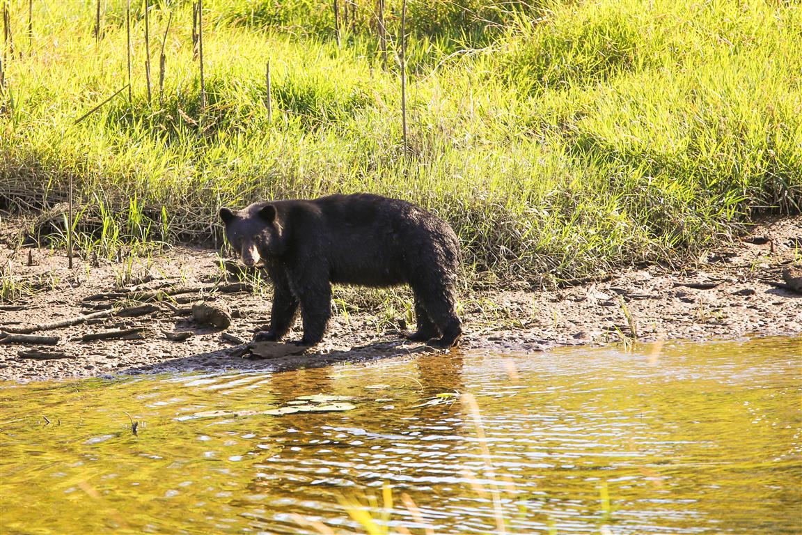
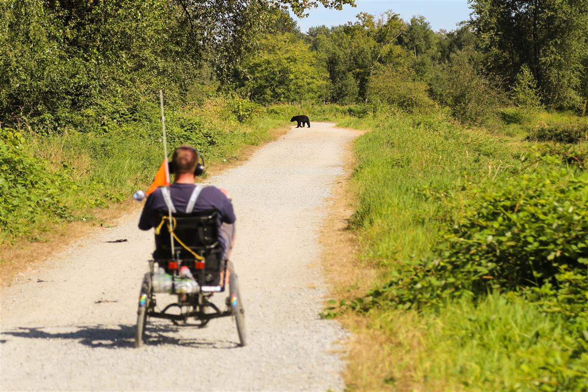
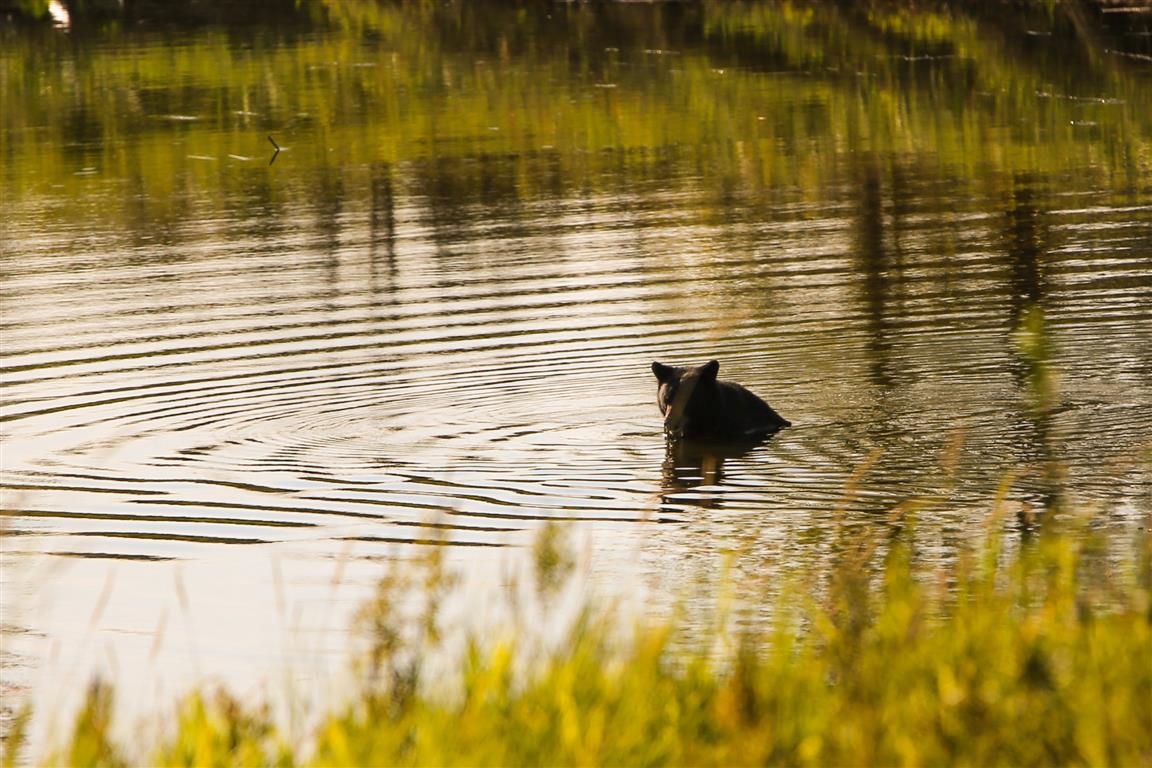
The scenery is great and you might even see a bear. I saw two bears on my trip, but they were at a distance and didn’t really care about me.

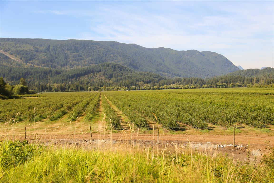
With blueberry fields to the north, blackberries around the slough and fish in the slough, this makes a great place for bears to dine.

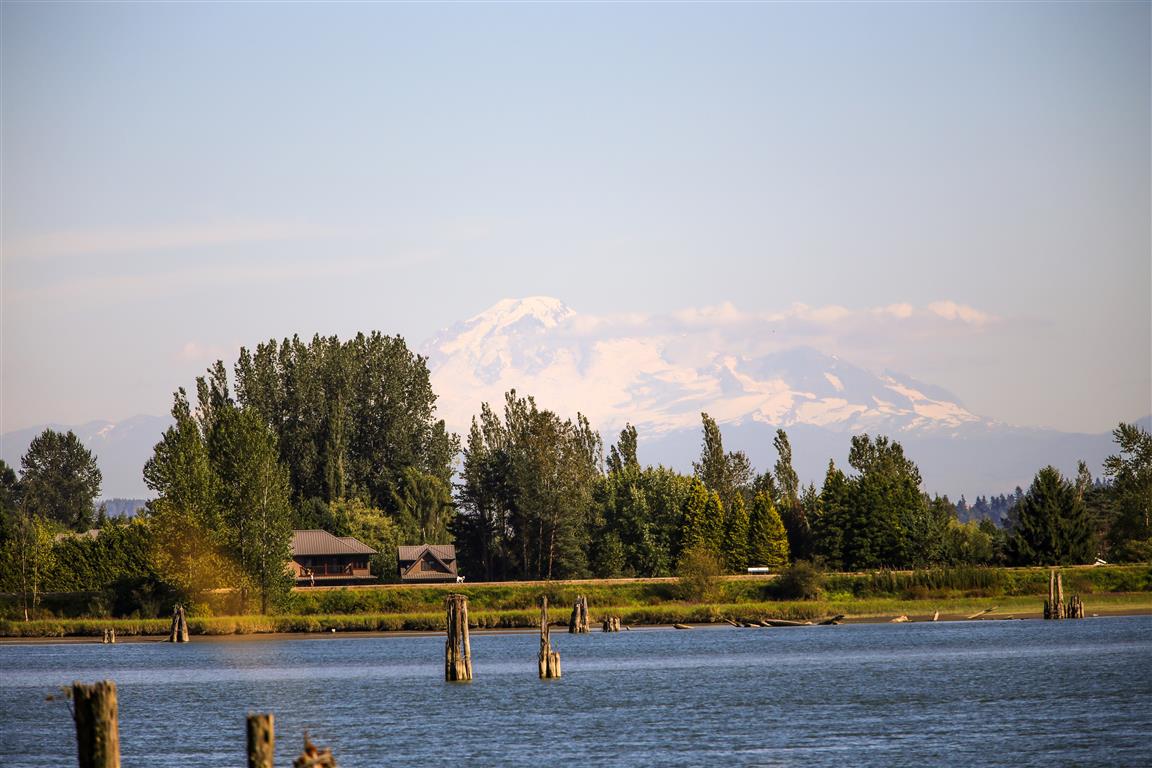
You have the choice of the north dyke or south dyke, which are both equally great. After reaching the Pitt River, you can head back or explore the shore of the Pitt River with a walk to the north or south along continued dykes.

There are two parking lots located on the east side of Cedar Drive. This is the location of the biggest parking lot HERE.

Distance: 5 km (to Pitt River and back)
Time: varies
Low point: near sea level
High point: near sea level
Elevation gain: minimal
Trailhead for south Dyke: 49° 17’ 7.4” by 122° 44’ 1.0” (Google Maps and navigation)

The south dyke route with downloadable gpx…
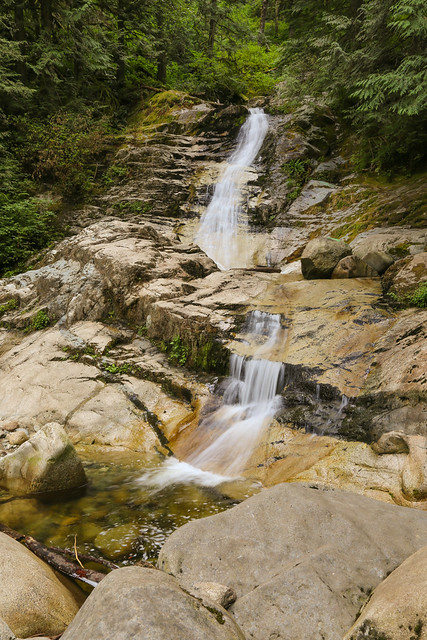
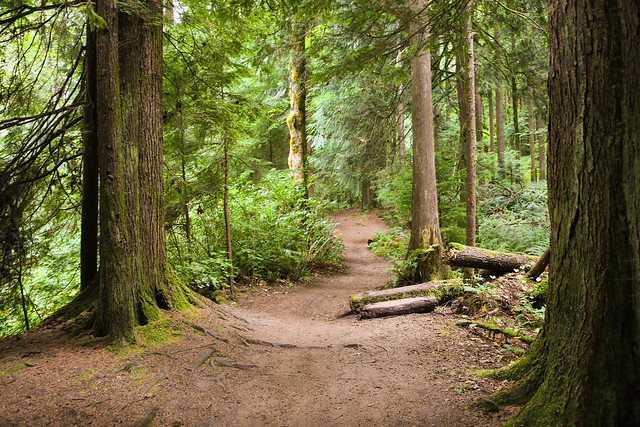
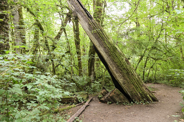
The Photos…

Pitt River
Pitt River
Bear on path
Bear on path
Bear
Bear
Blueberry Fields
Blueberry Fields
DeBoville Slough
DeBoville Slough
Mt. Baker
Mt. Baker
Put on the brakes !
Put on the brakes !
Swimming Bear
Swimming Bear

The Photos…

Coquitlam Crunch

The Coquitlam Crunch is a workout trail in North Coquitlam. The trail underwent some improvements in 2014, which included new signage and stairs. Sections of the old trail had steep gravel areas, which were slippery. Now, the crunch has become more popular than ever.

Distance: 2.2 km (one way)
Low point: 38 m
High point: 289 m
Elevation gain: 251 m
Trailhead: 49° 17’ 8.2” by  122° 48’ 56.7” (Google Map)
There is a driveway to a parking lot on the south side of Lansdowne Drive, just north of Scott Creek Middle School.

Here’s the route…

This is the view from the start…

Coquitlam Crunch

Here is a view from Runnel Drive…

Coquitlam Crunch from Runnel Drive

New stairs…

New Stairs on Coquitlam Crunch

Trail nearing the top…

near top of Coquitlam Crunch

One of 5 interpretive signs you’ll see…

Interpretive Sign on Coquitlama Crunch

And finally, a scenic view in winter with some fog below…

Top of Coquitlam Crunch

★★★★★★★★★★★

Before heading out on your hike, make sure you are well prepared. This means, having the TEN ESSENTIALS. It is also important to leave a trip plan (route details and estimated return time) with someone you trust.

Bring your smartphone, fully charged and put it in airplane mode while hiking. I always bring back-up battery packs for extra piece of mind. It is highly recommended that you bring a GPS device; I use my smartphone with a GPS app (Backcountry Navigator). The GPS will work in airplane mode. Learn how to use it before your hike.

For anyone new to hiking, there is a rule to which hikers follow; it is called “Leave No Trace” or LNT. The concept is generally to pack out what you pack in and respect nature, so all future visitors can enjoy what you have enjoyed.
To learn more about LNT, please check out this BLOG by a certified LNT Trainer.

★★★★★★★★★★★

Crystal Falls


The hike to Crystal Falls starts at north end of Shaughnessy Street in Coquitlam. This walk/hike has very gentle slope and generally follows the Coquitlam River. On hot summer days, it’s nice to take a dip in the shallow river. Be careful of some of the steep cliffs on the trail. The falls are located on Prichett Creek – a tributary of the Coquitlam River.

Tip: On a hot summer day, take your sandals, so you can cool off in the low-flowing Coquitlam River.

You can park on Shaughnessy Street or Karley Crescent – just pay attention to the parking signs and be mindful of residents.

Distance: 5.6 km (return)
Low point: 50 m
High point: 114 m
Elevation gain: 64 m
Trailhead and Parking: 49° 17’ 44.4” by  122° 46’ 15” (Google Map and Navigation)

Here’s the route with downloadable gps…

Here is a photo of the falls…

Crystal Falls

And a couple trail photos…

Coquitlam River Walk

Coquitlam River Walk

★★★★★★★★★★★

Before heading out on your hike, make sure you are well prepared. This means, having the TEN ESSENTIALS. It is also important to leave a trip plan (route details and estimated return time) with someone you trust.

Bring your smartphone, fully charged and put it in airplane mode while hiking. I always bring back-up battery packs for extra piece of mind. It is highly recommended that you bring a GPS device; I use my smartphone with a GPS app (Backcountry Navigator). The GPS will work in airplane mode. Learn how to use it before your hike.

For anyone new to hiking, there is a rule to which hikers follow; it is called “Leave No Trace” or LNT. The concept is generally to pack out what you pack in and respect nature, so all future visitors can enjoy what you have enjoyed.
To learn more about LNT, please check out this BLOG by a certified LNT Trainer.

★★★★★★★★★★★