Category Archives: Buntzen Lake Hikes

Croker Lookout


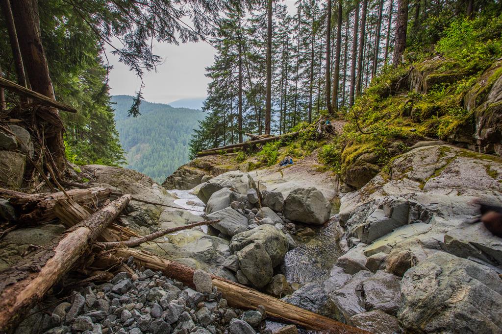
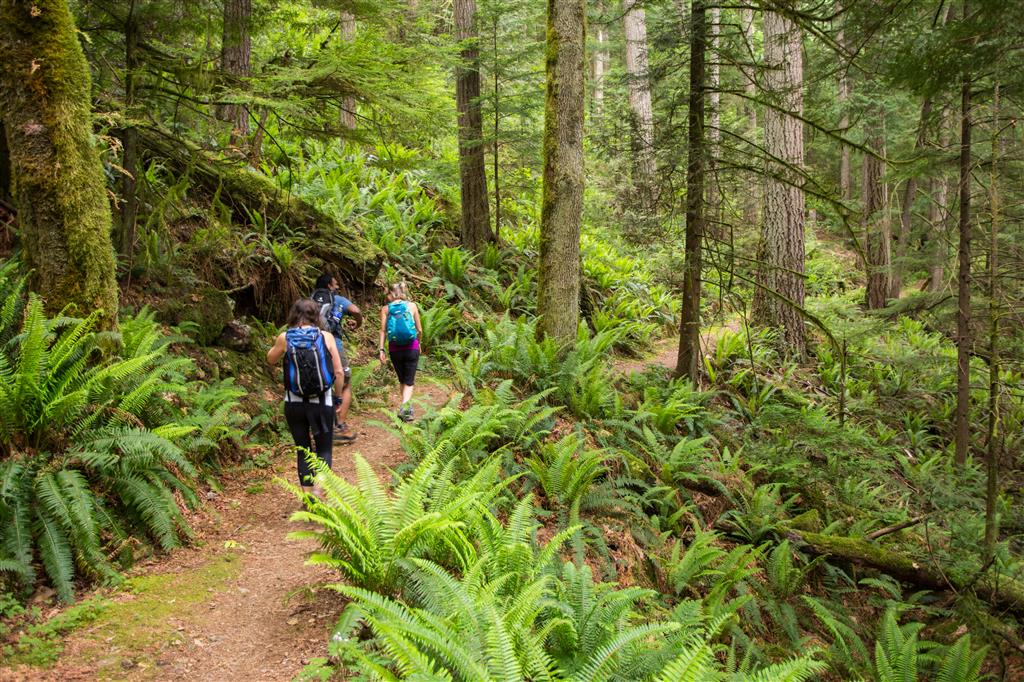
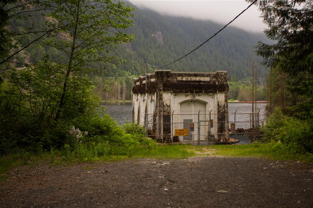
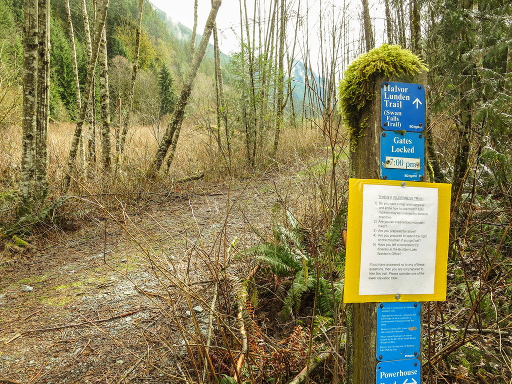
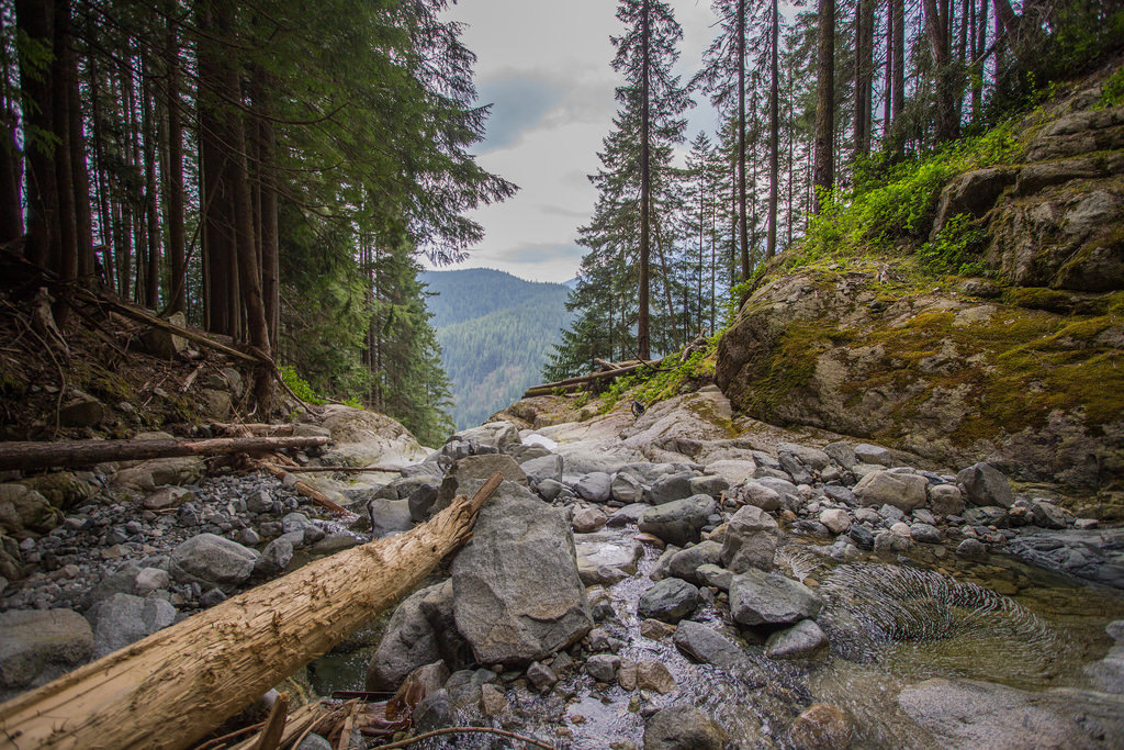
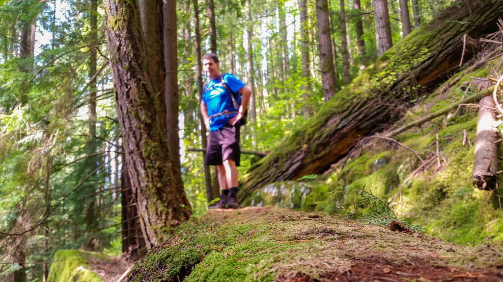
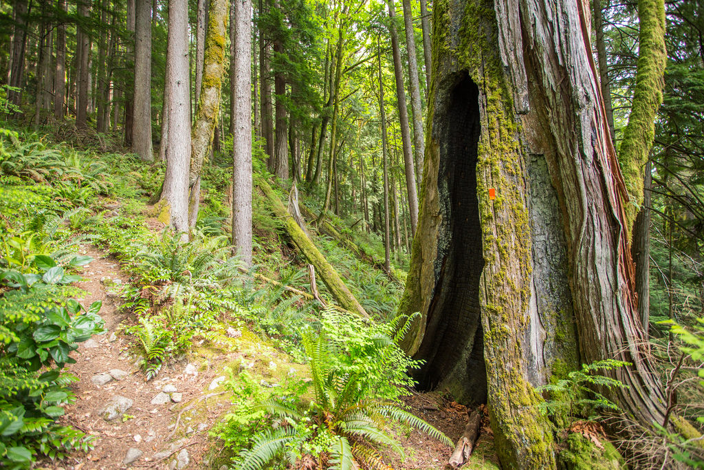
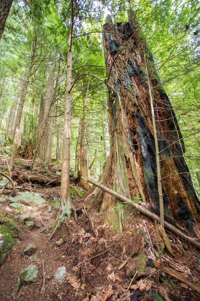
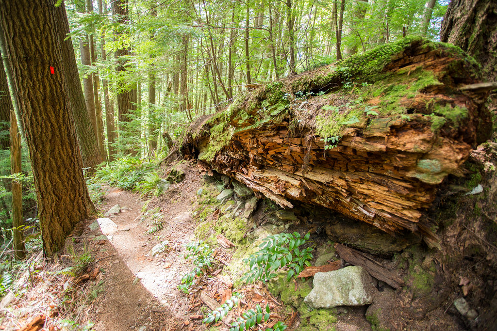
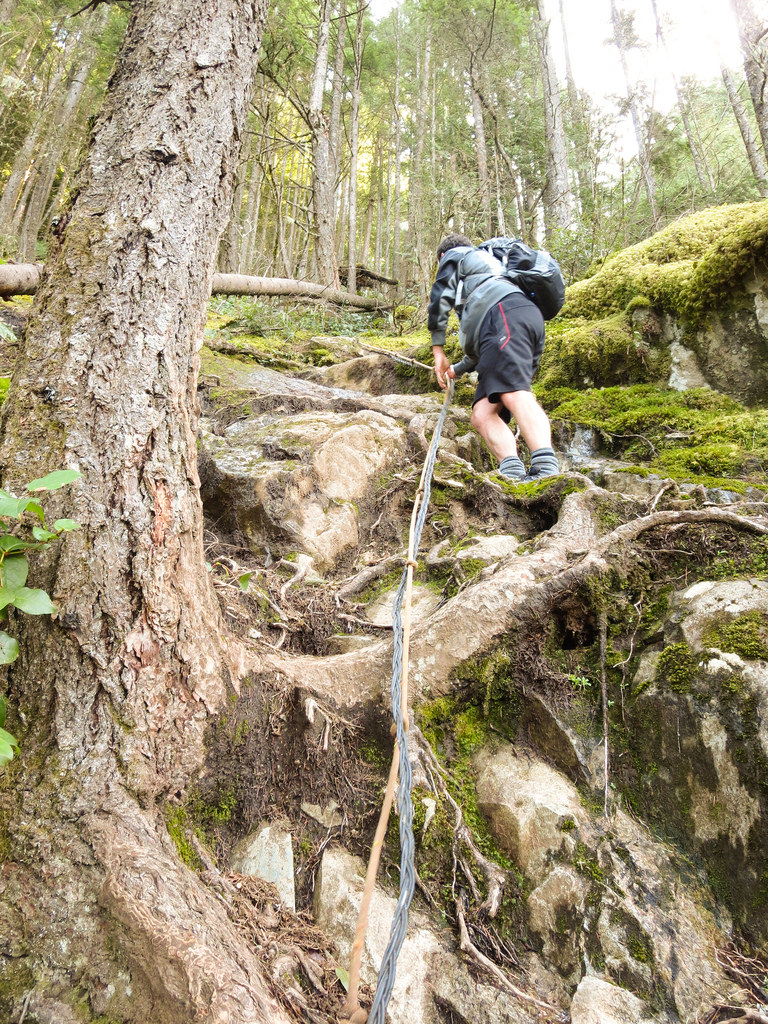
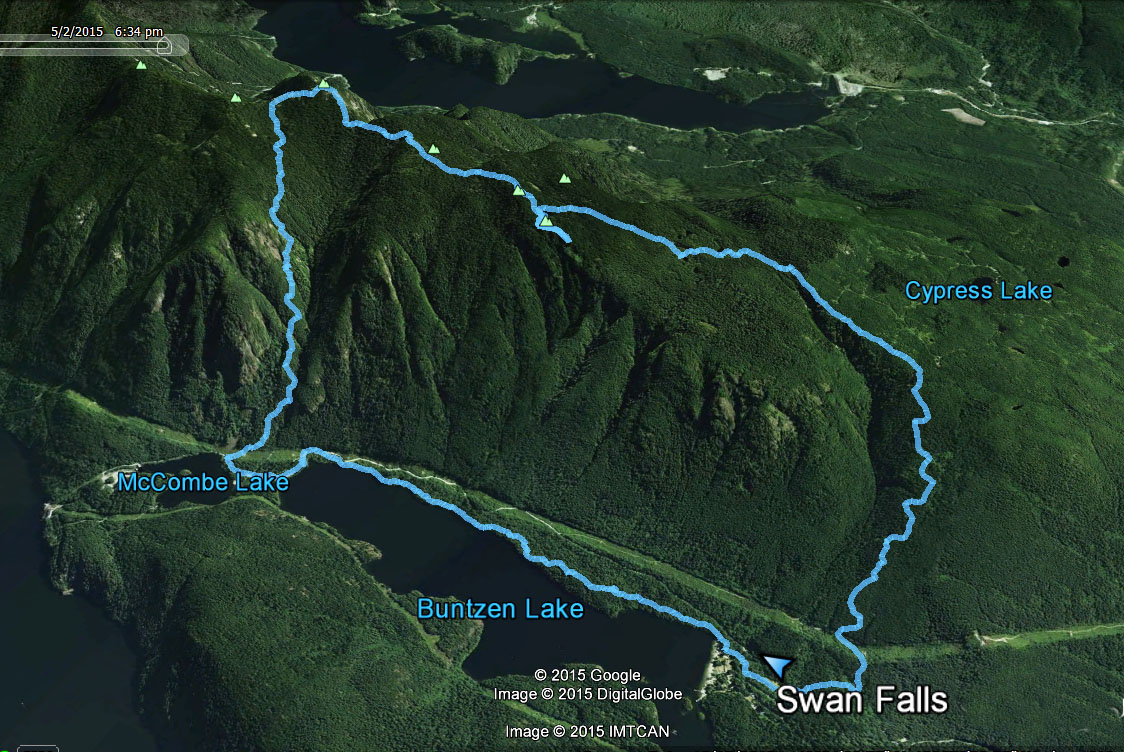
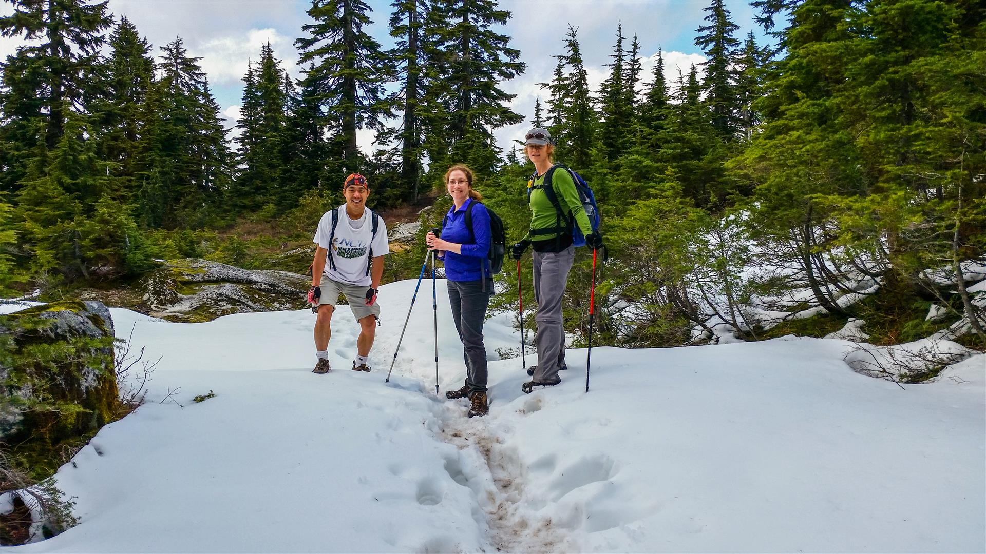
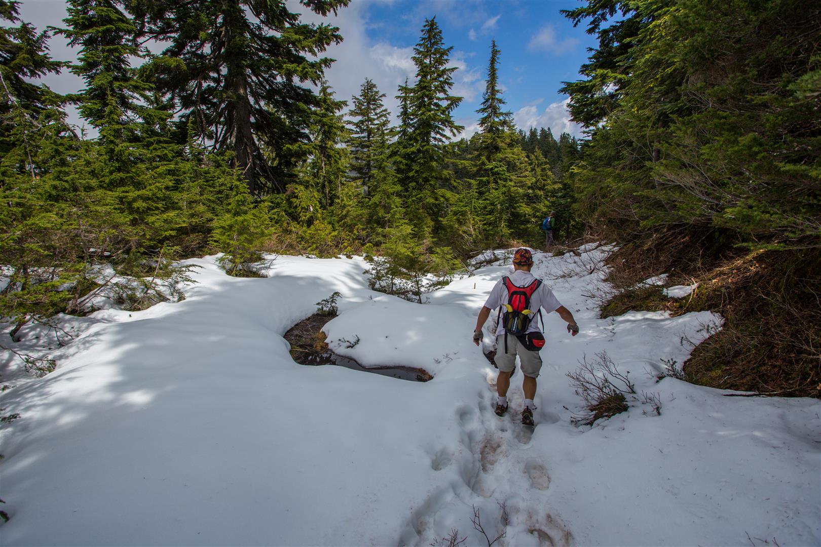
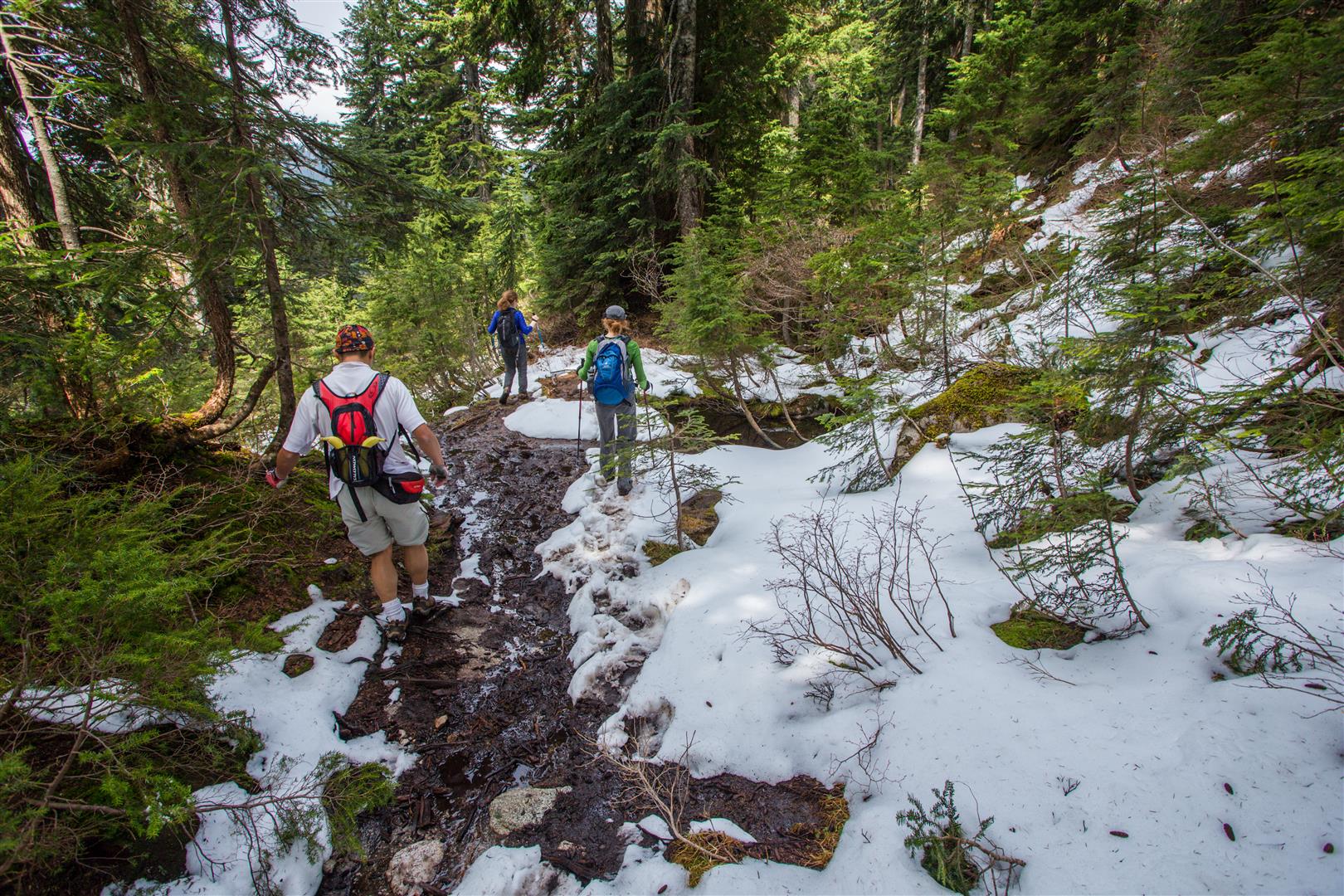
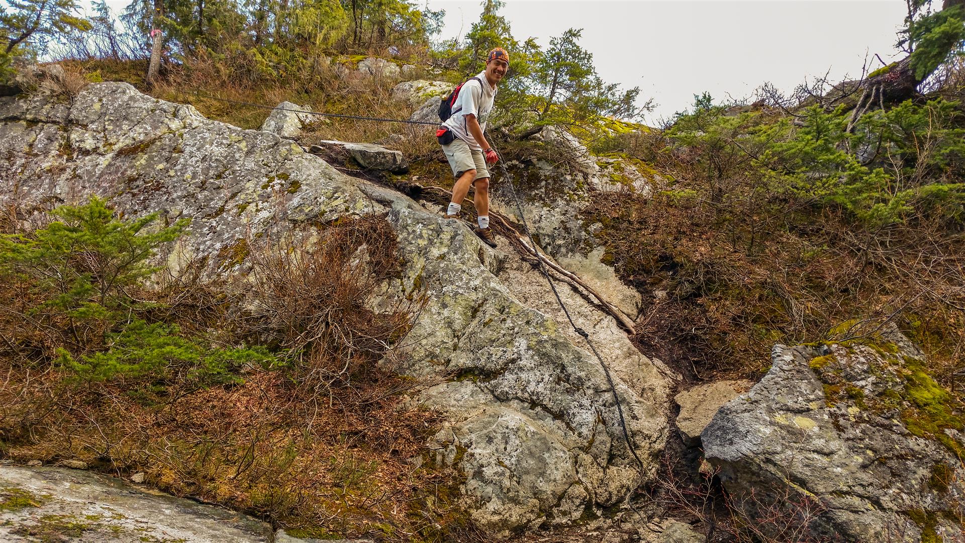
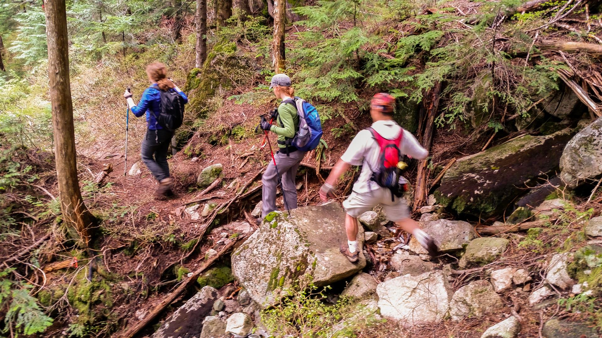
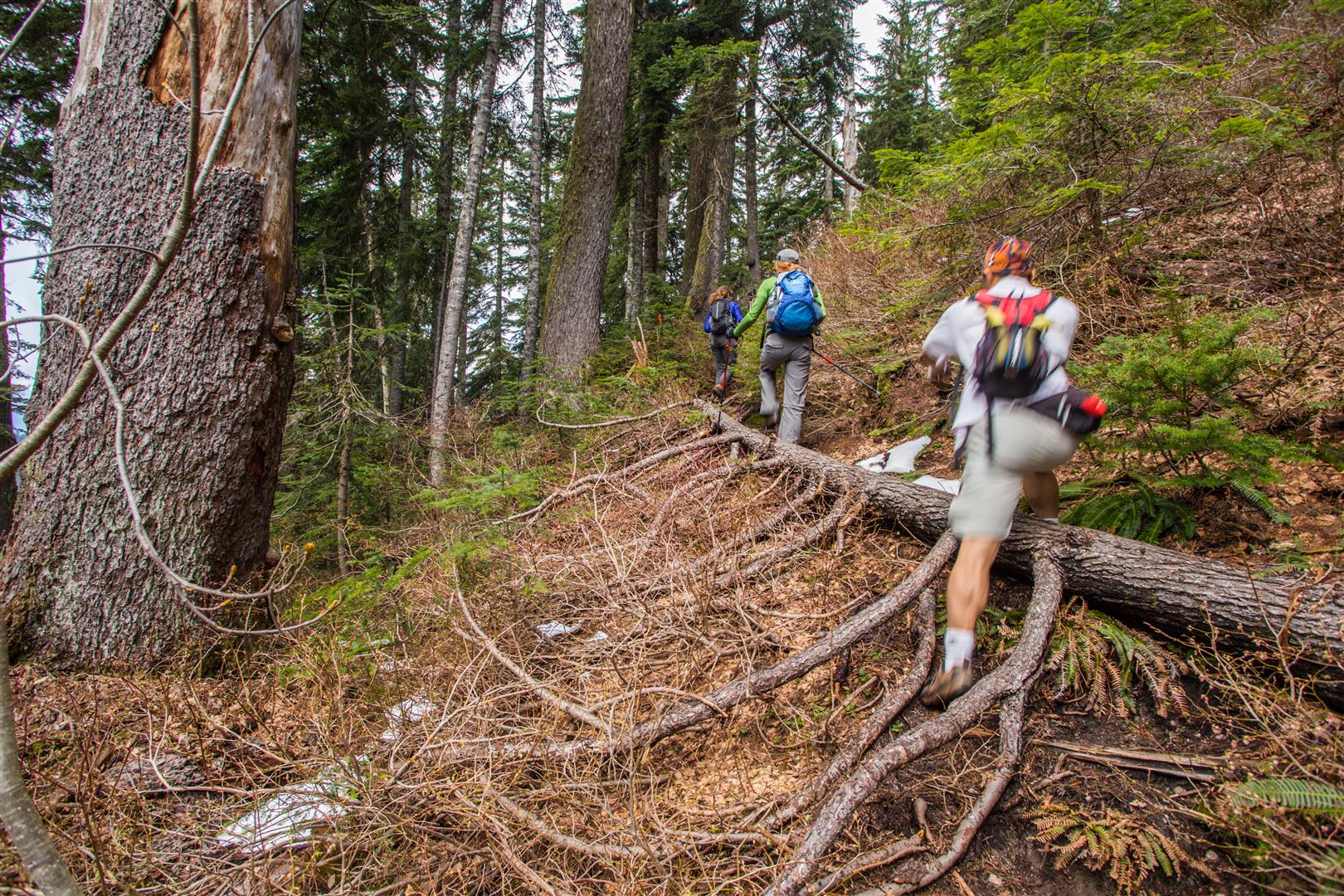
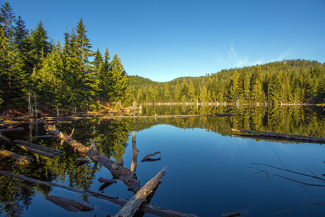
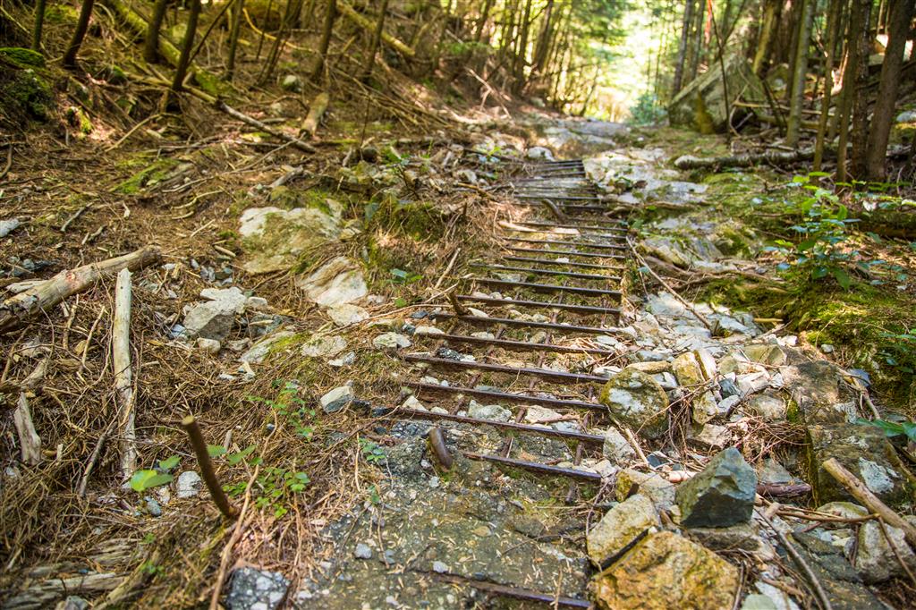
Croker Lookout is located on a spur trail 500 m off the Dilly Dally Trail and 3 km north of Buntzen Lake. Croker Lookout is named after Croker Island, which is located at the north end of Indian Arm. There are many different ways to get to the trailhead and today we took the west side of Buntzen Lake and coming back, we took the east side of the lake. Whichever way you take, you will take the gravel road located by the Buntzen Dam – follow this road for nearly 2 km at which point, take a right and head into the forest on the Dilly Dally Trail. The first little bit is steep, but then it levels out a bit.  After a bit, you’ll reach an old logging road, where you’ll see relics of the era, such as steel wire, asphalt with steel re-bar and wooden supports on the trail (photos below). As you can see from the stats below, the elevation gain is only 1/3 of the cumulative elevation gain – there are plenty of ups and downs on the route !

According to the Province of BC, Croker Island was presumably named by Captain Richards, RN, while surveying the waters in 1859-60, probably after James L. Croker, assistant paymaster, HMS Plumper in 1860.

The Stats:

Distance: 19.3 km (return)
Time: 6.75 hours (with a 30 min swim break)
Low point: 53 m
High point: 447 m
Elevation gain: 394 m
Cumulative Elevation gain: 1260 m
Calories burned: 4422
Trailhead 1: Buntzen Lake Parking
Walk or bike to the Buntzen Lake Dam and you’ll find Trailhead 2; 2km north up the road, you’ll find Trailhead 3
Trailhead 2: 49° 22’ 25.3” by  122° 51’ 49.5” (Google Map)
Trailhead 3: 49° 23’ 7.9” by  122° 51’ 35” (Google Map)

The route…

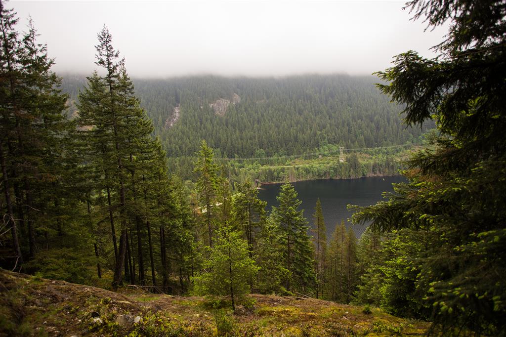
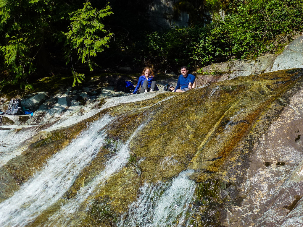
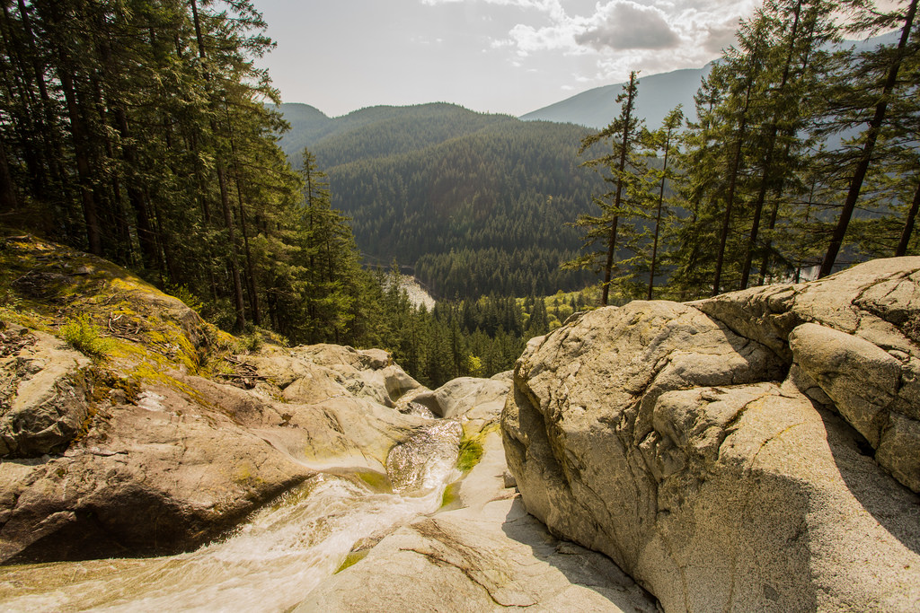
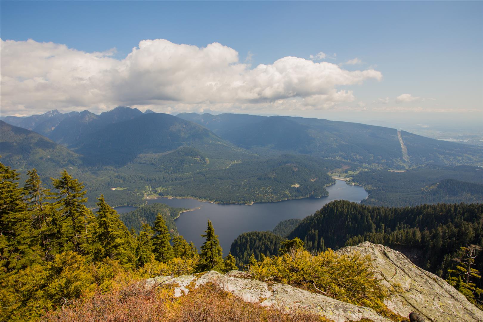
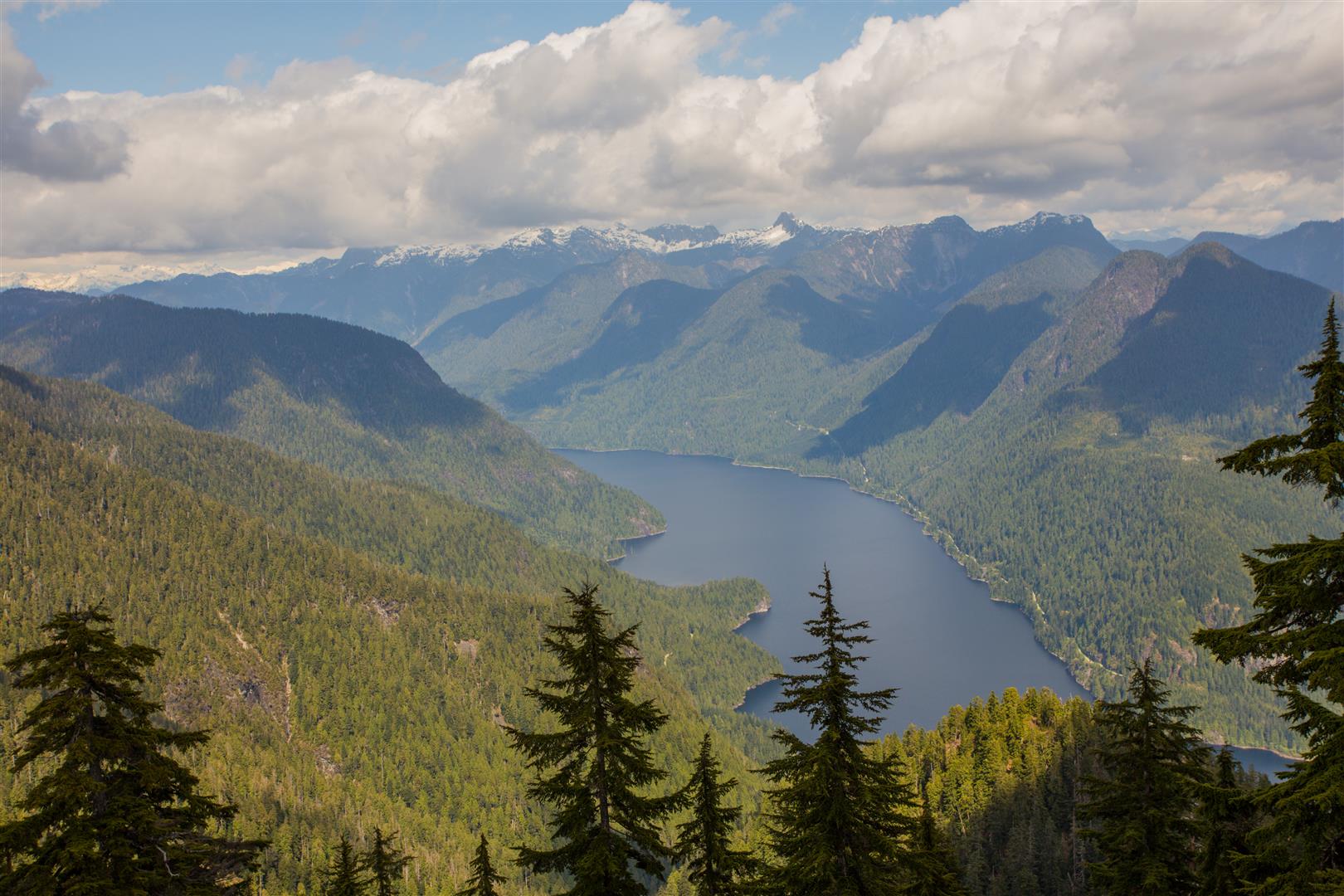
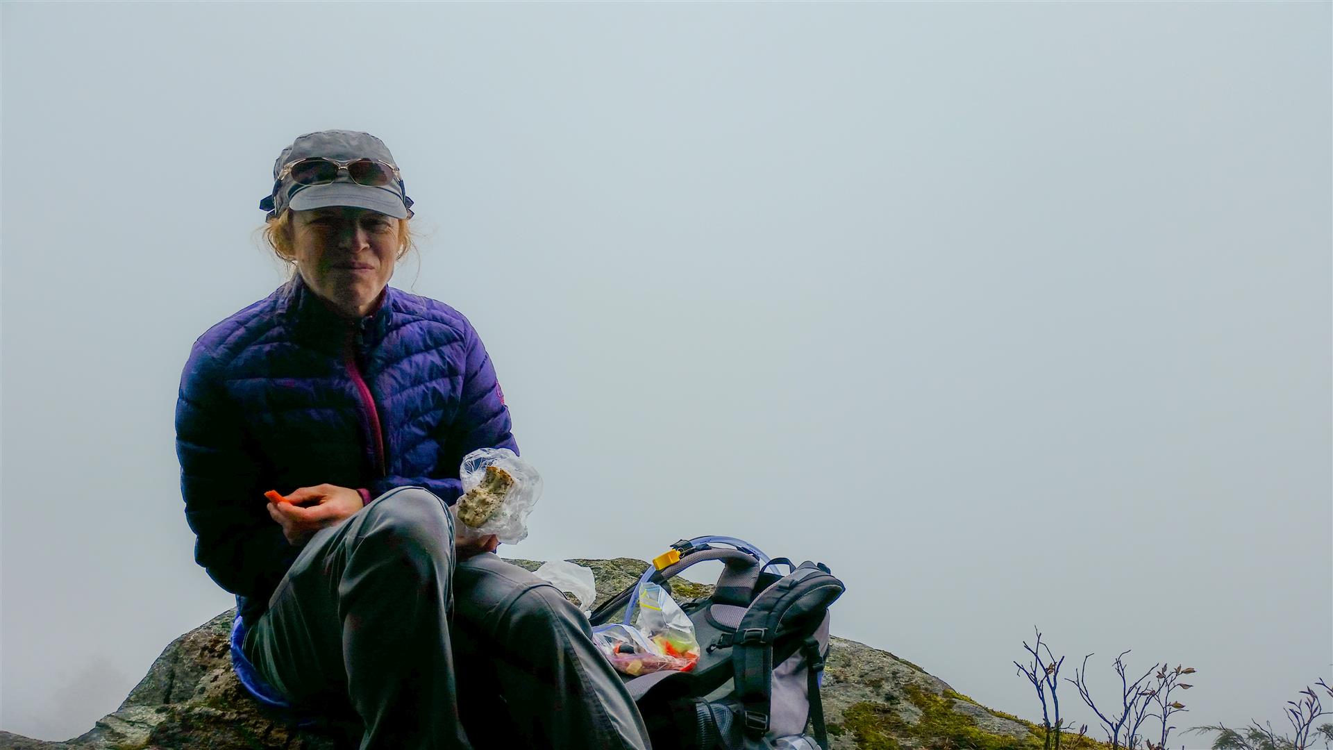
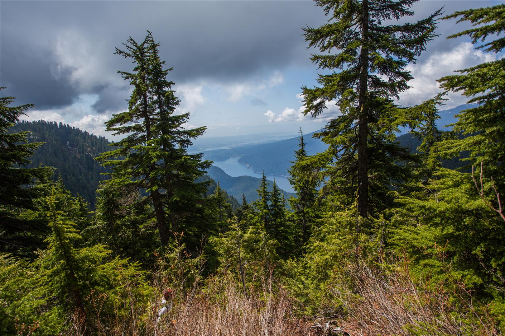
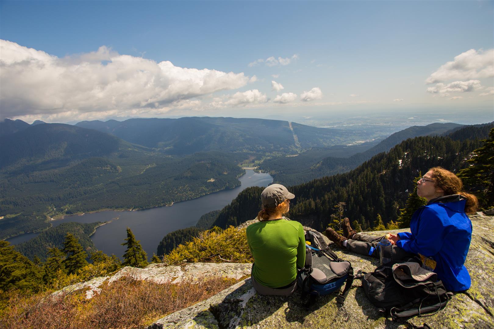
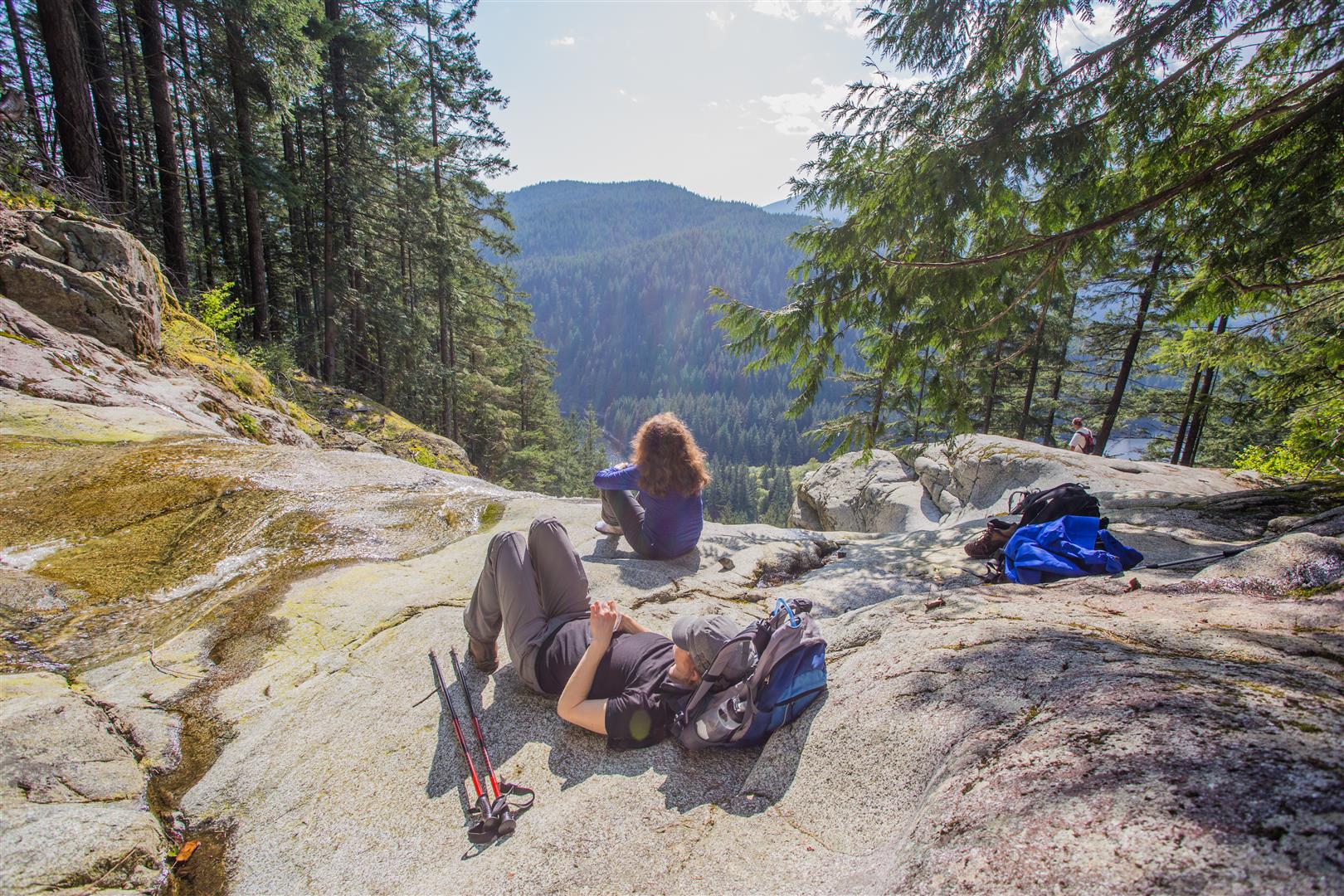
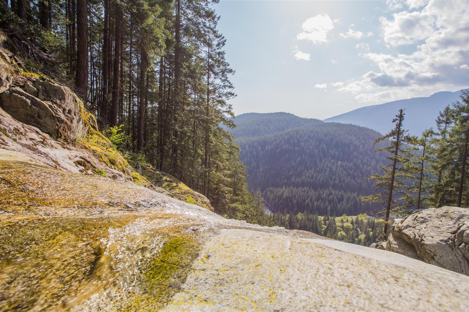
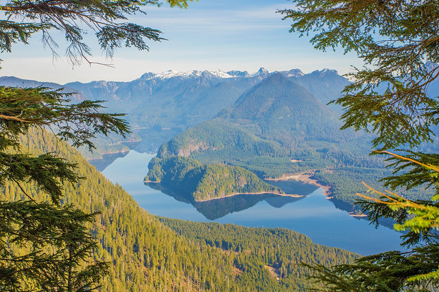
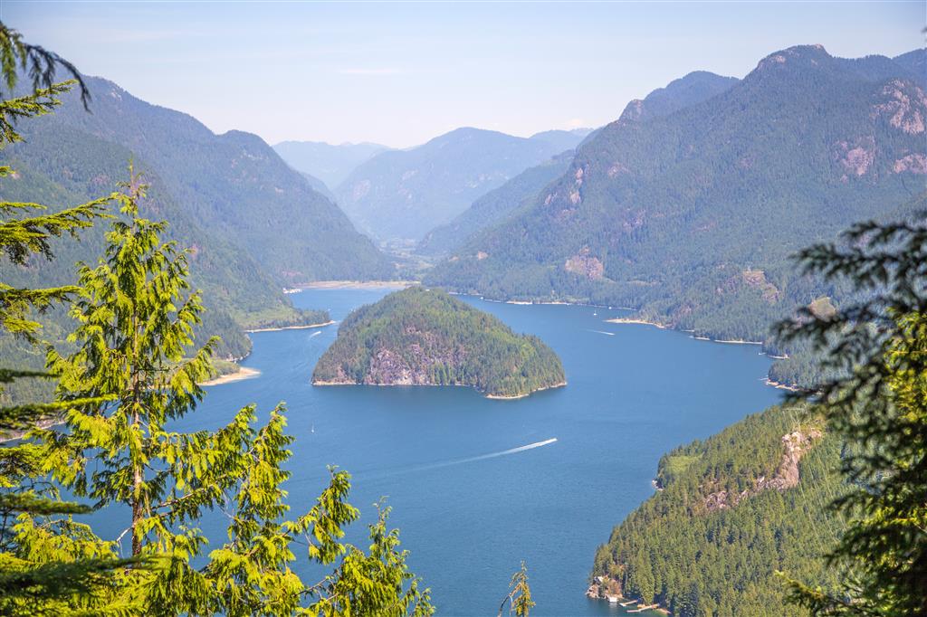
Here is the view from the lookout…

Croker Island

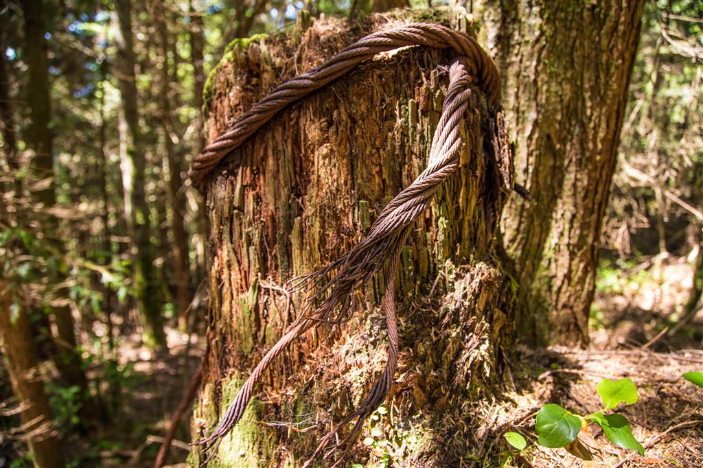
Here are some relects of (I presume) past logging in the area…

Wood supports…

Asphalt with wood supports

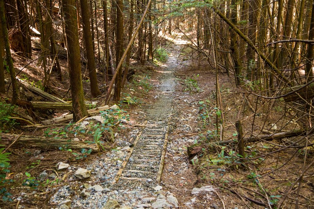
Metal rebar in asphalt…

Metal rebar

Metal rebar in asphalt

Steel wire around a tree…

Steel wire around a tree

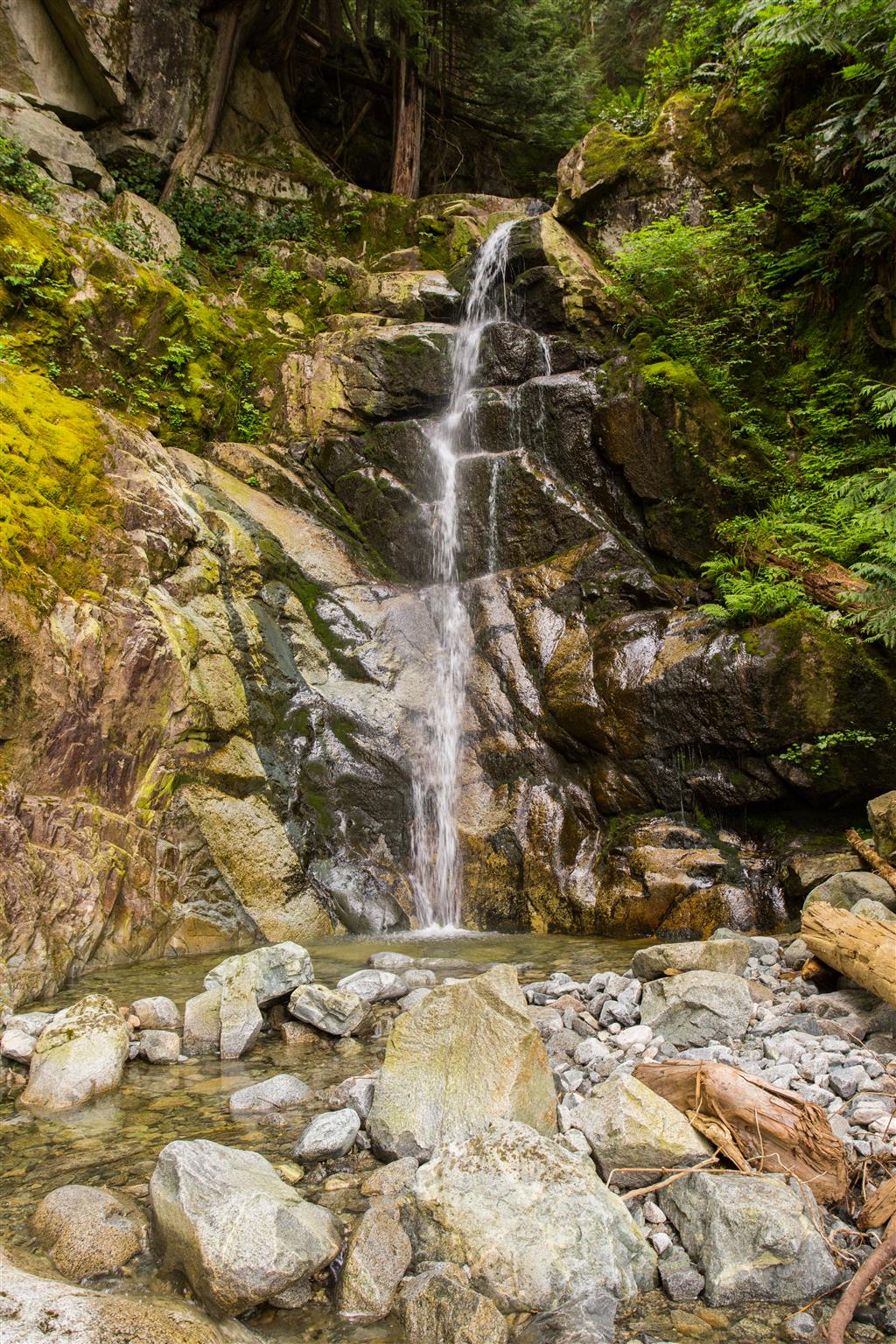
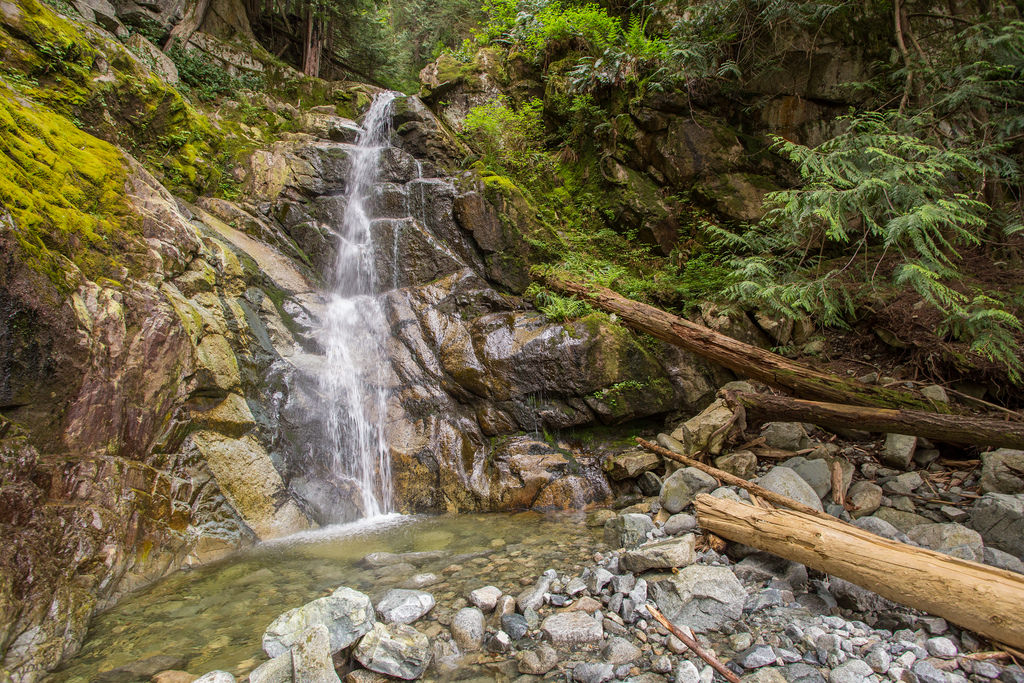
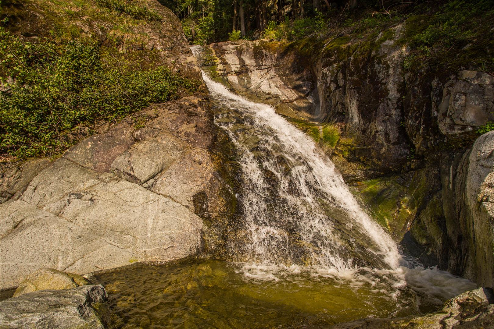
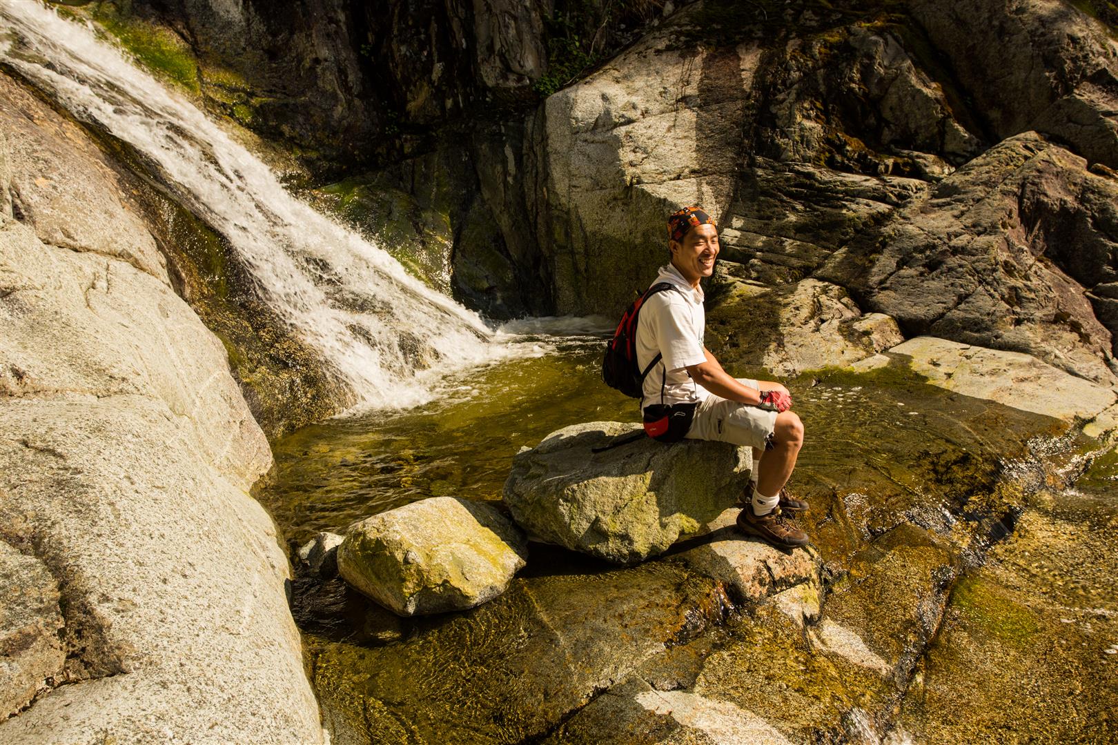
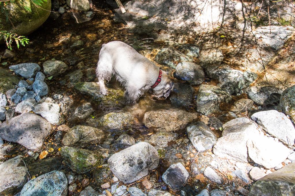
There were a couple of creeks with some water, which was nice for the dog…

Having a drink

We saw some wild blueberries at the lookout…

Wild Blueberries

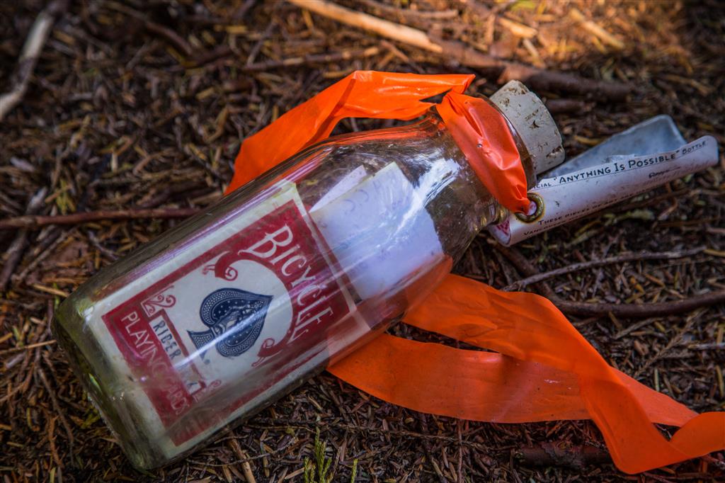
Someone left a full deck of playing cards in a bottle for someone to find…

Cards in a bottle

★★★★★★★★★★★

Before heading out on your hike, make sure you are well prepared. This means, having the TEN ESSENTIALS. It is also important to leave a trip plan (route details and estimated return time) with someone you trust.

Bring your smartphone, fully charged and put it in airplane mode while hiking. I always bring back-up battery packs for extra piece of mind. It is highly recommended that you bring a GPS device; I use my smartphone with a GPS app (Backcountry Navigator). The GPS will work in airplane mode. Learn how to use it before your hike.

For anyone new to hiking, there is a rule to which hikers follow; it is called “Leave No Trace” or LNT. The concept is generally to pack out what you pack in and respect nature, so all future visitors can enjoy what you have enjoyed.
To learn more about LNT, please check out this BLOG by a certified LNT Trainer.

★★★★★★★★★★★

Lakeview Trail, McCombe Lake and Swan Falls


The original forecast for today was sunny with a high of 19. The morning of the hike, the forecast changed to sunny breaks in the afternoon. However, we saw no sun today ! It was overcast all day, but very comfortable temperature wise. This route is a slightly longer variation of the Buntzen Lake and Swan Falls route.  Our group of 4, set off at 8:45 am and made our way to the south end of Buntzen Lake, over the Floating bridge. At the Pumphouse, we choose the Lakeview Trail, which is a highly underused trail. After Lakeview Trail, we headed north on the Old Buntzen Lake Trail past McCombe Lake, the old intake station, the Buntzen Dam and the massive aquiduct. After a short walk on the service road, we reached the Swan Falls trailhead and ascended to the falls, which is a 200 m elevation gain. The cumulative elevation gain of 937 m is due to the many ups and downs on the route, so it’s not really indicative of a strenuous hike. In fact, the hike is quite easy, except for the 200 m elevation gain on the Swan Falls trail, but that is only for a short time. There are nice views from Lakeview trail and from Swan Falls. The Swan Falls area is a great place to relax on the smooth rocks, while listening to the water fall.

Today’s Stats:

Distance: 14.3 km (return)
Low point: 110 m
High point: 341 m
Elevation gain: 231 m
Cumulative Elevation gain: 937 m
Trailhead: 49° 20’ 11.4” by  122° 51’ 30” (Google Map)

Here is the route…

Here is a close up of Swan Falls…

Swan Falls

Here is a view looking west from Swan Falls…

Looking down from Swan Falls

Here’s a group photo from the lower falls area…

Group photo at Swan Falls

On the Lakeview Trail, there is a nice viewpoint near the end. You can see the low cloud cover in this shot…

Lakeview Trail viewpoint

Here is a of trail pic on the Lakeview Trail…

Lakeview Trail at Buntzen lake

After the Lakeview Trail, we headed north on the Old Buntzen Lake Trail, which took us past McCombe Lake and past this intake station…

Intake house on McCombe Lake

Further on down, we past this huge aquiduct, which takes water to a power station on Indian Arm…

Buntzen Lake Aquiduct

We saw some nice flowers today, like the Western Columbine…

Western Columbine

And this one…

Pink flowers

★★★★★★★★★★★

Before heading out on your hike, make sure you are well prepared. This means, having the TEN ESSENTIALS. It is also important to leave a trip plan (route details and estimated return time) with someone you trust.

Bring your smartphone, fully charged and put it in airplane mode while hiking. I always bring back-up battery packs for extra piece of mind. It is highly recommended that you bring a GPS device; I use my smartphone with a GPS app (Backcountry Navigator). The GPS will work in airplane mode. Learn how to use it before your hike.

For anyone new to hiking, there is a rule to which hikers follow; it is called “Leave No Trace” or LNT. The concept is generally to pack out what you pack in and respect nature, so all future visitors can enjoy what you have enjoyed.
To learn more about LNT, please check out this BLOG by a certified LNT Trainer.

★★★★★★★★★★★

Buntzen Lake and Swan Falls


This hike really adds flare to the Buntzen Lake loop. After traversing to the north beach, just take the service road northwards for 500 m and then the Swan Falls trailhead is on your right. The Swan Falls trail goes to the top of Mount Beautiful, but for this hike, we’re just going to the actual Swan Falls.  The Swan Falls trail is far beyond the difficulty of the Buntzen Lake trail. You should be confident in traversing steep slopes and using rope for climb-assisting in one place.

The vertical elevation gain on this portion of the Swan Falls trail is only 200 m, but it is tough trekking.

Here are the route stats:

Distance: 11.8 km (return)
Low point: 127 m
High point: 340 m
Elevation gain: 213 m
Total Elevation gain: 700 m
Trailhead (for Swan Falls): 49° 22’ 7.8” by  122° 51’ 29” (Google Map)

Here is the route:

This is the sign at the trailhead at base of swan falls…

Swan Falls Trailhead sign

There are two good spots to rest at the falls. Here is a photo of the upper falls…

Upper Swan Falls

Here’s a view looking west from the upper falls…

Upper Swan Falls 2

The lower falls, which are only small distance from the upper falls, are a great place to bask in the sun and have a snack…

Relaxing at swan falls 2

Relaxing at swan falls

Here’s a view looking down from the lower falls…

View from Swan Falls

Here are some trail photos on this section of the Swan Falls Trail…

16961787513_ea9203912e_b

Hollow Tree

Trail (2)

Trail

Here are the ropes to help climb a steep section…

Rope Climbing

Swan Falls Loop


This is one of the difficult hikes at Buntzen Lake. You should consider the ‘Diez Vistas’ hike easy before attempting this one.  We started at 8:30 am and ascended the Halvor Lunden trail from the Buntzen Lake Parking lot. The temperature was 9 degrees when our group of 4 started. We made to Polytrichum Lookout in about 1 hour, to the lake’s district 1 hour after than and then Lindsay Lake just before the 3 hour mark. We took a short detour to see The Pulpit Viewpoint and to have snack. Unfortunately, all we saw was white cloud ! So, after our cold break (5 degrees here !), we continued back to the Lindsay Lake Junction and up to Mt. Beautiful. We saw some snow today, the most being around Tangled Summit. We made it to Mt. Beautiful (1260 m) at 1:30 PM and had a relaxing 30 minute break in the sun !! Yes, thankfully the sun came out for us and we had amazing views of Coquitlam Lake and the mountains to the north and east. After our break at Mt. Beautiful, we continued on and we reached the Swan Falls/Dilly Dally Junction a short time later. We headed west, down the Swan Falls trail. After an hour of slow downhill trekking we reached the actual Swan Falls at 350 m elevation and we had another 30 minute break in the sun.

Here are the stats:

Distance: 16.7 km (loop)
Low point: 129 m
High point: 1260 m
Elevation gain: 1,131 m
Total Elevation gain: 1515 m
Trailhead: 49° 20’ 14” by  122° 51’ 23” (Google Map)

Here is the route…

Here is today’s route from Google Earth…

Swan Falls

Here are the two payoff views of Coquitlam Lake we had today…

IMG_6018

IMG_6023

There was snow in sections…

20150502_124337

IMG_5954

IMG_5968

After the Lindsay Lake Junction, we did a quick detour to “The Pulpit” viewpoint, but when we got there, it was all white…

20150502_114310

There is an ok view of Indian Arm on the approach to Mt. Beautiful…

IMG_5975

At the top, on Mt. Beautiful, we had time to relax and to play around…

Jumping

Resting at Mt. Beautiful

Here are 3 more trail pictures…

20150502_143208

20150502_145851

IMG_5966

On the way down we had a nice rest stop at Swan Falls…

Relaxing at Swan Falls

Section of Swan Falls

Sitting by the Falls

Sitting on Rock in Swan Falls

★★★★★★★★★★★

Before heading out on your hike, make sure you are well prepared. This means, having the TEN ESSENTIALS. It is also important to leave a trip plan (route details and estimated return time) with someone you trust.

Bring your smartphone, fully charged and put it in airplane mode while hiking. I always bring back-up battery packs for extra piece of mind. It is highly recommended that you bring a GPS device; I use my smartphone with a GPS app (Backcountry Navigator). The GPS will work in airplane mode. Learn how to use it before your hike.

For anyone new to hiking, there is a rule to which hikers follow; it is called “Leave No Trace” or LNT. The concept is generally to pack out what you pack in and respect nature, so all future visitors can enjoy what you have enjoyed.
To learn more about LNT, please check out this BLOG by a certified LNT Trainer.

★★★★★★★★★★★

East Bastion Trail and White Rock Viewpoint

A gorgeous day for a hike up Eagle Mountain. It really felt like summer today ! We started off at the end of Hickory Drive (325 m) in Port Moody at 9 am and made our way up through the mountain biking trails. We reached Cypress Lake (800 m) 1.5 hours after starting and we met two other guys heading to the same location, but taking a different route. After a short stop at Cypress Lake, we headed to the West Rampart viewpoint via the east loop of the East Bastion Trail. We made it to the West Rampart viewpoint (880 m) at 11:30 and we met the two guys we met at Cypress Lake – It turns out they are the architects of the East Bastion Trail ! Anyways, after a 10 or 15 minute break, we headed off to the White Rock viewpoint (950 m), where we arrived at 12:30. After 20 or so minutes basking in the beautiful sun (and listening to the woodpeckers), we made our way back onto the trail and began the descent. We finally made it back to the starting point just after 3 pm. The only snow we saw was a dusting in a shaded area off the side of a logging road.

Check out this POST for some more info on this hike

Today’s Stats:

Distance: 14.6 km (return)
Low point: 324 m
High point: 977 m
Elevation gain: 653 m
Cumulative Elevation gain: 860 m
Trailhead: 49° 18’ 25” by  122° 49’ 58” (Google Map)

The route:

Here’s the amazing view of Coquitlam Lake at the West Rampart viewpoint…

Coquitlam Lake

Our stop at the West Rampart viewpoint…

Coquitlam Lake

Cypress Lake today…

Cypress Lake

★★★★★★★★★★★

Before heading out on your hike, make sure you are well prepared. This means, having the TEN ESSENTIALS. It is also important to leave a trip plan (route details and estimated return time) with someone you trust.

Bring your smartphone, fully charged and put it in airplane mode while hiking. I always bring back-up battery packs for extra piece of mind. It is highly recommended that you bring a GPS device; I use my smartphone with a GPS app (Backcountry Navigator). The GPS will work in airplane mode. Learn how to use it before your hike.

For anyone new to hiking, there is a rule to which hikers follow; it is called “Leave No Trace” or LNT. The concept is generally to pack out what you pack in and respect nature, so all future visitors can enjoy what you have enjoyed.
To learn more about LNT, please check out this BLOG by a certified LNT Trainer.

★★★★★★★★★★★