Monthly Archives: February 2015

Mt. Seymour

What a beautiful late winter day for a hike. On arrival to the parking lot (1,020 m), there were only a handful of cars at 9:00 am and not many other hikers were seen on the way up. Stopped to put on micro spikes at 2 km into the hike at 1,230 m elevation due to increased hard snow and ice. Arrival at the first peak (1,395 m) was made in 1 hour and had a 15 minute break for photos. The snow was about 1 m thick here. Still not too many people seen. There were amazing views of Vancouver, Indian Arm and the Coast Mountains. Onward and upward to Mt. Seymour Peak. It gets technically more difficult here; although, not for seasoned hikers. Due to a few cm of fresh snow, it was apparent that two hikers were ahead. There is some class 3 scrambling here and some cliff walking, but it was all good. Made it to the summit (1,475 m) 30 minutes after leaving the first peak and lo and behold, there were the two other hikers. After having a conversation and taking more photos we all made the descent together starting at 11:00 am. On the descent, the crowds coming up were insane, especially below the first peak. Also, I couldn’t believe the number of people in runners up there ! Anyways, we arrived down at 12:40 pm and was greeted with a very warm car ! All in all, it was an absolute amazing day for a hike and the views were amazing. Will definitely go back !


The stats:

Distance: 8.1 km (return)
Minimum elevation: 1017 m
Maximum elevation: 1439 m
Elevation gain: 422 m
Total elevation gain: 715 m
Time: 3 hours 35 mins (inc. 30 mins of stops)
Trailhead: 49° 22’ 2” by  122° 56’ 56” (Google Map)

Here is the route:

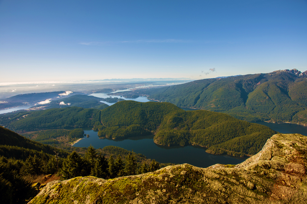
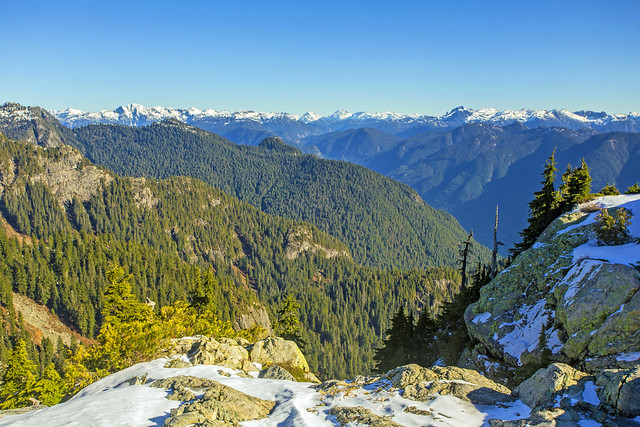
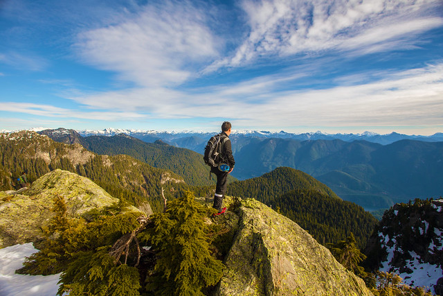
Here is the view from the first peak…

Mt. Seymour First Peak - 1397 m

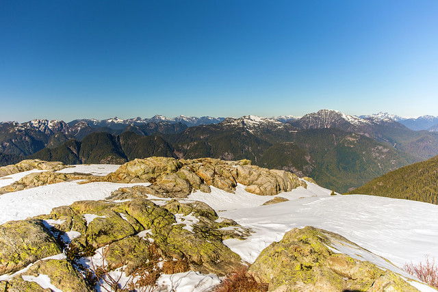
From the summit looking south…

Mt. Seymour summit - 1475 m


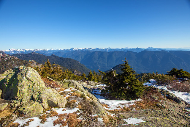
From summit looking north…

Mt. Seymour summit - 1475 m

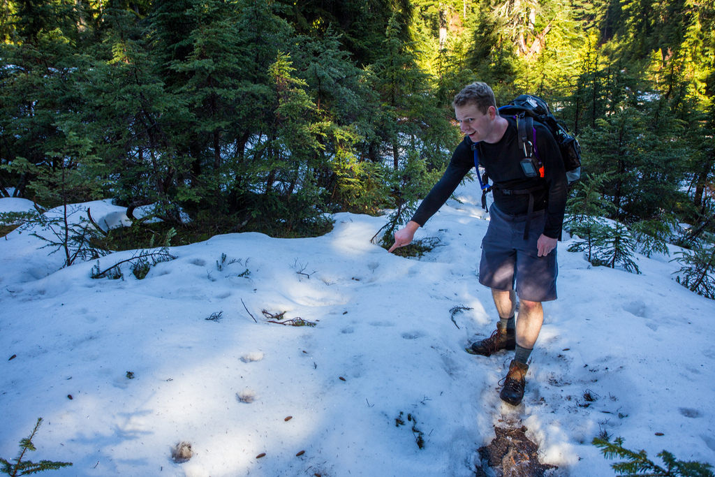
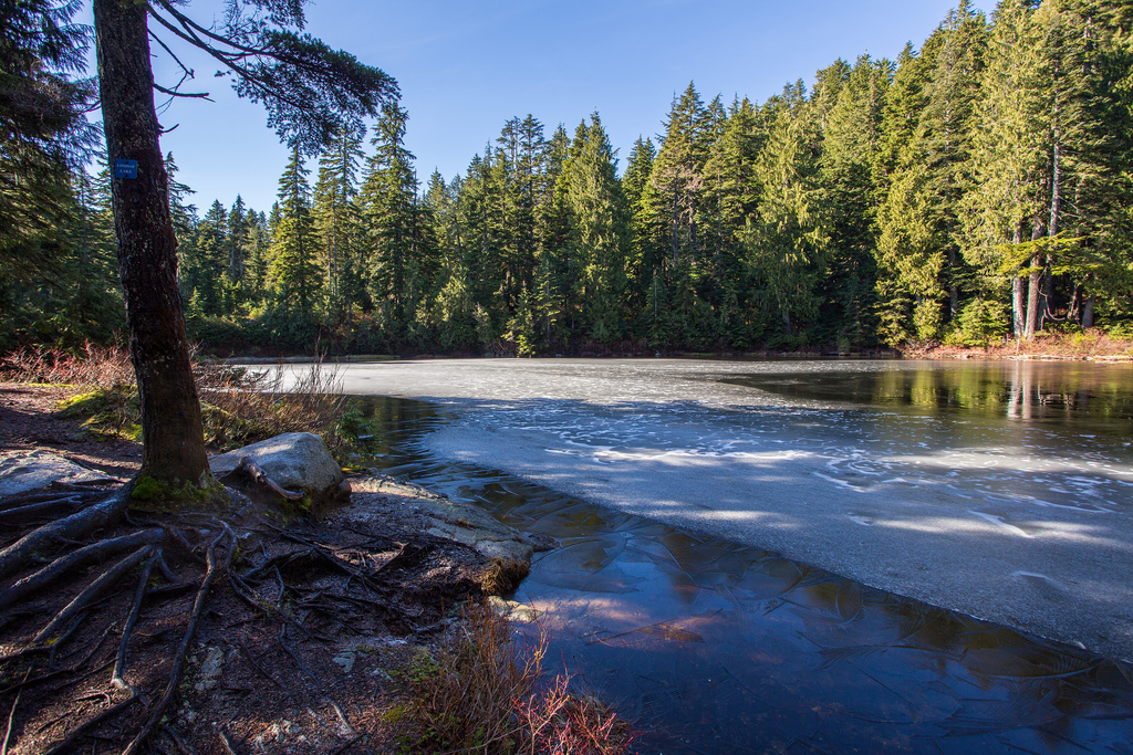
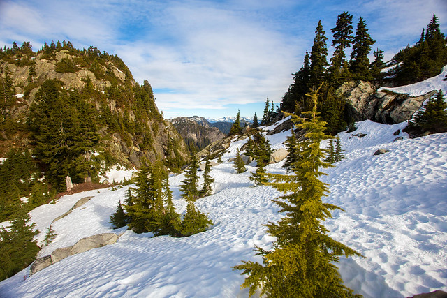
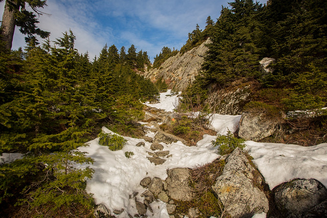
Snow along the trail…

Nice snow at the top


Many people at the first pump…

Lots of people at "1st pump"

Here’s me admiring the view…
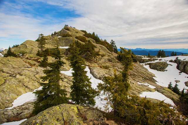
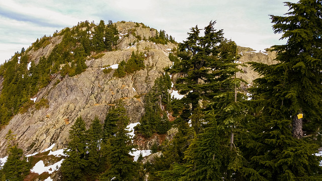
Admiring the view

There’s the peak…

Mt. Seymour

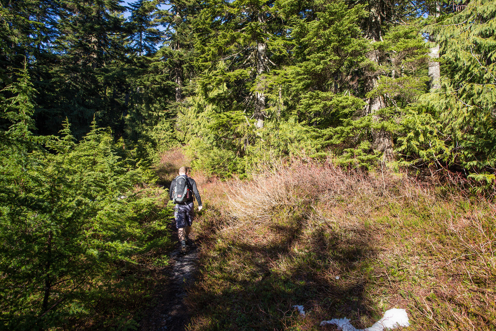
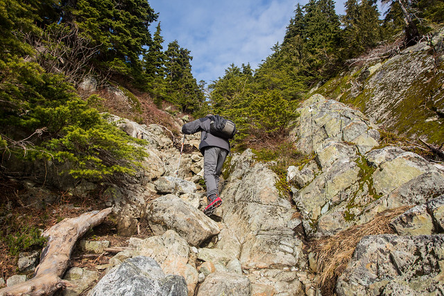
Continuing up the trail…

Continuing up the trail...


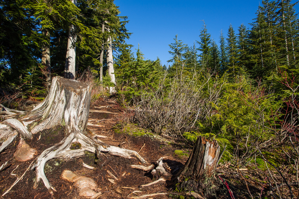
Narrow section here…

Narrow trail here

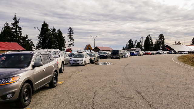
Loads of cars in the parking lot…

Lots of people hiking at Mt. Seymour

★★★★★★★★★★★

Before heading out on your hike, make sure you are well prepared. This means, having the TEN ESSENTIALS. It is also important to leave a trip plan (route details and estimated return time) with someone you trust.

Bring your smartphone, fully charged and put it in airplane mode while hiking. I always bring back-up battery packs for extra piece of mind. It is highly recommended that you bring a GPS device; I use my smartphone with a GPS app (Backcountry Navigator). The GPS will work in airplane mode. Learn how to use it before your hike.

For anyone new to hiking, there is a rule to which hikers follow; it is called “Leave No Trace” or LNT. The concept is generally to pack out what you pack in and respect nature, so all future visitors can enjoy what you have enjoyed.
To learn more about LNT, please check out this BLOG by a certified LNT Trainer.

★★★★★★★★★★★

Lindsay Lake in February


A beautiful weekend was in the forecast and it didn’t disappoint ! It’s been over two months since I was up on Eagle Mountain and I needed to get my fix ! As we still have limited daylight right now, I wanted to stick with Lindsay Lake, rather than traversing the entire Eagle Mountain ridge.

Today’s stats were:

Distance : 12.9 km
Time: 6 hrs 50 mins (with breaks for pictures)
Min elevation: 102 m
Max elevation: 1,120 m
Elevation gain: 1,018

The route:

On a typical February day, this hike would be impossible to do without snowshoes. The only snow we found today was about 3 or 4 inches of hard pack at Lindsay Lake…

Snow at Lindsay lake

Today started off at 6 degrees and got up to 11, but it felt warm all day in my shorts (that’s not me above).

Here is a view from the premier viewpoint, named The Pulpit…

The Pulpit Viewpoint

The Pulpit is at 1,000 m above Buntzen Lake and is a 20 minute hike from the Lindsay Lake Junction.

We saw a number of people today and one unlucky girl who’s hiking boot came off her foot in a mud puddle !

Below are Siskin Lake and Chickadee Lake…

Siskin Lake

Chickadee Lake

Here is Lindsay Lake, with a thin layer of ice and some frost…

Icey Lindsay Lake

Here are a couple of trail pix…

Lindsay Lake Trail 2

Lindsay Lake Trail

I’ll end with a photo of the Buntzen Creek headwaters, located just north of El Paso Junction, at 800 m above Buntzen Lake…

Buntzen Creek headwaters

Overall the conditions were great. Warm enough all day with lots of sun. Very little snow and what was there was just a few inches of hardpack. There were many mud patches, but they were no problem.

★★★★★★★★★★★

Before heading out on your hike, make sure you are well prepared. This means, having the TEN ESSENTIALS. It is also important to leave a trip plan (route details and estimated return time) with someone you trust.

Bring your smartphone, fully charged and put it in airplane mode while hiking. I always bring back-up battery packs for extra piece of mind. It is highly recommended that you bring a GPS device; I use my smartphone with a GPS app (Backcountry Navigator). The GPS will work in airplane mode. Learn how to use it before your hike.

For anyone new to hiking, there is a rule to which hikers follow; it is called “Leave No Trace” or LNT. The concept is generally to pack out what you pack in and respect nature, so all future visitors can enjoy what you have enjoyed.
To learn more about LNT, please check out this BLOG by a certified LNT Trainer.

★★★★★★★★★★★