Monthly Archives: June 2014

Nuevo Diez Vistas

For a description of the Diez Vistas hike please see:

BuntzenLake.ca/Diez-Vistas/ and
Buntzenlake.ca/hiking/

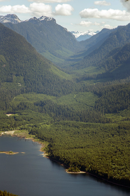
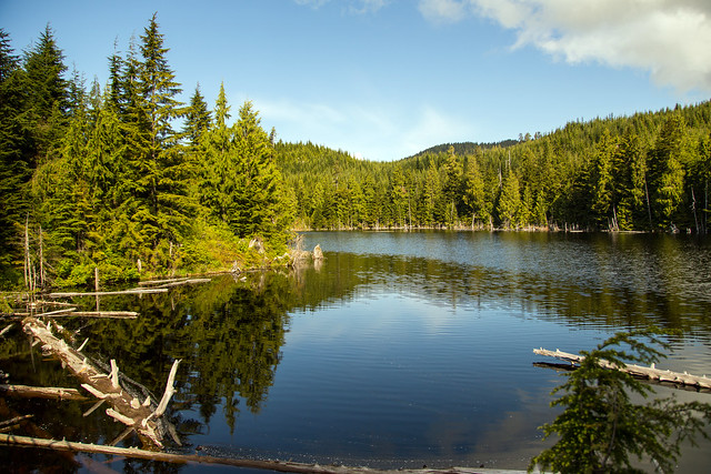
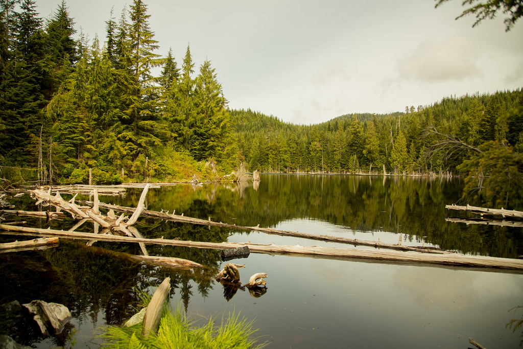
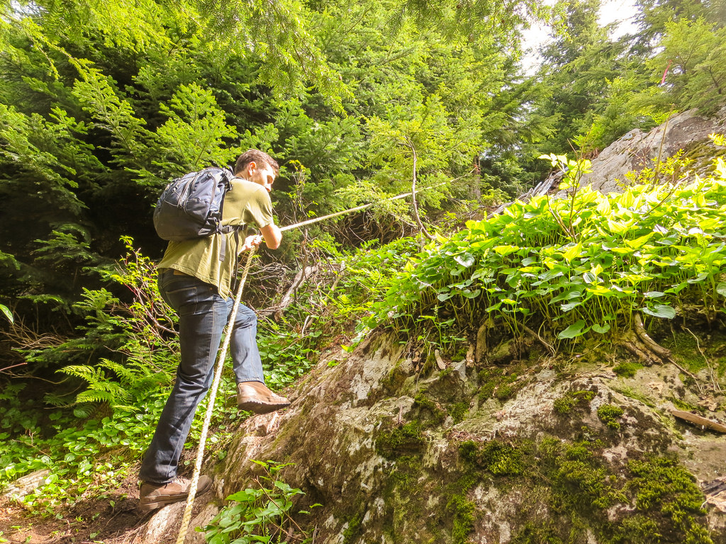
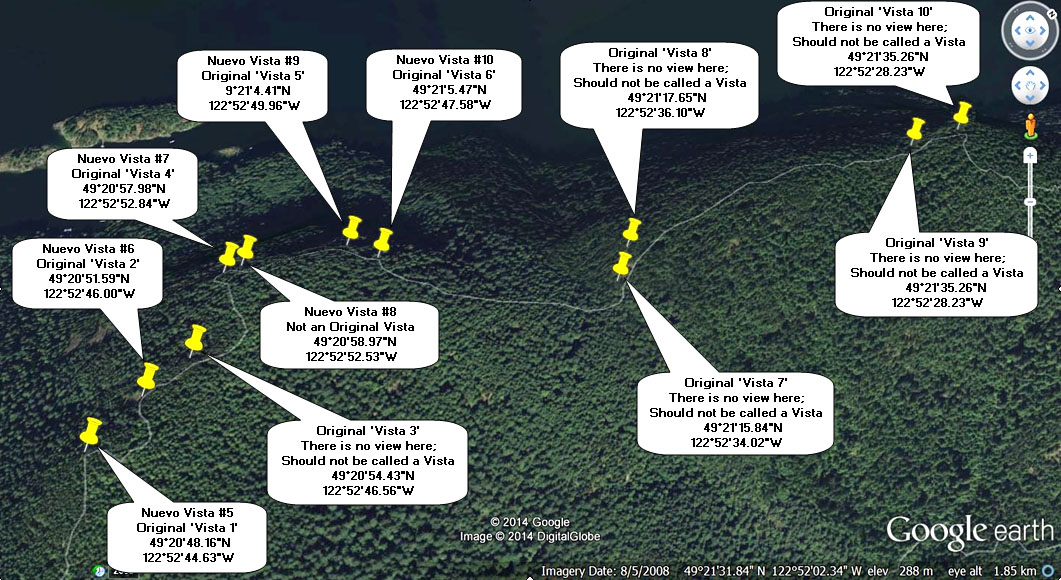
I have mentioned how the vista numbering on the Diez Vistas trail is all wonky and some of the original vistas no longer have views. Many people blog about their hikes and one common thing I read is: “Diez Vistas was a great hike, but I only found 3 or 4 of the vistas”. As the trail dates back to the 1980s (I presume), five of the original vistas have become obstructed by trees (yes, how dare they grow and ruin our views !!!).


Strangely enough, four great views at the south end of Buntzen Ridge were never included as official vistas – these being the very first viewpoint of Burrard Inlet/Indian Arm and the three viewpoints on the East point loop (Yes, there is an east point loop !).  Also, the signage is poor here (there is no sign) and most people miss out on the three east point loop vistas. There is also a nice viewpoint just after Original Vista #4, that was never included as an original vista.

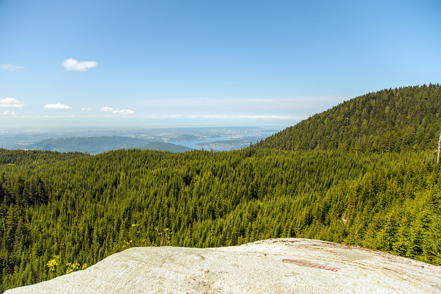
So I have suggested to BC Hydro to consider renaming the vistas as seen in the two photos below…
I would still keep the Spanish names where present (eg. Punta Apecio and Punta Del Este), but have markers noting the vista numbers. Also, a sign should be put near the first vista, noting where to go to the East Loop and the East Loop By-Pass route.


When putting together the maps of the new vista numbering, a thought occurred to me to name the trail ‘Nuevo Diez Vistas’ or at least have that as an unofficial name.

Click on the images for the larger size.

East point detailRidge Detail

It is my hope that BC Hydro will consider my alternate numbering. In the meantime, I hope this will help future hikers on the trail.


West Rampart Viewpoint


Today I hiked up to the East Bastion Trail on Eagle Mountain to see the West Rampart Viewpoint and White Rock Viewpoint. We started from the Hickory Drive Reservoir in Port Moody and proceeded up the myriad of hiking/biking trails. I suggest using GPS to do this route or you’ll find yourself going in all different directions.  Here is the GPX file. You must right click it and save link as – once downloaded, change the extension from .jpg to .gpx.  You can then use the gpx file with your gps device or with Google Earth.

Today’s  Stats:

Distance: 14.6 km (return)
Low point: 324 m
High point: 977 m
Elevation gain: 653 m
Cumulative Elevation gain: 860 m
Trailhead: 49° 18’ 25” by  122° 49’ 58” (Google Map)

Today’s route:

Here are some route details…

route

The view of Coquitlam Lake from the West Rampart Viewpoint…

West Rampart Viewpoint

The next photo is a view of the Blakeny Creek (also known as Cedar Creek) Valley from the West Rampart viewpoint… Blakeny Creek is one of Coquitlam Lake’s major inflow rivers.

Or Creek Valley

The weather today was perfect for hiking – we had sunny skies all day with some small clouds. The view from the White Rock Viewpoint (which is a 45 minute hike and 1.5 km from the West Rampart viewpoint) was better than two weeks ago…

White Rock Viewpoint

When we finished at the White Rock viewpoint, it was time to head back. There is a fork in the trail we took the east fork, eventually hooking up with the Halvor Lunden Trail.  After only about 250 m on the Halvor Lunden Trail, you’ll find the turn-off for the Coquitlam Trails. Below is a photo of the trailhead. Its up a tiny embankment, which is probably why its missed so often…

Start of trail to Coquitlam Trails

Here’s the view of Cypress Lake today…

Cypress Lake

There are some impressive old growth trees here…

old growth trees

★★★★★★★★★★★

Before heading out on your hike, make sure you are well prepared. This means, having the TEN ESSENTIALS. It is also important to leave a trip plan (route details and estimated return time) with someone you trust.

Bring your smartphone, fully charged and put it in airplane mode while hiking. I always bring back-up battery packs for extra piece of mind. It is highly recommended that you bring a GPS device; I use my smartphone with a GPS app (Backcountry Navigator). The GPS will work in airplane mode. Learn how to use it before your hike.

For anyone new to hiking, there is a rule to which hikers follow; it is called “Leave No Trace” or LNT. The concept is generally to pack out what you pack in and respect nature, so all future visitors can enjoy what you have enjoyed.
To learn more about LNT, please check out this BLOG by a certified LNT Trainer.

★★★★★★★★★★★

White Rock Viewpoint

Today was my second venture up Eagle Mountain. The route started at the end of Hickory Drive in Port Moody and went as far as the White Rock Viewpoint (Not a view of White Rock, the town). The white rock is a large rock, whitish in colour and there is a large platform to sit, have a snack or lunch and take in the great views.

Here is the route from Hickory Drive, Port Moody…

The stats:

Distance: 14.7 km
Starting elevation: 327 m
Max elevation: 984 m
Elevation gain: 657 m
Cumulative elevation gain: 889 m
Time: 5-7 hours

Here are two great views from the viewpoint (950 m elevation)…

White Rock Viewpoint on Eagle Mountain

White Rock Viewpoint on Eagle Mountain2

This was my first time up this route and there are many many trails and they’re not marked well. I had a GPS unit and my smartphone for back up. As it turns out the smartphone had a GPS signal all day and that was the go to device. I highly recommend using one or both of these devices up here.

On the way up, you’ll see Cypress Lake at about the 5km mark. Here is a picture of the peaceful Cypress Lake at 800 m elevation…

Cypress Lake on Eagle Mountain

Also on the way up, you’ll pass through a network of mountain biking trails and there are some serious jumps here. See below…

Killer mountain bike ramp

There is a rope on one steep section of the trail…

Rope Climbing

The next photo is a serene little marsh…

Marsh on Eagle Mountain

I’ll end with some various trail pictures…

Blow downs

Trail

Trail 2

★★★★★★★★★★★

Before heading out on your hike, make sure you are well prepared. This means, having the TEN ESSENTIALS. It is also important to leave a trip plan (route details and estimated return time) with someone you trust.

Bring your smartphone, fully charged and put it in airplane mode while hiking. I always bring back-up battery packs for extra piece of mind. It is highly recommended that you bring a GPS device; I use my smartphone with a GPS app (Backcountry Navigator). The GPS will work in airplane mode. Learn how to use it before your hike.

For anyone new to hiking, there is a rule to which hikers follow; it is called “Leave No Trace” or LNT. The concept is generally to pack out what you pack in and respect nature, so all future visitors can enjoy what you have enjoyed.
To learn more about LNT, please check out this BLOG by a certified LNT Trainer.

★★★★★★★★★★★